|
High Street Part II , Blisworth, Northamptonshire, UK. All pictures are presented at relatively low resolution. Printed below each image is the photographer's name, if known. |
|
|
Back to INDEX page Part I This is Part II |
|
|
Various dwellings in this street are listed - information available. |
|
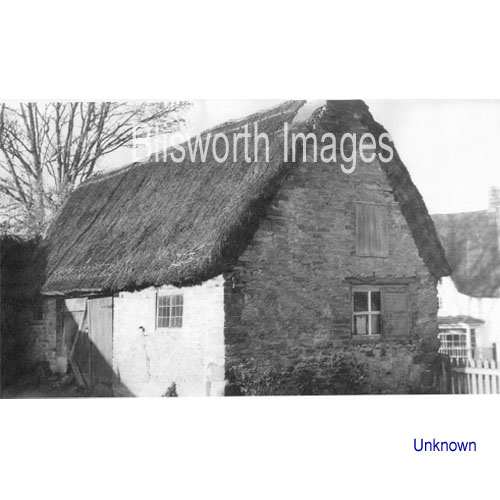 |
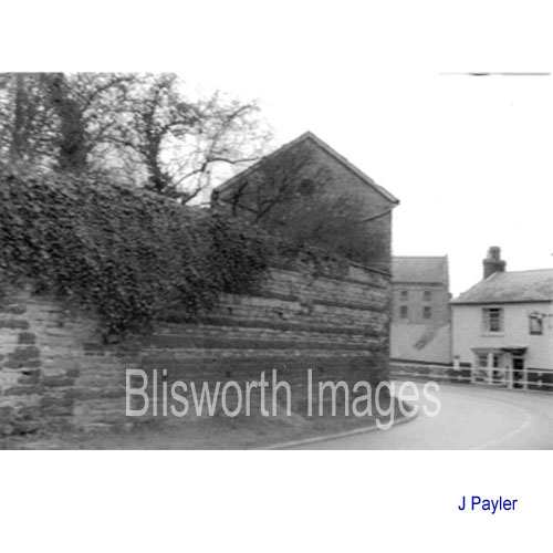
16-12a This is the back of the Old Boot Shop ran by a cobbler (Mr William Hill). It was opposite the pub which can just be seen in the background. Beyond the high wall to the left is Crieff House. The remains of the furthermost gable end is discernable today, embedded in the garden wall to the next property.
|
|
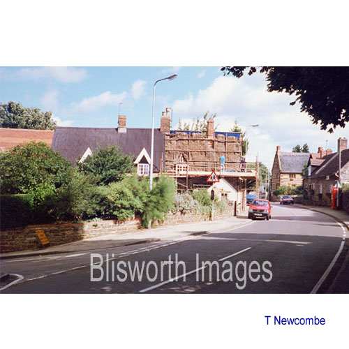
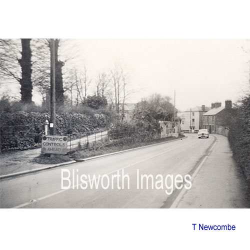
Footnote: A view of the cobblers shop from the other side has come to light, thanks to Tony Newcombe. Please click here. |
|
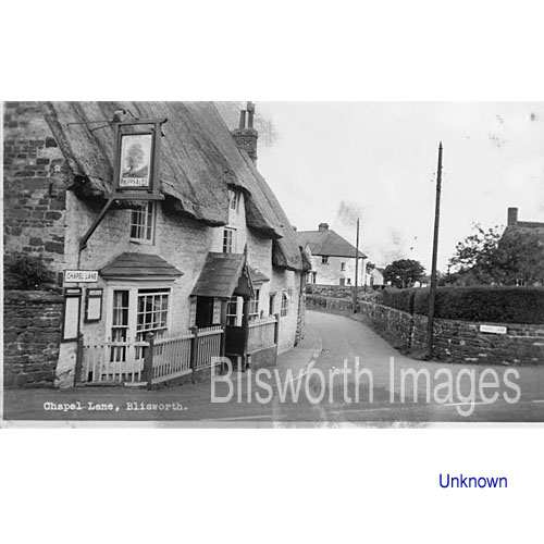 |
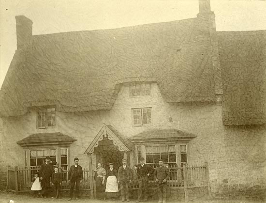
16-13 The Royal Oak Inn c. 1950. The next two pictures also relate to this inn. There is an early picture of the inn dating from about 1885 indicating that the pub had changed very little in 50 years. At that time Thomas Tee was the publican - he is dressed in a bowler to the right of the doorway. For a list of publicans see the reference section.
|
|
Brief
History of the “Royal Oak Pub”
Tony Marsh 2010. Because
many Grafton estate records were lost in a fire there is little detail
available for buildings in Blisworth before 1700 and that includes the
“publick house” at the crossroads-centre of the village.
Up until about 1955 it was enclosed on the High Street side by
three small cottages, a sweet shop and a blacksmith’s workshop, all of
which were demolished to yield a small car park and lawns to go with the
small field surrounding and attached to the building.
It has
been a notable meeting place; for the Court Leet gatherings in early
times, for village ‘dinners’ on high days such as for celebrating
coronations etc., and for the parish council, sometimes, and the
Oddfellows Society in the 20th century. A previous landlord has claimed the building is at least 400 years old but, as explained above, there are no records. It has also been claimed that the building contained an upstairs prison despite the fact that in most thatched houses it would have been possible for a prisoner to burrow out through the thatch and escape. |
|
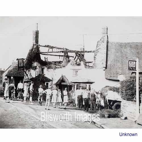 |
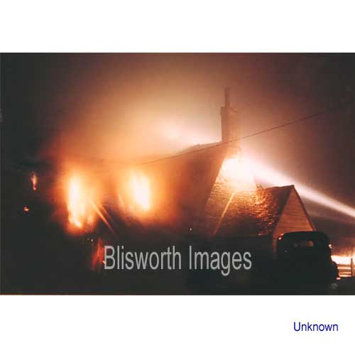
16-13a On August 20th, 1959, the
thatch over the Royal Oak caught fire. That was in the days when
the M1 was being built; there was much bulk movement of earth by heavy
lorries through the village and the 'Caravan
Park' had been expanded to take many employees of motorway
constructors. A lad who lived at the park just threw a cigarette butt onto
the thatched roof - heaven knows what precisely had motivated him. The
unfolding incident was
particularly harrowing because the fire brigade brought the fire quickly
under control and, after hours of damping down, then departed. The fire,
however, rekindled and totally destroyed the upper part of the building.
One onlooker remembers helping to get the landlord's possessions out of their tiny home above the pub, down narrow stairs. "And we never smashed one ornament". |
|
Footnote: Click here for an additional image which has come to light. See also picture 32-07 in section on The Cross |
|
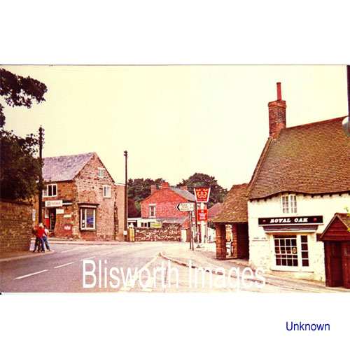 |
16-13b A "postcard" view of the High Street some years later showing the pub with its new roof. The ugly red inn sign has since been replaced with a much more elegant one. |
 |
16-22 After the fire at
the Royal Oak, one householder on the lower part of the High Street
immediately converted their thatched roof to tiles.
For this cottage however, located across the top of Chapel Lane from the pub, there was a 1999 uplift from a corrugated sheet roof to thatch. They had to first remove the old thatch that the sheeting was protecting. These cottages are notable in 32-01 to be found in The Cross section. They are the subject of a subsidiary page - click here. |
 |
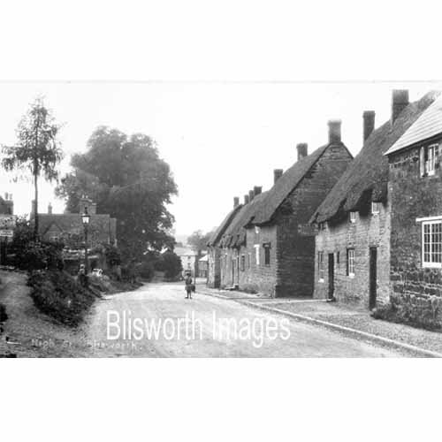
16-14 Tile House, or Tyle House - located next to the village general store. Some history of this house and neighbours is provided in the section on the Great Fire. |
 |
16-15 Date c. 1905, looking down the
street towards Towcester and showing Young's
shop and a ramp up to Tilehouse, also a ramp access to lower cottages.
By
the churchyard the old ramp to the rectory is visible (see picture
16-19a below). At about this time, Tile House offered "Teas" in the garden.
When this part of the street was first established it had to be cut into sloping land, hence there are ramps on the left and some gardens behind the houses on the right drop away fairly steeply. Based on the scene a little lower down the street, a Victorian painting has turned up in Australia. |
 |
16-15a A similar location
as the picture above, date approx. 1920. Not only did Tile House
put on "Teas" for visitors but also Mrs Marriott across the
road, as proclaimed on a sign attached near the thatch of one of the
houses.
The written side of the postcard, for the picture above, includes the words "You will notice our only shop where you get every thing you want (sometimes). I can tell you it is quiet here. I don't think the place wakes up from one year's end to another." This last sentence also appeared on a second postcard leading one to suppose it was a commonplace village saying. Like our current one, "it is quiet here except for all the noise the blow-ins make" - see our condensed history of the village. |
 |
16-16 Centred in this picture is the section of the High Street mentioned immediately above. |
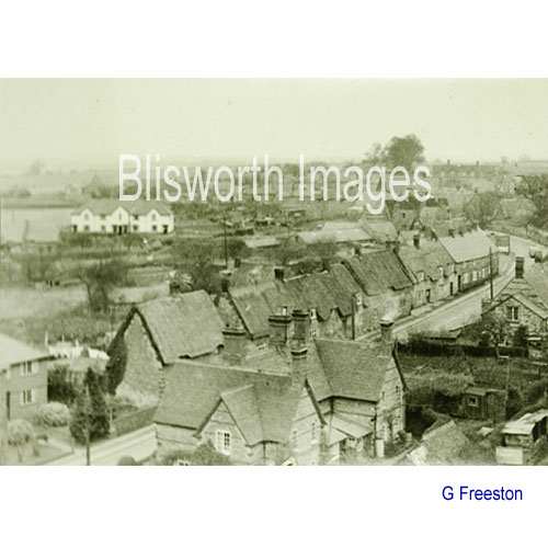 |
16-17 From the church tower c. 1953. The building in the foreground is called the "Gables", built c.1860. Part of it has fallen so far into disrepair that a recent American visitor to the village thought it was surely haunted. |
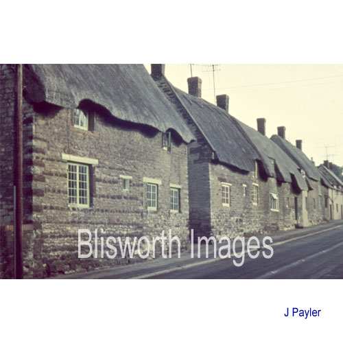 |
16-18 |
|
Footnote: There are some details for this row of High Street cottages - please Click Here |
|
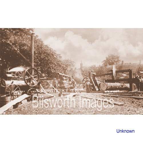 |
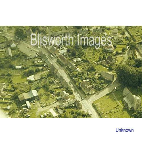
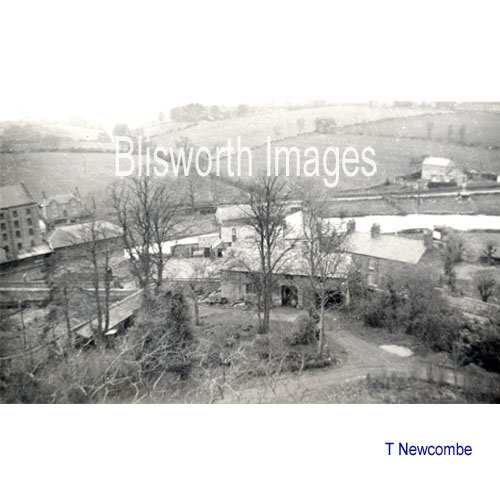
16-19 This is thought to be Burbidge's sawmill to the north of the High Street, in a yard behind No 50. The gable facing towards the left is thought to be the bake-house behind No 38 - now pulled down. |
|
|
|
 |
16-19a Dated 1957, shows the ramp to the rectory and the corner around the rectory coach house. At the time when the coach house was demolished, the ramp was shortened, made steeper and moved away from the road to allow road widening. | 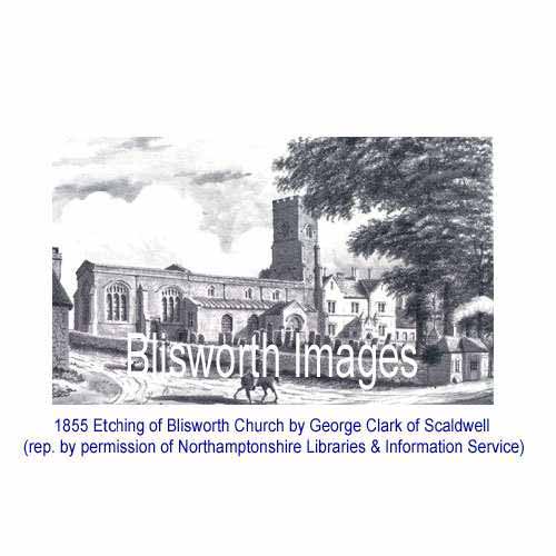 |
16-21 Blisworth Church in 1842 - 1855. In 1842 the rectory was built and in 1855 a new roof of steep pitch was built over the nave. By this time the toll-house had probably been set up by the railway arch. The old toll house would have been too small to live in - surely the smoke is artistic romanticism? Just beyond the toll house roof the ornamentation of the "Cross" in the churchyard can be seen. All that remains of it now is a rough square of loose ironstone blocks although it was cited in a 1718 document and photographed in about 1880. About George Clarke. |
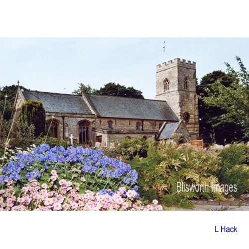 |
Blisworth Church in 2005. |
 |
16-20 At some point in the 18th
century the rector had his coach house at this corner in the High
Street. The sharpness of the corner was not exceptional (compare
Deddington, Oxon. or Kimbolton, Hunt.) but in 1841 the rectory was re-built
and with it an even more imposing coach-house was built making the
corner even more blind. It's photographed here in about
1958. In c. 1964 the stone from the coach-house demolition was used in the
fore-garden of the rectory to raise levels and the road was
straightened somewhat. The old line of the road is preserved as a
lay-by or service road running next to the Sun, Moon and Stars building.
In fairness to the 19th century rector, there was a 1812 plan to extend a new road in a straight line from West Bridge (the Mill Bridge) to the railway arch, straight across the front of the Sun, Moon & Stars. In 1835 this by-pass was again tabled as a means to link up with the coming of the railway station at the arch with a coach-house or toll-house there. The kink in the High Street would have then evolved into a Tee junction. Such plans would have provided the village with its by-pass and a basis for a much improved village layout in the 20th century (see the bypass section). It is a mystery why the scheme was never put through. |
 |
16-20a Dated 1957, taken from the
church tower. The picture is intersected by the canal with
"The Bays" cottage beyond the canal to the right and the mill on the
extreme left. At the bottom there is the drive up from the ramp to
the coach house (centre foreground). The Sun, Moon & Stars inn
is partly obscured by the coach house and the trees in the foreground.
The dominance of the coach house at road level is because it has been
built on such a slope. There are more pictures of the coach house
at the end of the West Bridge section. The supposed Roman path to a lookout on Gayton Hill (see the book "Blisworth" by Tony Marsh, 2004) is aligned with the church tower and therefore would appear as a vertical line in this picture - it would be between the a and g of the watermark running through the corner of a nearby small field and adjacent to the Sun, Moon & Stars Inn. |
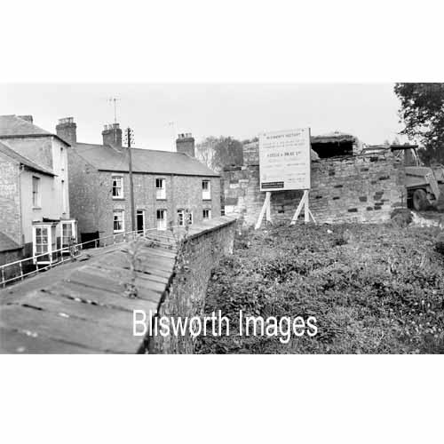 |
16-20b The subject of the demolition of the coach house is mention in the section on West Bridge. This rare shot shows the coach house from within the grounds adjacent to it. |
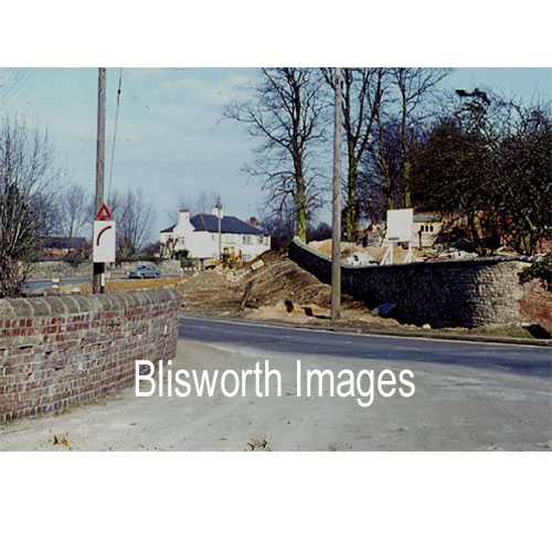 |
And this shot shows the result of removing the coach house and re-profiling the ground. Includes a rare picture of the lime trees in the cemetery in a state of heavy pollarding. See West Bridge section. At the time of the road re-profiling the Rector was the Rev. Bunker. The large slice of earth that was effectively taken from the 'mound' on which the church and vicarage are built was apparently the subject of some controversy in the village - the name used to refer to this was "The Battle of Bunker's Hill" (with thanks to John Whitehead for that gem!).
|
 The
main building is listed as a c1675 public house much modified in the 19th
and 20th centuries.
The
main building is listed as a c1675 public house much modified in the 19th
and 20th centuries.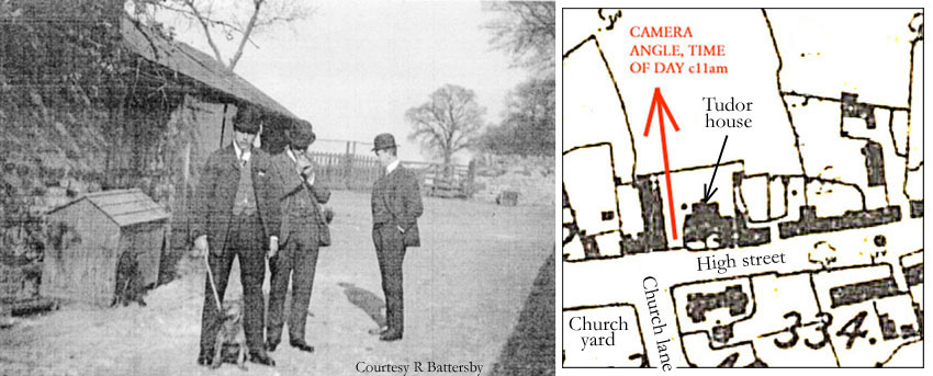