|
The Cross , Blisworth, Northamptonshire, UK. All pictures are presented at relatively low resolution. There will be hundreds of pictures on this site - there is an economic limit to the webspace available. The point of this presentation is that you can see for yourself the extent of the collection and return later as the collection expands - as it surely will. Any interest in copies of a picture at a higher resolution (ie. clarity) should be directed through contacts given in the Blisworth "Round and About" parish council publication or using the comment form on the home page. In some cases the pictures are not available due to copyright restrictions. However, permission has been obtained, where possible, to include them here. Printed below each image is the photographer's name, if known. |
|
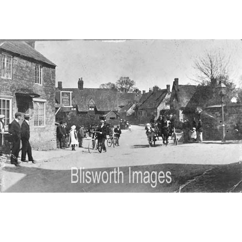 |
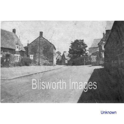
32-01 Looking east from just outside the sweet shop. The date is c. 1910 and the people are probably off to the races at Towcester. |
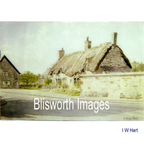 |
32-02 An artist's representation of the Cross, a widened part of High Street which would have been used for markets and gatherings.
|
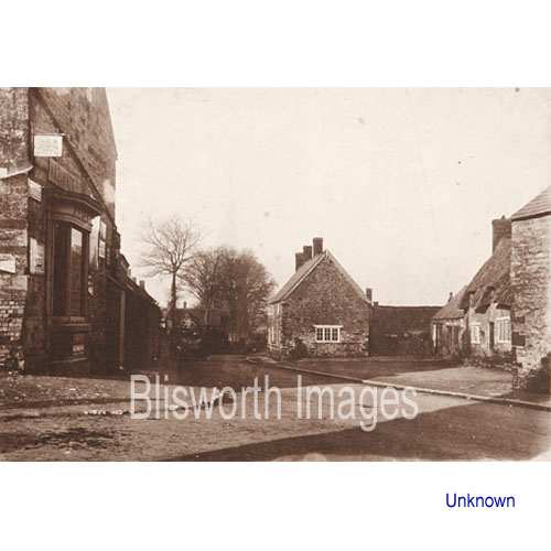 |
32-03 This is a newly discovered photograph of the Cross in which a bake-house behind No. 38 is visible in the gap next to the cottages which are set-back. The bakehouse was quite a tall building but was built on a garden level which fell away from the street. It is thought that the bakehouse was in use in the 18th century by John Staughton and that well before that Huggett's shop was also a bakery since in 1757 it was referred to as an "Old Bakehouse now a Wool Shop". |
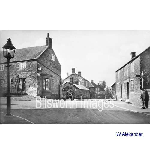 |
32-04 A very sharp picture with detail sufficient to date it 1925, the year a few telephones were wired into the village. A telephone bracket has been installed on the corner of the Post Office on the left but there are no wires which would have been well within the capability of the camera lens to show. To the left is the beginning of Stoke Road with Crieff House, just out of sight, on the corner. Note that the lamp is an oil lamp.
|
.JPG) |
32-05 A 21st century view of the Royal Oak Inn. |
| There has been, since WWII, much heat
dissipated in the village concerning the probability of "The
Cross" being common land. Most of the village was owned by
the Duke of Grafton up to the time of the Estate sale in 1919.
Plot (56), comprising of 3 cottages including a blacksmith premises, was
sold en-block. The map indicates with brown ink that the extent of
the purchase would have been right across the Cross. Nowhere else
on the village sale map is there an example like this. The brewery
which acquired the Royal Oak (160) also, later, acquired five cottages
comprising of the original plots (55) and (56). In consequence
they have taken the line that what was possibly 'common' is their land
and maybe used as a car- park for patrons of the pub. Much argument arose in the 1960's when a seemingly obstreperous landlord shut the car-park to villagers including access to the side of a cottage in plot (57) thus attempting exclusivity. The parish council were central in considering the issues and "after a long examination of various letters" conceded that it would be a long legal battle to show that the Duke's ink was misplaced. I imagine that would be a battle that only the NCC could afford or perhaps be motivated to wage. The issue seemed to resolve itself into both sides saying there would be no further aggressive moves as long as the land would have associated with it a "public right of access". |
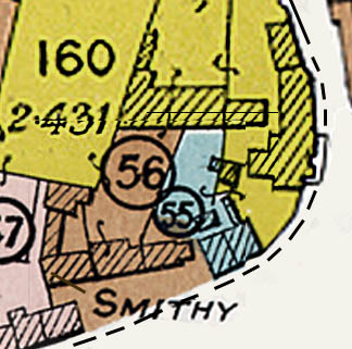 |
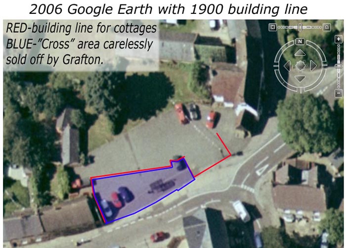
| The diagram/map below demonstrates that part of the land, shaded in blue, that maybe the Duke should not have sold off with the cottages. The red line corresponds with the building line as taken from a 1890 OS map, to an accuracy of about +/-1 metre (see pdf report). It is a trivial slice of land really and it is embarrassing how heated some discussions have become in dealing with it. | |
|
|
|
 |
32-06 In roughly the place where the three cars are in the picture above there was a double cottage which housed the sweet shop belonging to Mrs Huggett. The cottages to the left are the same ones as in 32-03 above. The wide pavement, ie. The Cross, is now part of the car park for the Royal Oak. The camera is outside Young's shop (village general store) and the substantial wall to the right is the side of a long building which housed a mail sorting office before WW II. A better view of the sorting office is in 32-04 and the record of its demolition is shown in 32-11, the rear wall being used as the boundary wall to the wider pavement. Date probably pre-1899 as no sign-post can be seen.
|
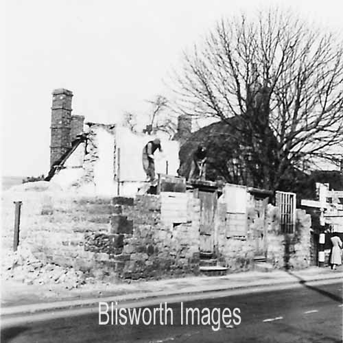 |
32-08 Demolition of the
twin cottage which once hosted Mrs Huggett's sweet shop. Dated
before 1959 but no-one seems to remember!
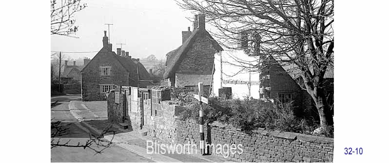
Picture 32-10 below is a particularly revealing one which was probably taken from a window at Crieff House. It shows that there were substantial outbuildings lean-to the back of the shop. It also shows the row of cottages on the Cross, as yet unmolested. Another interesting detail is that the building was referred to as the "Old Bakery" in the early part of the 18th century. |
 |
|
 |
|
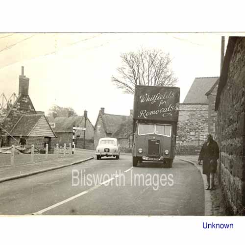 |
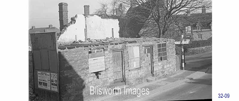
32-07 This interesting picture shows the street side wall of the old mail-sorting room, also notable in picture 32-04 above, which was demolished to provide a pavement from the crossroads to Young's shop. The date of this picture is Autumn 1959. It also shows the chain around the car-park which so inflamed villagers. The timbers over the Royal Oak clearly indicate that the time of the picture was not long after the thatch fire at the Royal Oak, say, winter 1959/60.
|
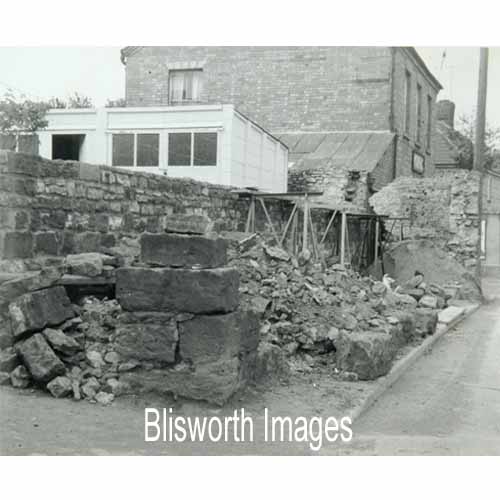 |
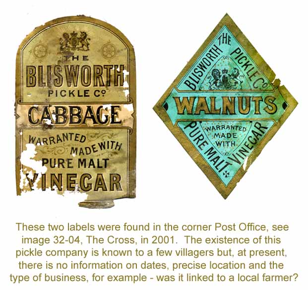
32-11 Demolition of the mail sorting house - date early 1960s. The shed behind the sorting house may have been the home of the Blisworth Pickle Company
|