|
West Bridge, Blisworth, Northamptonshire, UK. All pictures are presented at relatively low resolution. There will be hundreds of pictures on this site - there is an economic limit to the webspace available. The point of this presentation is that you can see for yourself the extent of the collection and return later as the collection expands - as it surely will. Any interest in copies of a picture at a higher resolution (ie. clarity) should be directed through contacts given in the Blisworth "Round and About" parish council publication or using the comment form on the home page. In some cases the pictures are not available due to copyright restrictions. However, permission has been obtained, where possible, to include them here. Printed below each image is the photographer's name, if known. |
|
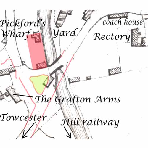 |
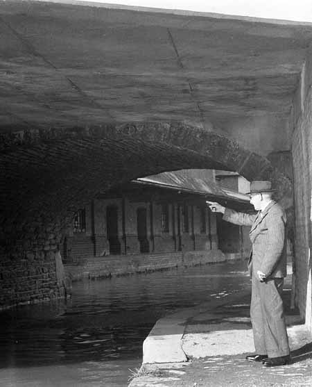
34-19 This map is based on the 1812 award map. The mill at the bridge, indicated by the pink square was not built until 1879. Earlier than that, c. 1865, the High Street was straightened as shown by the pink lines, the bridge over the canal then consisted of two bridges in one; a humpbacked bridge dating from c. 1800 and a flat bridge based on a network of rolled steel girders. There was originally a large yard in front of the Grafton Arms but this was tidied up to leave a triangle of land shown as green (now it is grass but for many years it was a dump for road mending materials too) The small house marked where the triangle is was the house and shop of the foreman of the wharves - the "Wharfinger" - a Mr Thomas Goode at the time with John Whitlock son-in-law and lodger, father of "Witty". In the picture shown here Witty is effectively pointing at his father's home. There are other maps of similar vintage which raises interesting questions regarding the wharfs. Most of the pictures which follow were taken in 1956/7 at the time of the renewal of the steelwork of the 1865 bridge. |
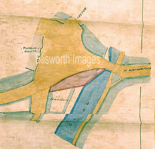 |
This is a copy of Grafton Document G2533 (NRO) showing the layout of the bridge area in 1865. The document relates to the house and garden south of the main road - ie. the wharfinger's house, prior to the road alterations. |
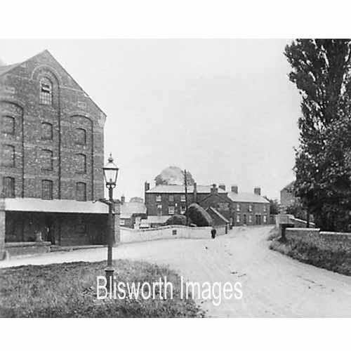 |
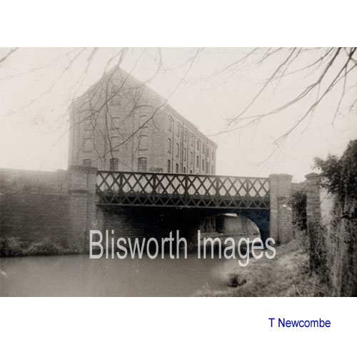
34-00a This view dated approx. 1910 relates well to the fan shape of the bridge and the straight alignment of the street. There were ricks placed in the yard attached to the Half Moon Inn (Sun, Moon & Stars) ready for threshing - the publican Mr Capell and his successor ran a threshing team and probably hired one of Burbidge's machines.
|
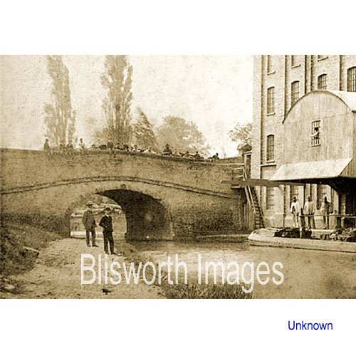 |
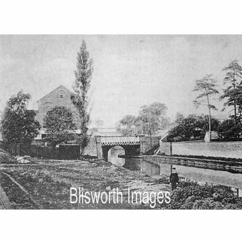
34-00 An early picture of the bridge over the canal. It is not likely to be of the original design as it is known that most bridges required flattening to cope with the Victorian demands for more comfortable travel. Date c. 1900. |
 |
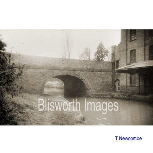
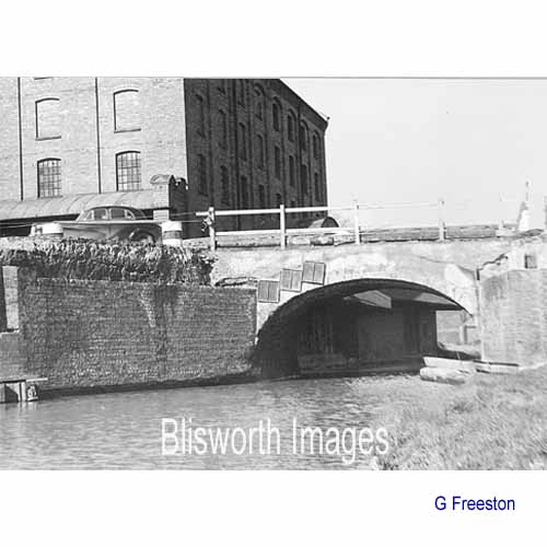
34-10 Similarly dated, taken from the other side. The stretch opposite the towpath was a public wharf for many years - that is distinct from the commercial private wharfage on the other side of the bridge. There were once piles of coal and road mending stone at this wharf. The line of the hill railway, which was used briefly while the tunnel was being constructed, would have been to the extreme left of the picture and crossing the road where its level was the same as the foreground. In this picture, and in 34-14 below, can be seen a retaining wall which supports a road that was probably elevated at the time of the bridge works in c. 1865. |
 |
The same wharf area pictured from the bridge in 1955. The land was owned by British Waterways and in 1980 it was offered for development. An application for relocating, nearer to the canal, the public path was successful and a single and rather large house was built on the land. |
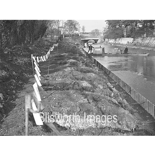 |
Wharf repairs in c1970 near West Bridge. |
 |
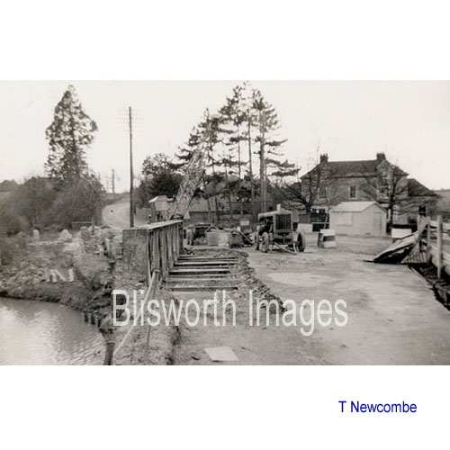
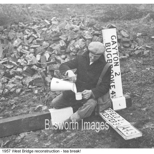
34-01 The sequence beginning with this picture covers the bridge widening and strengthening over the period December 1956 to Spring 1957. Compared to the picture number 34-00 above, it is evident that even before the 1950s the majority of the north facing side of the bridge, ie. this side, was renewed and this might have coincided with improved levelling of the road to facilitate traffic flow.
|
 |
34-02 This is the view from the other side - date c. 1950 |
 |
34-03 By 1956 the county highways dept. resolved to improve the approach on both sides of the bridge and considerably strengthen the steelwork of the newer part of the bridge. First, the newer part of the bridge already in place was to be dismembered, initially by removing concrete and road material. |
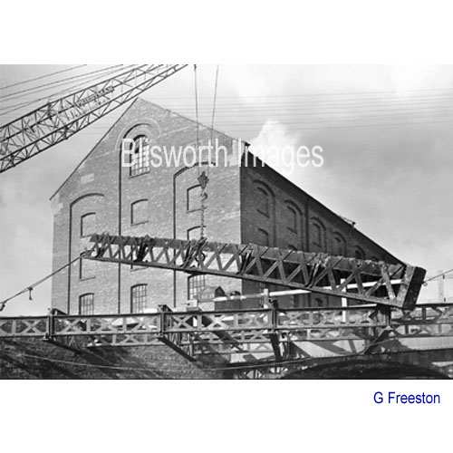 |
34-04 The steel was then cut and lifted away. |
 |
34-11 |
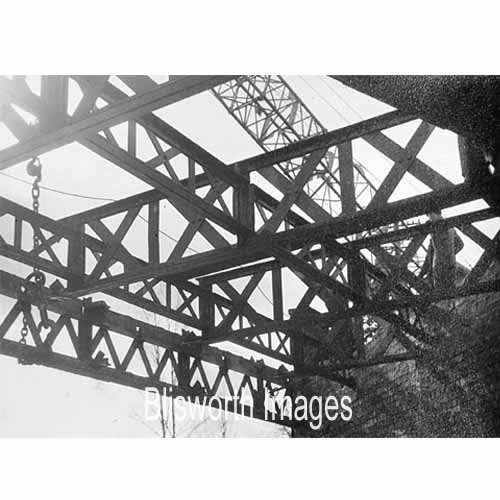 |
34-12 |
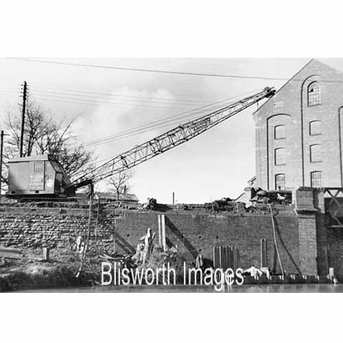 |
34-14 The retaining wall
of brick needed to be repaired and this revealed that an original
retaining wall made of stone had been left in place. It shows
clearly that the road once descended to within a yard of the water level
before arching over the bridge. For someone walking around the
green triangle just beyond the crane, it requires a moment to realise
that the entire area was once level and just above water level.
Evidently the job was an arduous one! |
 |
34-15 Finally the 1875 structure over the canal is removed to reveal the solitary profile of the c. 1800 bridge. |
 |
34-05 A new steel girder and concrete bridge was constructed using RSJ's of at least 15" in height. A double-decker bus probably terrified its passengers by running the bridge before a parapet was built. |
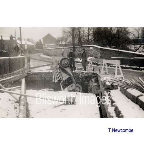 |
34-06 During the work, the arch of the old bridge (the snow covered cylinder in the picture) was inspected and then encased in concrete. Sadly, a MG driver met a bumpy end to his drive from which, apparently, he escaped without scrapes and is talking to a passerby. |
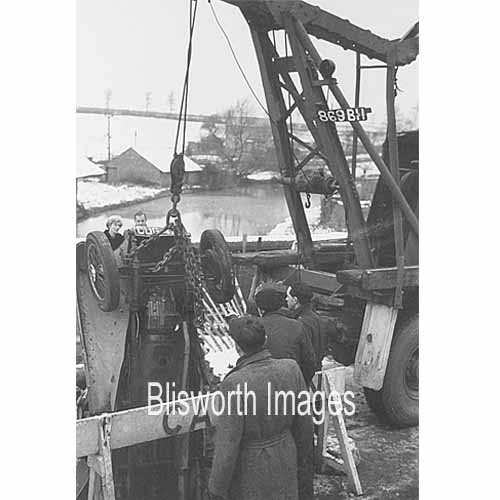 |
34-16 His car was unceremoniously hauled out of the hollow. |
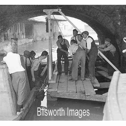 |
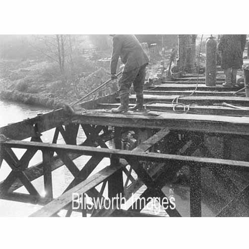
34-17 There were concerns about the integrity of the brickwork of the old bridge and here workmen are using a rather miniature pile driver to stake a work platform in place. |
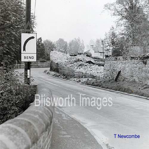
| 34-07 The highways department of the day decide to make the bridge more visible. Note the revision in the white line edge to the road. The arrow did not survived beyond 1959 (see next picture) - it had a curious design heritage which is hard to place. | |
 |
34-07a View at the "bottom corner" in 1960. |
 |
34-08 Having spent some money on straightening and widening the bridge, engineers soon exerted influence on the next hazard for motorists as they entered the village from Towcester. In the 1960's the old Rectory coach house was demolished. There is comment on the coach house also in the High Street, Part II section - especially in the last two pictures. |
 |
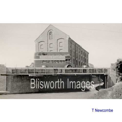
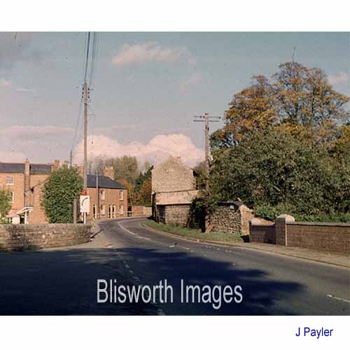
34-18 The bridge has been finished nearly 50 years. In approximately 1980 it required the renewal of the stone capping on the southern parapet . The bridge's twin character blends in well with its surroundings. |