|
Blisworth Bypasses , Blisworth, Northamptonshire, UK. All pictures are presented at relatively low resolution. There will be hundreds of pictures on this site - there is an economic limit to the webspace available. The point of this presentation is that you can see for yourself the extent of the collection and return later as the collection expands - as it surely will. Any interest in copies of a picture at a higher resolution (ie. clarity) should be directed through contacts given in the Blisworth "Round and About" parish council publication or using the comment form on the home page. In some cases the pictures are not available due to copyright restrictions. However, permission has been obtained, where possible, to include them here. Printed below each image is the photographer's name, if known. Home Page This is an Overview Page Works near Blisworth Station & Canal |
|
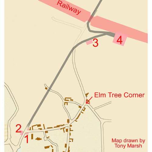 |
41-01 The First Bypass Maps dated c.1810 and 1838 from the Grafton Collection at the Northampton Records Office show, drawn in pencil, an intended bypass around the village beginning at the Sun, Moon & Stars. On a pocket map c. 1825, presumably carried by the Duke's agent, there is detail added near the railway (the intended railway) added in a sketchy manner, again in pencil. Key: 1. Rectory Coach House 2. The Half Moon Inn (later known as The Sun, Moon & Stars) built in 1797 to gain from local activity brought by the canal. 3. Turnpike Toll House (to be placed thereabouts but previously sited by the church yard, see image 16-21) and 4. Blisworth Station (the first somewhat temporary station c. 1837/8) Half way along the bypass the road would have passed very close to the watermill which had been rendered useless by 1797. It is not known why the road was never built especially in view of the substantial road traffic which the coming of the canal (not shown in the map) would have created. However, it seems likely the village traders would have made their objections. |
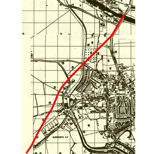 |
41-02 The Second Bypass The red line placed on this relatively recent map is very approximate. However, people seeking a house in the village c. 1970 were told by their solicitors of the bypass plan, specifically that it would pass near to the bottom of the gardens of houses on the Towcester Road and would pass exactly over Candle Bridge (ie. replace it). The map which showed this latter intention has been lost but the transport department of the day (1978) confirmed that the plan had been abandoned. Blisworth Parish council minutes of 1951 note that the bypass would cut through a parish field adjacent to the Towcester Road - just off the left-hand edge of the map.
|
 |
41-03 The Third
Bypass (This page will be corrected if evidence is
provided to show that the final project, completed in 1991, was actually
the fourth or fifth....)
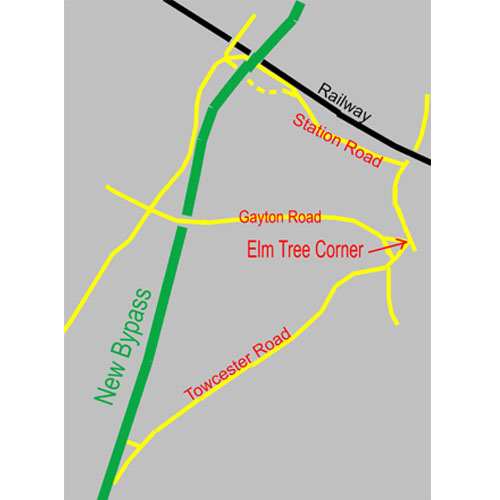
Readers are referred to another page for a brief account of planning issues bearing on this bypass. By 1990 the traffic through the village was up to a staggering 12000 vehicles a day. In addition, the traffic through Flore was substantial because of the need to link to the M1 motorway the A43 trunk road (which is part of a major scheme joining Winchester, Hants and Market Deeping, Lincs.). The green line shows the new alignment of the A43 which intersects the M1 near the Rothersthorpe service station. As explained at a village presentation, the line minimizes intersection of farms, is close to parish boundaries and would use the already compacted line of the railway branch from Blisworth station to Northampton. Links are available at the top of this page to the works for bridges under the Gayton Road and over Station Road, the railway and the canal. On completion of the bypass, the road through the village was officially "detrunked" and some traffic calming measures were introduced - there is a link also to the traffic calming carried out in 1994. |
 |
Note that Station Road was rebuilt as near as possible to the railway so that one system of spans could cross both. This left a short section of Station Road as a cul-de-sac and allowed a longer section, also made a cul-de-sac and shown dotted in the map, to be adsorbed into the Blisworth Park homes area.
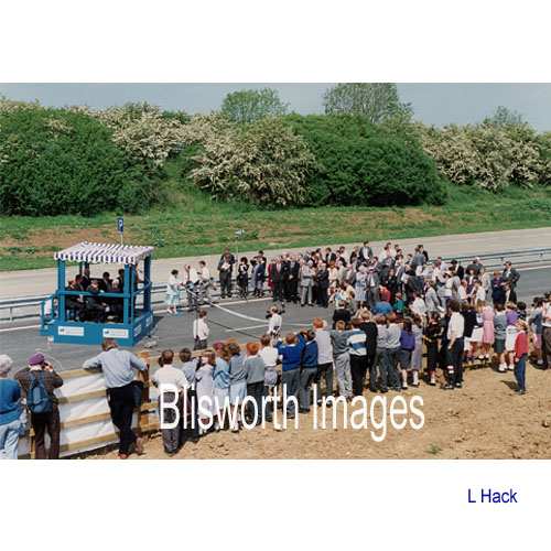
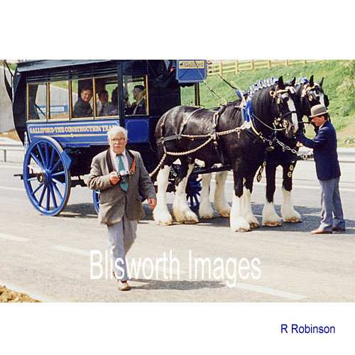
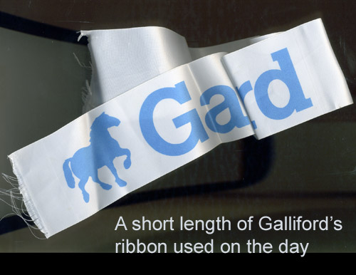
41-04 Upon completion in May 1991, the contractors Gallifords staged an opening ceremony near the Gayton Road bridge. It was watched by many villagers.
|
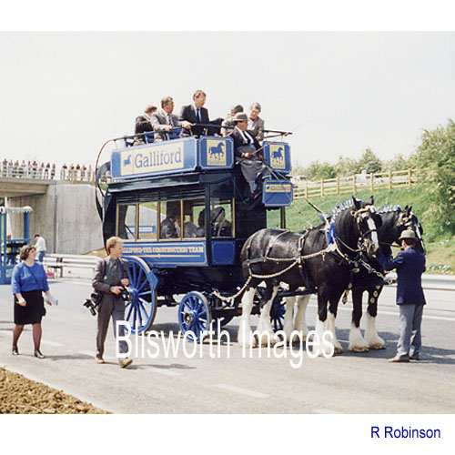 |
41-05 Officials from
Gallifords, the transport department and Northampton County Council were
given a trip along the new road towards the motorway. The
Rt. Hon. Christopher
Chope MP, Minister for Roads, at the Opening Ceremony for the Blisworth
By-pass, 21 May 1991 made the following statement: “90% of traffic will go along the by-pass..... currently 14000 vehicles a day go through the village of which 1200 are heavy goods vehicles” In fact, in terms of overall traffic numbers, he was amazingly wide of the mark as shown by a traffic count carried out just before the traffic calming measures were put in place in 1993 - the average daily number was around 6400 with the proportion of heavy goods vehicles unchanged. A generous estimate for the politician would be 5000/day in 1991, ie. around 65% of traffic used the bypass. The situation at off-peak times in the village seemed, however, markedly better than this statistic would suggest.
|
 |
41-06 George Freeston was there with his trusty camera to record the process. In fact, over the year long project, he took hundreds of slides. The pictures used on these web pages have been offered by villagers but include one taken by G. Freeston. |
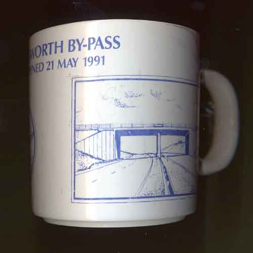 |
The tradition of the commemorative mug continues!
|
|
Please note the links near the top of the page for images of the bypass construction |
|
 |
|