|
Works at Gayton Road , Blisworth, Northamptonshire, UK. All pictures are presented at relatively low resolution. Printed below each image is the photographer's name, if known. |
|
 |
41-28 This picture is taken looking east at the site of the intended bridge. A new concrete road in the form of a 100 yard wide letter "U" has been constructed on the left (to the north) so that the cutting for the new road can be completed from the south and be extended a little way to the north. This measure allows the space to build the bridge. |
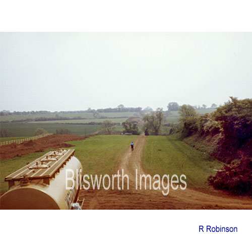 |
41-29 Taken at about the same time as the previous picture, looking south from the side of the Gayton Road. The swathe of land to be used by the new road, with its cutting, is already marked out and will include the line of the parish boundary (between Blisworth and Gayton) which in fact coincides with the high hedge on the right of the picture. The hedge is interesting in that it stands on a bed of ironstone. The fields on both sides have a lower level because the ironstone has been opencast mined in the 19th century. It was mined on both sides by different contractors, neither of which dared to obliterate the parish boundary. The tanker is for fuel needed by the earthmoving machines. |
 |
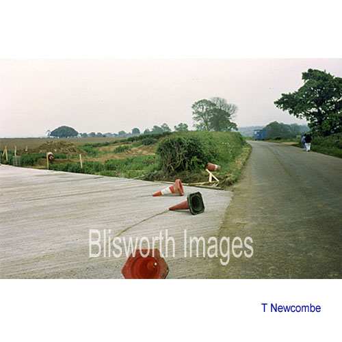
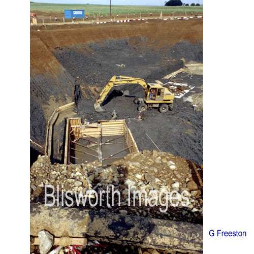
41-30 Looking north, this picture shows that topsoil plus about 5 metres depth has been removed and a boundary fence, which is recognisable today, has been established to the right. A large pile of top-soil, to be returned to farmers, is being collected towards the left of the picture, which has been taken from the middle of the "U" road. At about 15 metres to the left of the slight "crest" in the right hand boundary fence, a place now in mid-air, was found the remains of a Roman corn-drier, see image 12-04. The actual new bridge is to be built BEHIND the camera.
|
|
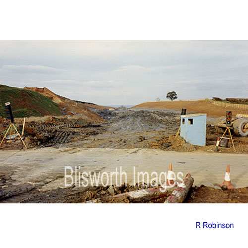
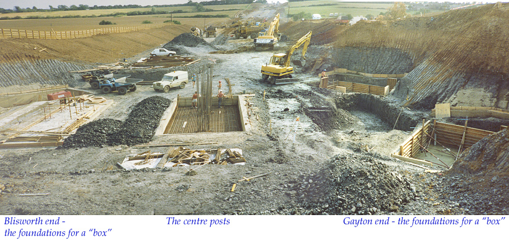
Basic Construction details The picture linked here is a view from the "U" road where most of the excavation has been completed. It shows the preparation of foundations for the "boxes" at both ends of the bridge and the foundations for the concrete post in the middle. I was assisted by the Chief Engineer (at the time, working for Galliford) whose name has slipped my memory because it has taken me too long to get round to posting this new detail. Once the boxes and posts are created, shuttering is created out of wood, mounted on a complex of supportive scaffolding, and the entire bed of the bridge is poured continuously over many hours to create a solid monolith of concrete. Steel cages are buried in the pouring to provide rigidity. The sequence for this process is shown in the following three pictures, taken by the chief engineer: scaffolding wooden shuttering poured, hardened and uncovered |
|
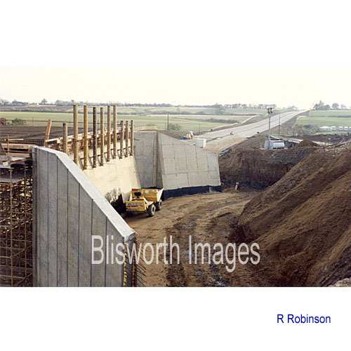 |
41-31 The "U"
road is still in use, at the time this picture was taken. It bypasses the place where the bridge is to be
built. This is looking south from the "U" road. The level of the new
A43 road is
established and has become a useful means of access for contractor's vehicles to
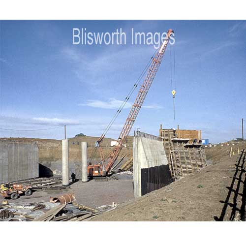
the works. The high reinforced concrete wall, with concrete
"wings", will eventually both retain soil and support one end
of the bridge. The hollow occupied by a yellow dumper-truck will
be entirely back filled with earth. To the left of the picture, the line of the bridge
is already established. There is another winged wall being built
on the other side of the new road making the whole job quite space
consuming - hence the considerable diversion needed for the Gayton Road
on the "U" road.
The wall and the wings need substantial concrete foundations and the box shaped excavation seen in the next picture will carry one of many enormous blocks of reinforced concrete needed for the foundations. |
 |
41-30a Since no bridge
has been built at this time, it is puzzling just where George was able
to stand to take this picture which, as explained above, shows
foundation preparations for the bridge and, at the top, a section of the
"U" road. Note the geology - the top few metres is sandy
and contains ironstone, the lower level is blue clay which goes down
to well below the level of the River Nene.
|
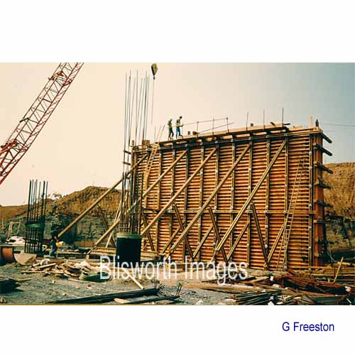 |
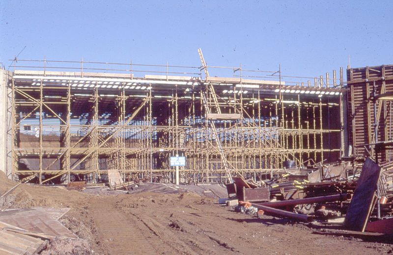
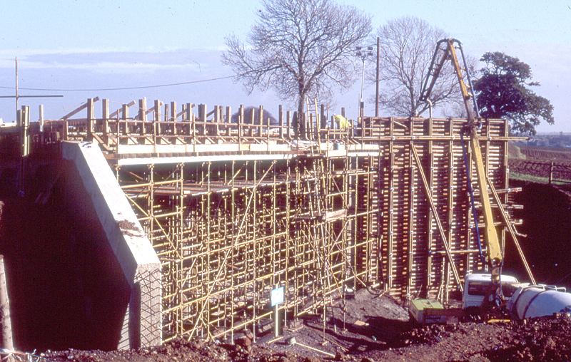
41-33 A tall shuttered box was then mounted to contain concrete for each slab shown above in 41-31. |
 |
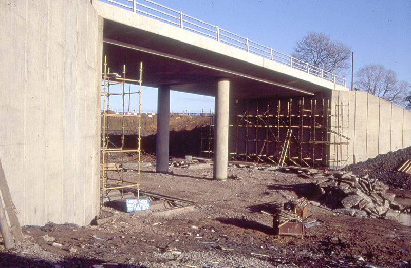
41-33a Showing progress on the end walls and central columns. |
 |
41-32 The view taken here
is from the near completed new bridge.
If anyone has some more pictures which help explain this part of the work then please contact me so that they can included. |
 |
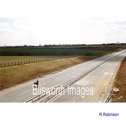
41-34 One year later! |