|
Views from the Church Tower , Blisworth, Northamptonshire, UK. All pictures are presented at relatively low resolution. There will be hundreds of pictures on this site - there is an economic limit to the webspace available. The point of this presentation is that you can see for yourself the extent of the collection and return later as the collection expands - as it surely will. Any interest in copies of a picture at a higher resolution (ie. clarity) should be directed through contacts given in the Blisworth "Round and About" parish council publication. In some cases the pictures are not available due to copyright restrictions. However, permission has been obtained, where possible, to include them here. Printed below each image is the photographer's name, if known. |
|
 |
View at the top The apex is the centre of a lead covered roof. In George Freeston's notes much is said about the scratching and initials on the lead. He did not photograph the marks but took rubbings of many of them. The roof was replaced in c. 1960 with one clad in copper. The stones around are, of course, the 'battlements' of the tower wall. |
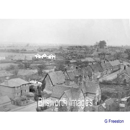 |
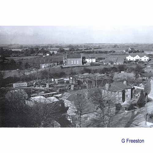
East Showing the lines of houses along the lower half of the High Street with what was once called Rose Cottage at the lower left corner - the home of "Clocky" Whitlock, William (1836 - 1905), sexton and clockmaker. William's son, William Thomas (1874 - 1935) was born at Rose Cottage and buried in the CoE cemetery nearby. This William Thomas however lived elsewhere for most of his life and was a first cousin to our colourful Witty, William John (1873 - 1966). There is more about the Whitlock family on the website. |
| South-east missing | |
 |
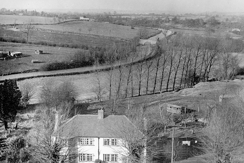
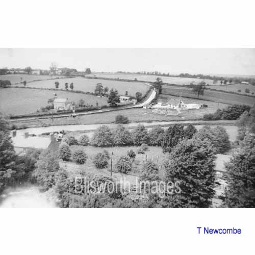
South Looking towards the first bend in the canal south of the mill. The line of the old plateway is clearly discernable. |
|
|
|
|
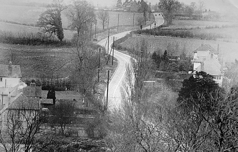
View towards the Towcester Road. Note that in 1950 there was no wide grassy verge on the right beyond the last house. Apart from having the effect of improving visibility, the verge was probably created at the time ironstone digging machines were transported to the edge of the mining area c 1958. The electrical terminal for the limestone digger was placed well away from the road too. |
|
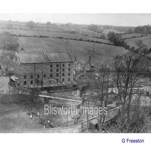 |
West Showing the mill with the heighbouring warehouse with a roof in the process of being re-covered - Rectory Cottages beyond. |
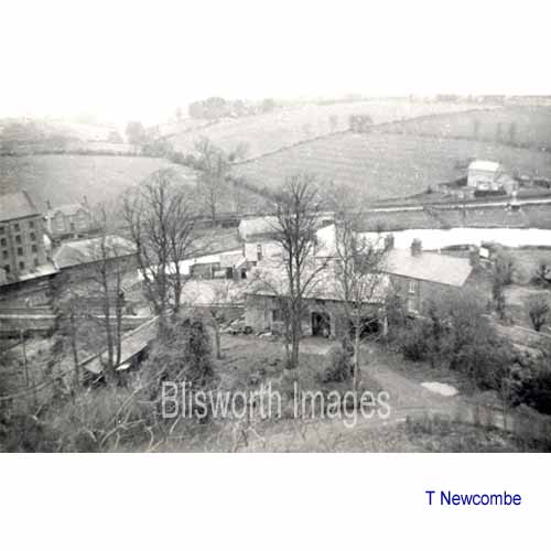 |
West, north west Extends
the view to incorporate the stone house now called The Bays, a short
distance along the Gayton Road. The old
Rectory Coach House is in the foreground amidst the trees.
Directly behind the Coach House is the Sun, Moon & Stars public
house - on the other side of the High Street.
The engine house roof is finished - all these photos date from the 1950/60 period. |
 |
North west The main point of interest is the rather tidy appearance of the CoE cemetery and the modest sized lime trees around it. The substantial trees to the bottom right are large elms which used to border the edge of the church yard.
|
|
|
|
|
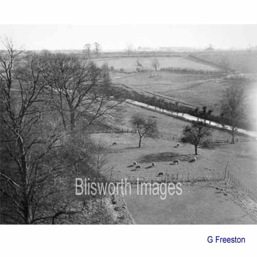
North Showing Candle Bridge and perhaps a hint of the modest bungalow beside it known as Candle Cottage. The barn at top centre-left was removed in c. 1960. The field in the foreground is Pond Bank and in front of that is Burbidge's yard. The fields on the other side of the canal all show signs of "ridge & furrow" cultivation - they were part of Nether Field before the 1812 inclosure. |
|
 |
North-East In the bottom
of the picture are a few of the topped elm trees which edge the church
yard. In the mid-foreground are Burbidge's timber sheds.
Behind that is the Baptist Chapel with its steep old graveyard.
Behind that the railway arch can be seen.
This picture is an early one. Between the chapel 'White House' and the Royal Oak stand 2 or 3 old cottages. These were replaced by a bungalow in the early fifties and the Day Nursery building (which began life as a mini-factory - Ashman & Clough's printing, c.1968). |