|
Pond Bank , Blisworth, Northamptonshire, UK. All pictures are presented at relatively low resolution. There will be hundreds of pictures on this site - there is an economic limit to the webspace available. The point of this presentation is that you can see for yourself the extent of the collection and return later as the collection expands - as it surely will. Any interest in copies of a picture at a higher resolution (ie. clarity) should be directed through contacts given in the Blisworth "Round and About" parish council publication or using the comment form on the home page. In some cases the pictures are not available due to copyright restrictions. However, permission has been obtained, where possible, to include them here. Printed below each image is the photographer's name, if known. |
|
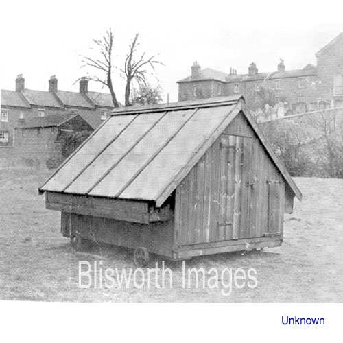 |
25-01 The corner of Pond bank field near to the Campion Terrace. This is one of the Burbidge chicken houses. |
 |
25-02 At some time before 1727, the area was turned into a meadow by draining a millpond. It has to be assumed that the village windmill was available for most of the milling duty and another alluvial field would be of high value. At that time, a tiny millpond in one corner was retained for part-time water-milling but was abandoned altogether in 1796 on loosing all water due to the arrival of the canal. The canal runs at a slightly raised level - to the right of the picture . The field has always been prone to flooding - not helped by a high water table imposed by imperfect seals to the canal sides and the fact that the mill dam is still there, supporting Chapel Lane. In the period 1945 to 1955 there were regular fairs put on in the field by the Strudwick family. In 1967 the field was surveyed as potential building land and, despite some concerns expressed by local folk over the flooding, contractors went ahead and established the streets of Pond Bank and Westbrook. The houses at the lower end of the field, nearest to Chapel Lane ie. nearest to the position of the mill pond dam, stand on footings which consumed more bricks than the houses themselves. |
 |
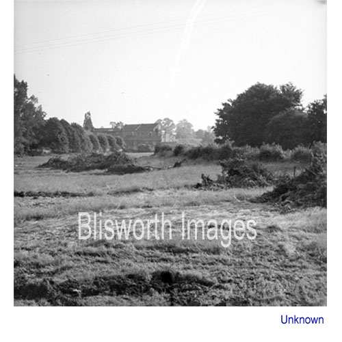
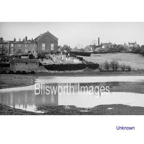
25-03 Pond Bank field looking towards Candle Bridge. The row of elms to the right of the bridge stand on the mill dam. There is also the reasonable supposition that the mill pond was equipped with a fish weir c.1700 or earlier. In the closing year of the European WWII there amassed here some Canadian troops with various types of vehicles including tanks. Villagers have stories of the tank drivers, in mad abandon, modifying fences and hedges in the area - even demolishing a barn. The troops were almost certainly assembling prior to the D-day push. They livened up the village, however. There is more of this from Shutlanger. There has been the comment that Canadian soldiers were on maneuvres also in 1940.
|
 |
25-03a A view of the boundary to Pond Bank field from a different angle to that above. Date 1962/3. |
 |
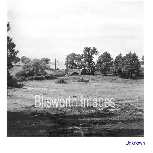
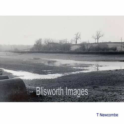
25-04 A flooded Pond Bank field. Date uncertain - probably 1960. The picture shows how much of old Blisworth was set upon an edge of ironstone with, in some places, a steep descent to the level of the mill pond. The edge peters out to the left of what is shown here and becomes indistinguishable with Cliff Hill. To the right it can be easily picked up again just below the old rectory, visible from the canal towpath. The edge disappears into the beginnings of the excavation for the tunnel mouth.
|
 |
25-04a The field in
1967. Bearing in mind that the hedge along the canal is obviously
level, then it is clear that the field has been 'levelled' over the
centuries by a pond, a mill pond in fact, which extended over nearly the
whole field. The huts on the left are pig-huts and are also
visible in the picture above.
Articles about the history of Blisworth Watermill have been added to the site - see 'Mills' and 'Water Mill'. |
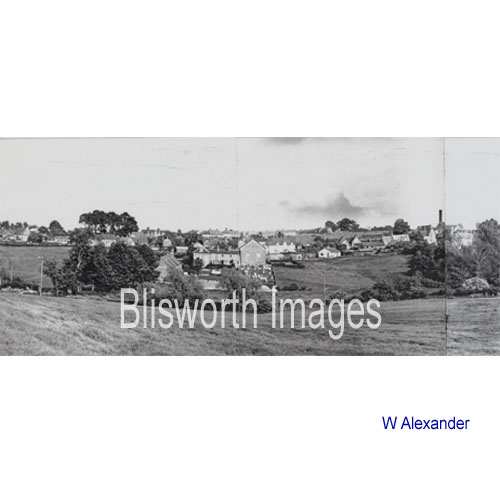 |
25-05 Part of a panorama created by the photographer showing a view across the canal towards the Baptist Chapel. |
 |
25-06
Watercolour by John Chamberlain, professional artist, based on a photograph by Walter Alexander. |
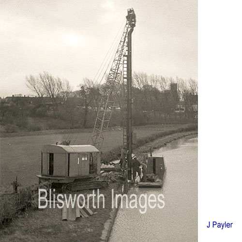 |
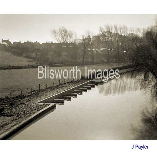
25-07 The weir at Candle bridge being constructed in 1958. The machine is driving in steel interlocking piles behind which the concrete for the weir will be formed. Once the new weir was completed, the old one on the other side of Candle Bridge became disused but was not sealed up until c. 1990. The new culvert for the waters that constitute the continuation of Fisher Brook (Wash Brook) is over 3' diameter. The old one, which passes under Candle Cottage, is about 18" diameter and was clearly inadequate.
|
 |
25-08 Winter's calm at the weir in 1960. |
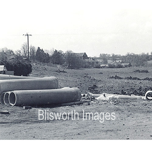 |
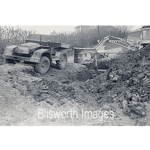
The beginnings of the K.G. Laurence housing estate on Pond Bank. Being a disused mill pond it was necessary to install substantial drainage and connect it to the stream taking the canal overflow from the canal weir. |
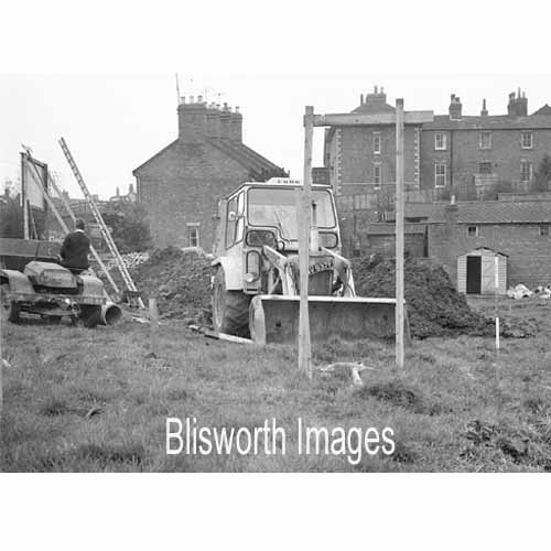 |
25-10 K. G. Lawrence expended much money and energy in draining the field ready for house building. A culvert at a depth of 13 or 14 feet had to be installed and taken across the lane and down to the bend in the brook known as Fisher Brook or Wash Brook. This is very close to the site of the old watermill. It was in the deep cutting that G Freeston found a fresh water mussel shell - see article on milling.
|
 |
|
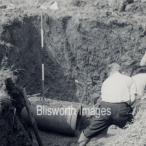 |
The drains extended into the field away from the embankment which carries Chapel lane. At this depth (6 foot) the location was probably near the bottom of Washbrook. |
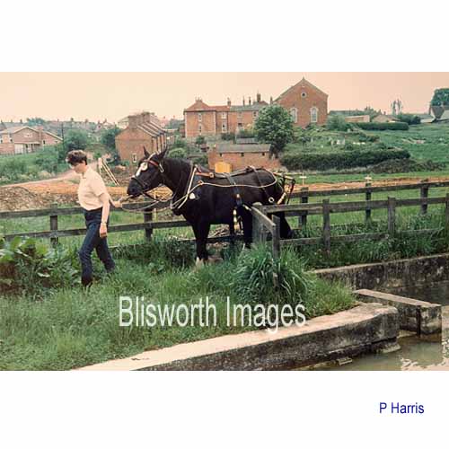 |
25-09 1969, at which time narrow boat Pamela was on hire as a horse drawn holiday boat. The interest in the background is that the main access road which was to become Pond Bank has been established. |
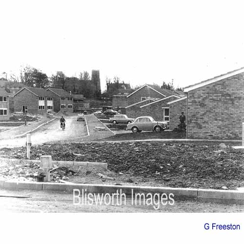 |
25-10 The establishment of
Pond Bank in 1970. As in the earlier estate streets set up in the
village, it was normal for some houses to be finished and occupied
before nearby ones were even started.
The houses on the right have gardens which go back to the towpath but there is a strip of land belonging to British Waterways which is let to the occupants of the house. It is now considered known how this anomalous strip arose. |