|
Aerial Views , Blisworth, Northamptonshire, UK. All pictures are presented at relatively low resolution. There will be hundreds of pictures on this site - there is an economic limit to the webspace available. The point of this presentation is that you can see for yourself the extent of the collection and return later as the collection expands - as it surely will. Any interest in copies of a picture at a higher resolution (ie. clarity) should be directed through contacts given in the Blisworth "Round and About" parish council publication or using the comment form on the home page. In some cases the pictures are not available due to copyright restrictions. However, permission has been obtained, where possible, to include them here. Printed below each image is the photographer's name, if known. |
|
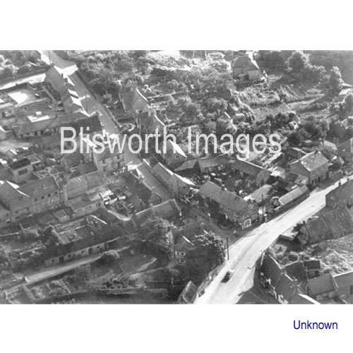 |
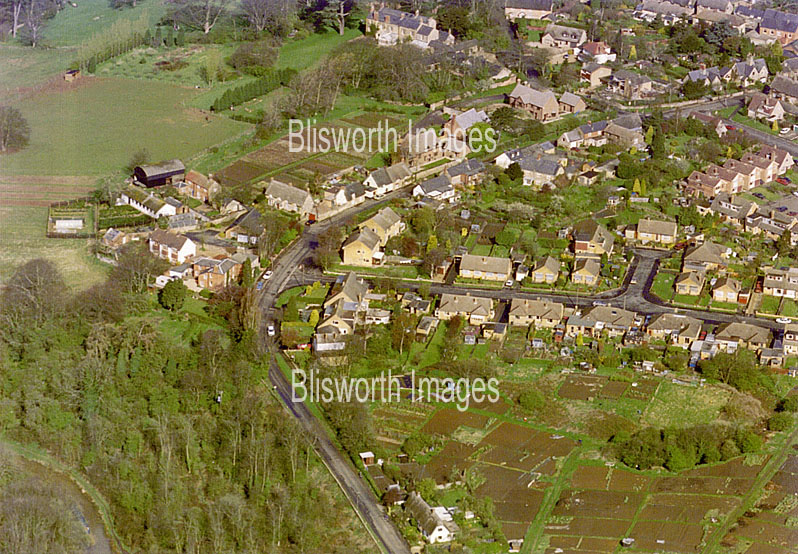
01-01 View showing The Cross on the right, lined by old cottages, and the junction between Stoke Road and the High Street. Date probably c. 1950. Note that Home Farm is there, near the top of Church Lane, as are the buildings associated with the bacon factory and the houses along the left hand side of Stoke Road (going towards Stoke Bruerne). Opposite the camera position, behind the post office building is the untidy yard of the Freeston garage. |
|
Footnote: Click Here to see sections of the picture above at higher magnification |
|
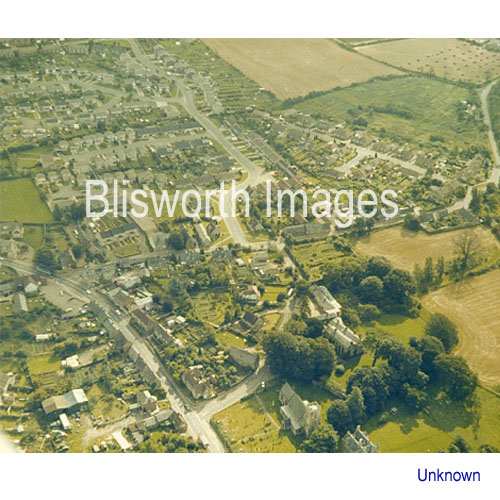 |
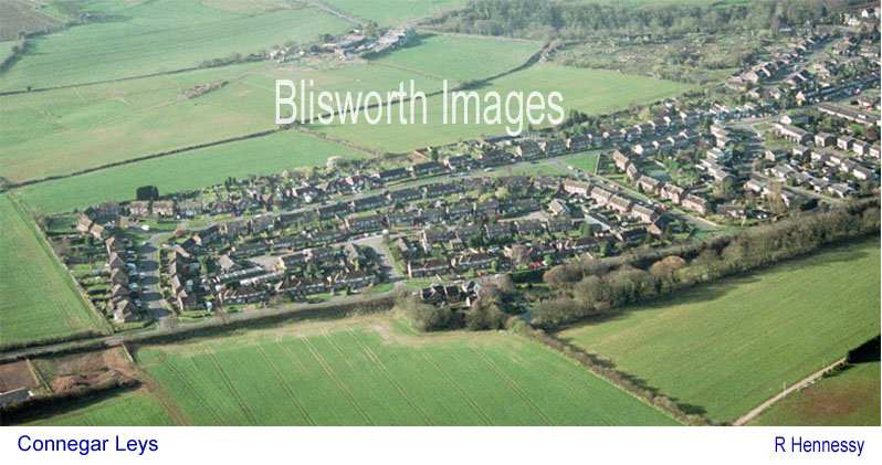
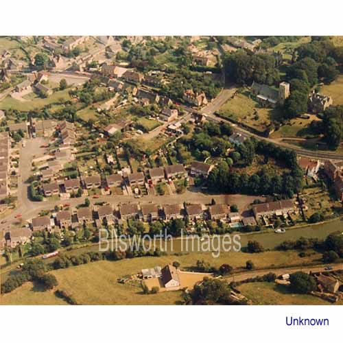
01-02 A view showing the church at the bottom of the picture, Blisworth House behind the church and most of the new houses as far as the edge of Connegar Leys. Date probably c. 1980 - Ashley Court has yet to be built. At bottom left are the Burbidge sawmill sheds
|
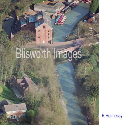 |
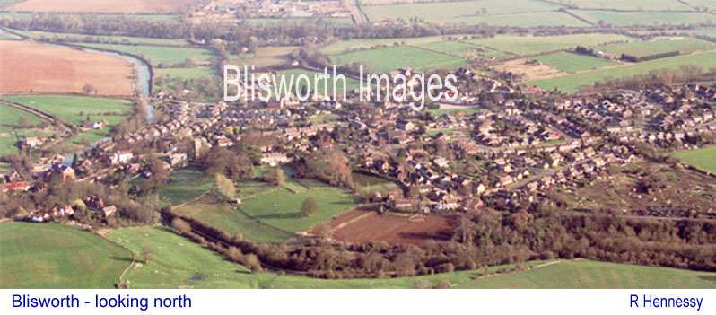
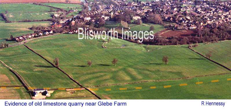
The majority of the images on this page have been taken by Dick Hennessy during a hot-air balloon flight over the village at around 8.30am on the 19th of March, 2000.
01-03 An unusual view of the mill - nearing completion for conversion into 21 flats. |
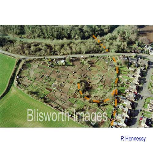 |
01-04 The allotment field on Stoke Road with Greenside to the right, ie. to the south. The path of railways used in the extraction of ironstone 1855 - 1900 are shown in orange. The canal is visible in its deep cutting at the top of the picture. The railway ran down to a bridge over the canal which facilitated discharge of the ironstone into narrow boats. Below is a relatively recent picture of the allotment field that includes a view of many Stoke Road properties.
|
 |
|
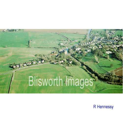 |
01-05 The west end of the village with Pond Bank in the distance. |
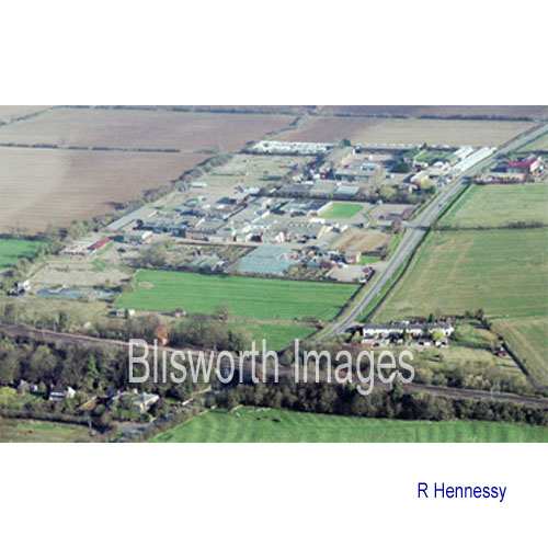 |
01-06 The industrial part including Young's Nursery, the meat processing factory (Buswell's) and the JBJ industrial estate. In the foreground are the Grafton villas, the main line railway and the Railway Cottages. Note the clear visibility of ridge and furrow cultivation (practiced in this parish up to about 1700) in the field at the bottom of the picture.
|
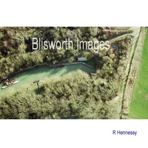 |
01-07 A view of 100 yards of canal adjacent to the north portal of the tunnel. The "arrow head" feature is the slit down which Fisher Brook joins the canal from a culvert.
Below are three more images, 01-08, 01-09 and 01-10 in order. |
 |
|
 |
|
 |
|
| In the image above there is a dotted orange line along the path estimated for the Roman Salt Way which cuts through the Parish of Blisworth. It is mentioned by a curate in c. 1718 in reviewing attributes of the parish with Wm. Taylor, referring to a source of stone being at a place called "Salt Way". Taylor was collecting information for Bridges for his History of Northamptonshire. At the centre of this view there has been found, in July 2009, evidence of a Roman farmstead. | |
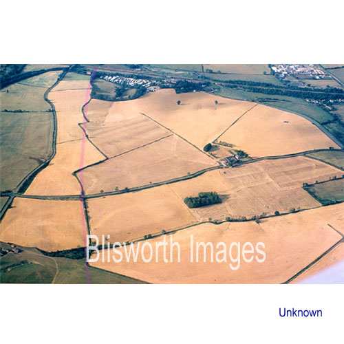 |
01-12 A view looking north with the industrial estate in the top right corner. The faint pink line is the very approximate line of the bypass, completed 1992. The line of hedges that the bypass roughly follows is the Blisworth Gayton parish boundary. The farm is Hill Farm on the Gayton Road. The small wood in the centre is called Fox Covert formerly a quarry or claypit. Almost the entire lower half in the picture was surface mined for ironstone. Perhaps the most obvious sign is the steep dark bank edging a cornfield centre-left where the ground was 3 or 4 metres below the level of the road - before the bypass construction. Many level differences in the area are noticeable from the road. |
 |
01-13 View of Pond Bank and the lower part of the High Street. |