|
The Ironstone Bridge , Blisworth, Northamptonshire, UK. All pictures are presented at relatively low resolution. There will be hundreds of pictures on this site - there is an economic limit to the webspace available. The point of this presentation is that you can see for yourself the extent of the collection and return later as the collection expands - as it surely will. Any interest in copies of a picture at a higher resolution (ie. clarity) should be directed through contacts given in the Blisworth "Round and About" parish council publication or using the comment form on the home page. In some cases the pictures are not available due to copyright restrictions. However, permission has been obtained, where possible, to include them here. Printed below each image is the photographer's name, if known. |
|
 |
17-01 This view of the bridge over the Grand Union Canal was incorporated in the Grafton Estate sale catalogue of 1919. The bridge was eventually taken down in about 1930 after many complaints about its safety. The canal-side opposite the towpath was a wharf not only for ironstone but also limestone. The path taken by the limestone railway down to the wharf this side of the bridge, to the right of the canal, can be easily made out though the rails themselves, which should be there, are not clear. The limestone track was probably taken up in the 1920's after the Hunsbury iron furnaces were closed. |
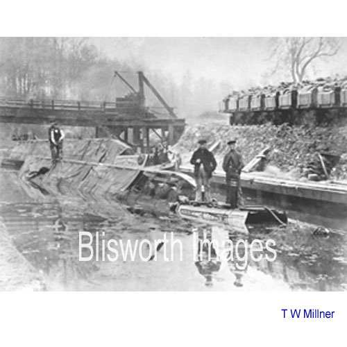 |
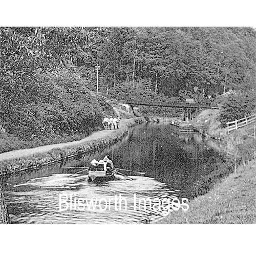
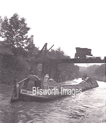
17-02 This picture taken by the GJC Chief Engineer is of interest for three reasons. Obviously it shows a canal incident (see the canal pages) but in the background there is the ironstone bridge. Some details of the wagon tipping mechanism is evident. On the bank are some limestone wagons from the nearby opencast quarry (even older than the ironstone workings). The wagons open at their sides so that limestone can be chuted into waiting narrow boats (see image number 08-04). Note that the wagons have a breadth perhaps twice that of the rail track. Unusually, not only a high quality print but also a glass 'whole plate', original negative, resides in the Northampton Record Office, G Freeston box 1996/Limestone. Offices at Blisworth Arm Wharf were in the process of being demolished when G Freeston pointed out there was material which should be saved. Much of the Canal Collection at the NRO was rescued by G Freeston at that time but this picture has not yet been transferred to it. |
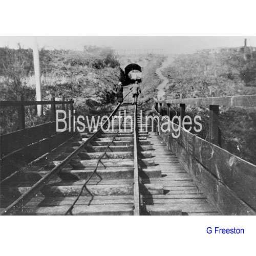 |
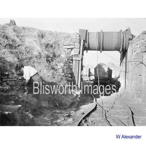
17-03 Despite safety concerns the photographer stood in the middle of the bridge to record Bill Freeston with his fiancee walking back up towards the bridge under the Stoke Road. At about this time, c. 1930, there remained on the bridge a single wagon that was left at the close of ironstone mining business in 1921. The workers arrived one morning to discover the gates locked. It was a feature of the hoist system that always left a wagon, or group of wagons, on the bridge. A rare photo of the last wagon, which may have been taken by Walter Alexander, is shown here. An overview of Blisworth mining is given here.
|
 |
17-04
The same view from a lower position since the bank of earth for the railway was removed. c. 1960 |
 |
17-05 About 30 yards on the other side of the Stoke Road was the brake drum which set up to lower full wagons onto the canal bridge and, with the extra weight, raise empties back up to the field. In the foreground is the fork in the rails to allow the wagons to pass each other. The drum was not steam driven.
|
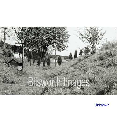 |
17-05a The same location in c. 1965. All that is left is a pronounced groove in the ground. Some gardens behind houses in Greenside have been extended into the cutting while maintaining the steep sides. The aerial view of the Stoke Road Allotments shows the line of the railway down to the bridge. |
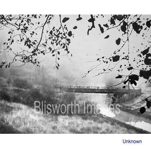 |
17-06
The photographer appears to have used a double exposure to create this pleasant picture. For that reason it is likely that it was taken by Walter Alexander - but we do not know. |
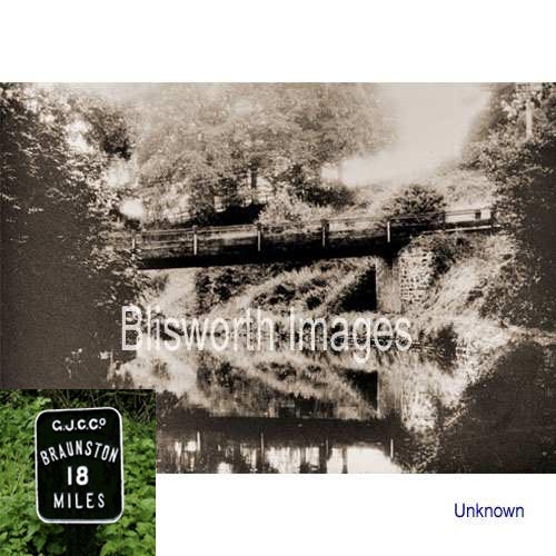 |
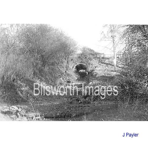
17-07 A view of the bridge
taken from the tunnel side. Date probably quite early judging from
the photography. The stone pier that supported the bridge has long gone. To the right
of the picture, by the towpath side, it is possible to make out the
canal milestone ("Braunston 18 miles" is presently written on a modern
re-incarnation of the milestone) from which anyone today can work out exactly where the
bridge was located.
The inset shows the 18 miles sign with its earlier Grand Junction Canal reference, photographed by J Payler. |
 |
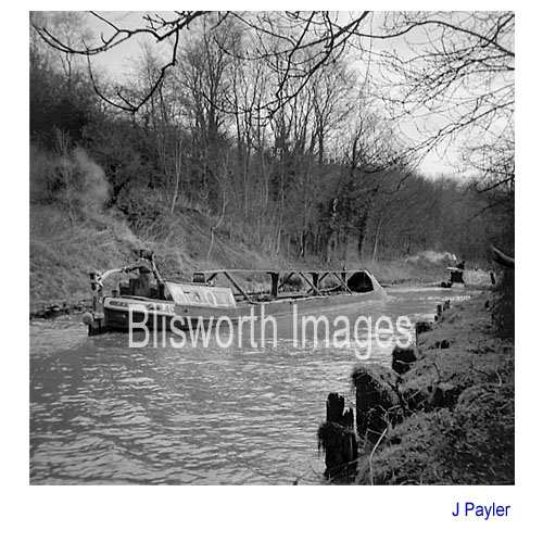
Judging from the condition of the towpath and the appearance of the telephone posts this picture is dated around 1930s. It provides a good view of the massive timbers that supported the off-side end of the bridge which appears to have the last wagon still mounted on it but shifted towards the end. The limestone chute, made of timber, has been cleared away. |
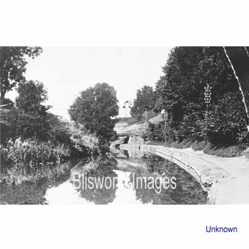 |
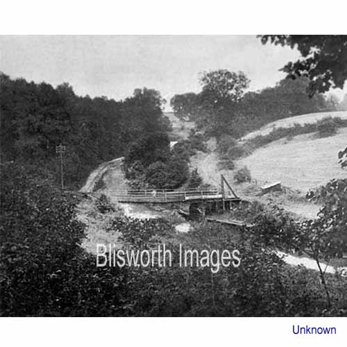
17-09 Yet another view of the bridge, this with millpond conditions. The telegraph equipment suggest c 1900. |
|
|
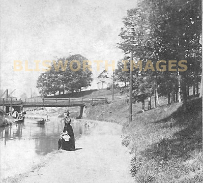
This picture comes from Rod Warner (via the Pictures of England website) and shows the scene from above at a stage a few years earlier. Estimating the date of this picture at 1885 suggests the lady may be the wife of the new rector Henry Thomas Barry (Rector: 1884 - 1904) as the gate from their gardens is just a short distance further on the towpath. The picture is from an album it seems.
|
 |
17-08 In 1958 there were remains of posts which marked the position of the bridge, or wharf or both. Nothing can be seen today. |