|
The Ironstone Works Part I , Blisworth, Northamptonshire, UK. All pictures are presented at relatively low resolution. There will be hundreds of pictures on this site - there is an economic limit to the webspace available. The point of this presentation is that you can see for yourself the extent of the collection and return later as the collection expands - as it surely will. Any interest in copies of a picture at a higher resolution (ie. clarity) should be directed through contacts given in the Blisworth "Round and About" parish council publication or using the comment form on the home page. In some cases the pictures are not available due to copyright restrictions. However, permission has been obtained, where possible, to include them here. Printed below each image is the photographer's name, if known. |
||
|
Back to INDEX page This is Part I Part II Part III |
||
|
||
|
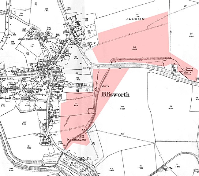
I have had some help in
providing details on ironstone mining from Steve Purcell who has
researched The map attached here shows
the extent of ironstone mining from 1865 - 1914 to the east of the
village. An overview of all Blisworth Mining is given here. |
||
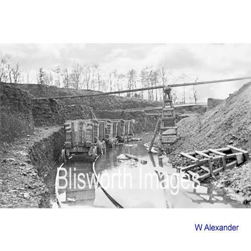 |
18-01 This is the curved cut in the allotment field also visible in an aerial view. Note the planking to allow overburden to be moved off the ironstone and piled on the other side. Found in the remaining cut across the allotment field was a pair of wheels from one of these wagons. However, the evidence in a recently recovered map suggests that the arc in the allotment field began as a wide one that was progressively shrunk down with a tightening of the curvature. This plate may well have been taken of an entirely different location to the allotment field because it shows a spoil layout for a widening curve. |
|
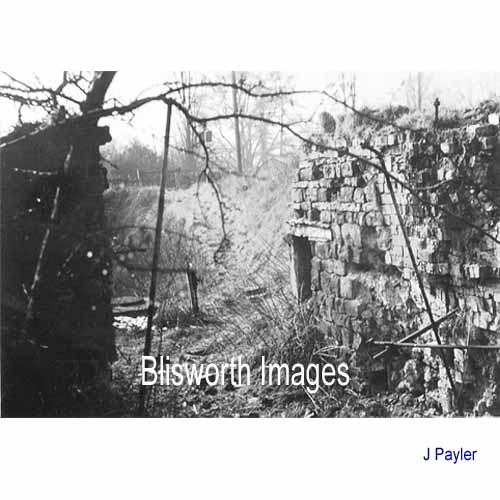 |
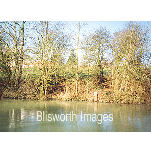
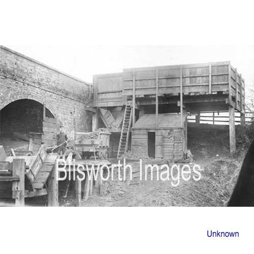
18-01a This picture shows the stone "portal" through which wagons passed from the allotment field workings down to the canal. Over the portal was installed an iron brake drum, see Iron Stone bridge. |
|
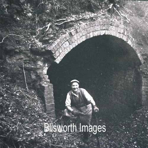 |
18-01b To get to the canal from the allotment workings, the rails for the wagons passed under Stoke Road through a tunnel. Dated 1974, this shows preparations for the tunnel to be filled with dry concrete mix. |
|
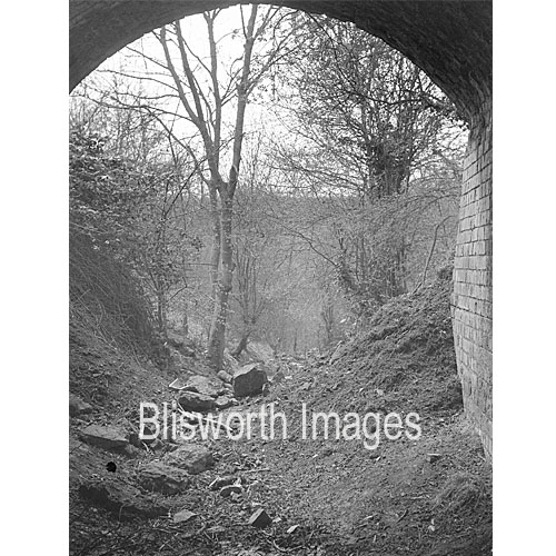 |
This was the view through the Stoke Road Tunnel looking up towards "The Drum" before the area was cleared and set to gardens - pre-1960. |
|
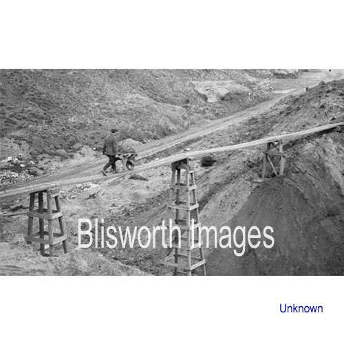 |
18-02 This death defying practice was apparently commonplace. The planks are of top quality pine, 2 or 3 inches thick and 12 inches wide. The steps of the barrowman must be sympathetic to the resonance of the plank. On a few sites 15" planks were used. It is said "they were like an ocean liner to walk on" compared to the lighter planks.
|
|
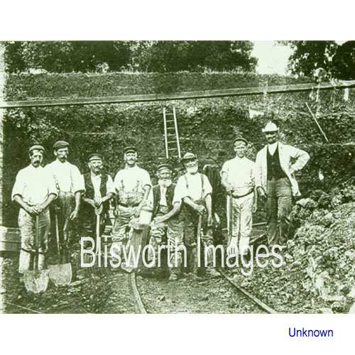 |
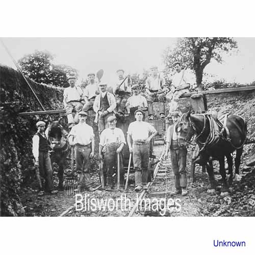
18-03 left to right:
Walter Chambers, "Pegleg" Clark Joseph (he lost one!), Bailey
Chambers, Tom Robinson (Shutlanger), Steve Mallard, James Pinfold, Bert
Valentine (Shutlanger), "Toby" Jim Durrant - foreman.
Location not known. |
|
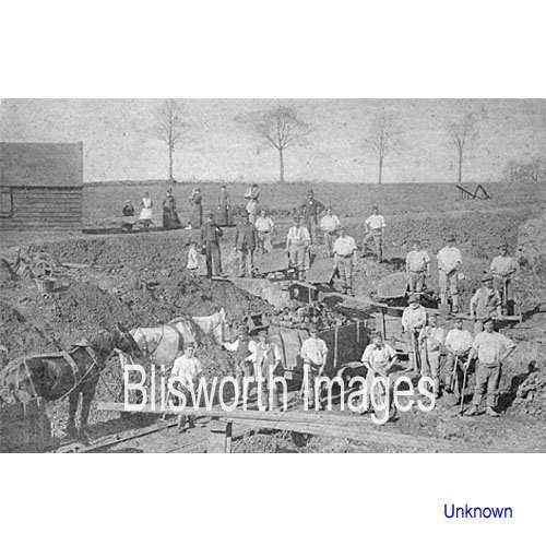 |
18-04 Dating from about 1880, this picture is of a group working in Blisworth on either "East Field" or "Windmill Field" - Blisworth Pit 1 - and the gentleman in the bowler hat is John Capell - second row down, third from the left (including the child) He became the publican at the Sun, Moon and Stars Inn and died in 1899. No other names are known.
|
|
|
|
||
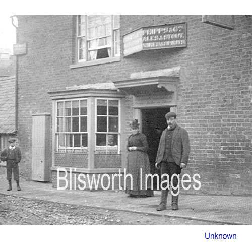 |
18-05 Mrs Capell, publican and ironstone foreman's wife. | |
 |
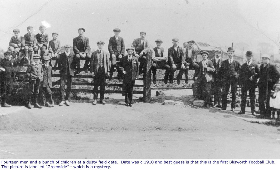
18-06 A Blisworth gang, most names
are known. Location is Cowhouse Close adjacent to the parish
boundary with Gayton. Date c. 1910.
If the location is actually Cow Close then as shown in the map (a few images below) there appears to be no rail for the waggons. The rail probably ran west from Cow Close and merged at railway points with the main rail towards the canal. |
|
 |
18-07 A picture provided many
years ago by Peter Butcher of Gayton. The gang is believed to be
working a shallow pit in the Gayton Parish. names are, Left to Right: Top Row - ? Middle row: Geo Scott (Tiffield), Dunkley (Gayton), Reg Nightingale (Pattishall), Chas Hillyard (BLIS), F Pinkhard (Tiffield), H Wootton (Tiffield). Bottom Row: Jack Nightingale (Pattishall), Walt George (Gayton), Aub
Shipperley (Gayton), Harry George (Gayton), Tom Pell (Gayton). |
|
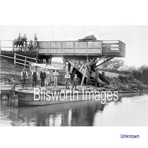 |
18-08 The Gayton Road loading station. A wagon railway ran through the field below Hill Farm, crossed the Gayton Road a few yards above a cottage called "The Bays" and ended over the canal opposite Pond Bank (house No. 44 approximately). The names of the Blisworth and Gayton workers in this picture are known. Ironstone was dropped down the chute into wooden crates in the narrow boats. The crates were then lifted by crane, at a railway siding one mile away, onto wagons destined for the Hunsbury iron furnaces. Date c. 1900 - 1914 - the furnaces closed in 1920 and WWI interrupted production.
|
|
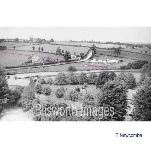 |
18-24 Taken form the church tower, as was the picture numbered 16-20a in the High Street section, the coloured line indicates the estimated position of the ironstone tramway and unloading chute described above. The rail line crosses the Gayton Road about 10 to 15 yards south of the hedge line behind the barns - this is shown in a 1947 aerial photo (NRO) by the hedges on both sides of the road. | |
|
|
||
|
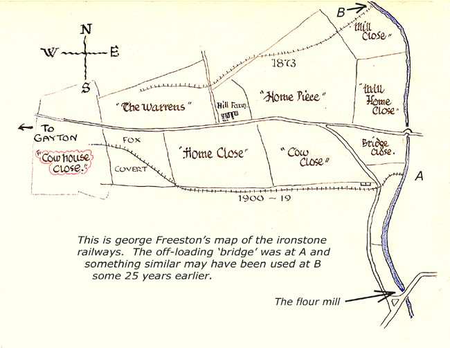
In fact, a good description of the rail and B off-loading point is provided in a Mining Overview. |
||
 |
18-08a By 1956 this was all that was left of the wooden stanchions for the loading platform or wharf. Nothing can be seen now. | |
 |
18-09 A distinctive off-load
chute at the SMJ railwaycutting estimated c 1900.
The location of this installation has been the subject of recent discussions and research. It was eventually realised that it was set up at the Gayton to Blisworth road bridge. |
|
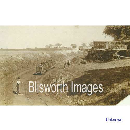 |
18-10 Date is believed to be 1895 according to G. Freeston (1953 "Scrapbook"). The difference in levels between the two sides of the picture and the depth of the cut indicate the thickness of the "seam" of ironstone. Note the curved line of planks to the right. George states the location is the field north of the Courteenhall Road and the vantage point is by the side of the road, over the bridge through which the rails ran. This picture therefore relates to picture 18-04 above. Scaled from the known width of those planks, 12 in, the depth of the excavation must be at least 20 feet where the wagons are located. For the location suggested by George that seems implausible until one notices that the houses built at the end of Wellspring are indeed placed very low in relation to the Courteenhall Road. Go there and wonder at the massive change that mining brought!
|
|
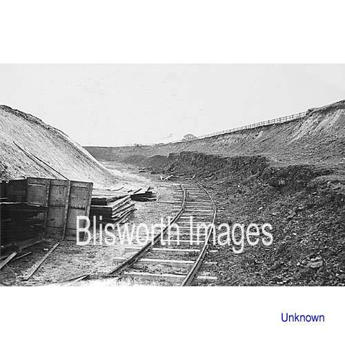 |
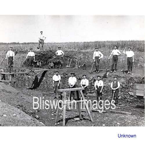
18-11 Also an unknown location
but is typical in terms of layout. There is layer of ironstone on one
side of a railway with the overburden cut back to reveal the ironstone. The overburden has been taken off and transferred to the
other side where it is piled at a safe stable angle. The modern
way of doing the transfer is with a mechanical digger mounted on a
turntable. In the Victorian open mines, all the material was
barrowed across narrow planks. After some time, the central
railway will be moved, in this scene - moved to the right, so that
mining can continue.
|
|