|
Blisworth
Houses and Quarries This
is to put the record straight. The question has been:- what sources of stone
were
used for the notable houses in the village?
Not all contention is dispelled by this paper. Perhaps the only way
to clear up doubts would be to get stone samples analysed.
Before 1800,
Blisworth had a couple of limestone quarries towards the east of the parish,
quite near to the Courteenhall Road. They are marked as Lime Kilns in
Bryant's map of 1825. The quarries could have been opened in medieval
times for providing stone for building and
repair of cottages in the village. By the time of the fields
enclosure in 1808 they were officially assigned to provide stone for road maintenance
and, apparently, the Duke of Grafton instructed his agent to find a new
quarry in order to sell stone. His agent (Mr.
Roper) was actually already
selling stone at the time and so he knew a likely place to establish a new quarry,
that being just adjacent to one of the "road" quarries and in 1821 he
opened it for business, opening onto the Stoke Road.
Two buildings can
be directly associated with the new quarry:
(1). The Stoneworks "Office" on the Stoke Road. It
was built with stone from mere 100 - 200 yards distant, the date it was
established is not recorded but assumed to be c.1830.
(2). The Pair of Villas built at the junction of the road to the
railway station
with the Northampton Road. A new agent, Mr. Gardner, suggested to the Duke in 1838
the site for
the Villas as appropriate for advertising the quarry
to anyone going to/coming from the station. So the date of the villas is
1839.
The
quality of the stone in buildings (1) and (2) is similar and not very
durable. Pieces of stone detail have fallen off due to weather spalling over the
150 years since they were built, in particular repairs to the villas were
made in the 1990s and new lettering in stone was installed at the head of
the Stoneworks building. Many limestone cottages and garden walls
have also suffered badly over the years and have been liberally dressed with mortar at stone
joints to minimise the weathering. Such cases are thought to be due to the
weak stone from the Stone Works quarry.
Consider
two more buildings:
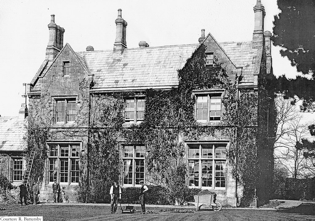
(3). The Old Rectory built next to the Church and finished in
1842 for the Revd. W. Barry. The reverend had very high standards and was
probably the wealthiest rector that the village has seen, coming we
believe from the Whitby, Yorkshire area and from a family involve in
shipping. This is what George Freeston said of the house in his
4-weekly Church News Letters of January 1971, "It certainly appears that, with all this sudden change around his old Rectory, within his first three years of coming to Blisworth
the Rector was prompted to build a new Elizabethan style Rectory a little further to the southwest of the old building. Although the Parish had a first class Stone Works and Quarry on the Stoke Road established in 1821, he chose to procure his stone from a quarry opened up on the Towcester Road at the Rectory Farm."
Well, George was right in saying that the Stone Works quarry was shunned
but totally wrong in declaring that the quarry on rectorial land was used
instead. We know this because there is no stone in the Blisworth area that
is robust to weathering, yet the Old Rectory has faired very well, at
least for the elevations that show smooth ashlar faces (not so well regarding the chimneys). The
rectory quarry stone is very shelly and friable, it is however of
scientific interest and the access hole has been labelled a SSSI for a
number of years. There is further comment about the "Rectory Fm
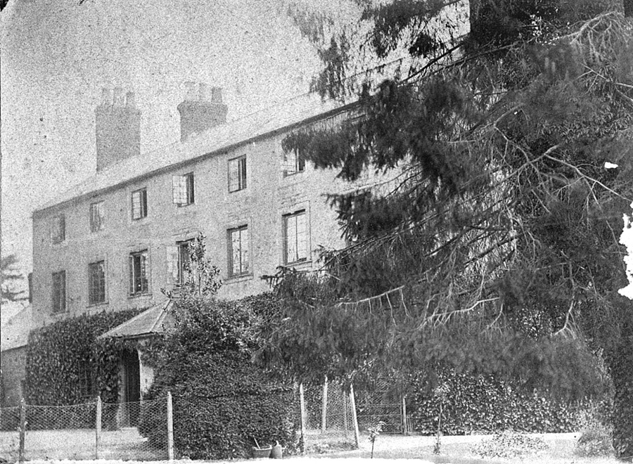
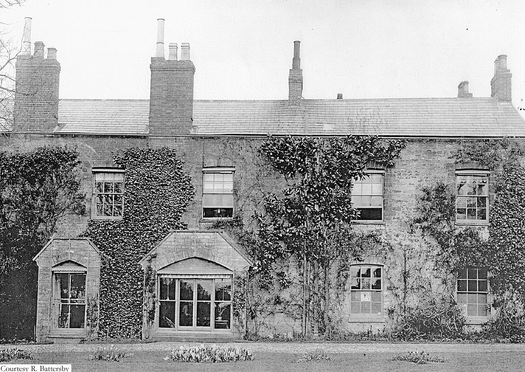
quarry" in the next paragraph. Unfortunately, we have no information on this rectory building and
who the architect was. The diocese has no resident expert who could help. Photo
was taken in 1906 of the rear elevation.
(4). The Church This is what George has said and was copied
into the out-of-print book on Blisworth: "A
substantial old quarry on glebe land, near Rectory Farm, provided the
stone for the 15th century changes to Blisworth church".
George also mentioned that N. Pevsner had told him this. But the statement
is not included in Pevsner's book on Northamptonshire buildings. That's
just as well because it would have been a major 'howler'. The rectory
quarry did not exist as far back as 1727 and the site in question was not
glebe land then, let alone in the 15C, and we know this because it does
not appear on the Grafton survey map of 1727. Instead, at that
location, was a "ridge and furrow" field given the name "Shelly Lye Furlong" thus
describing a particular stony nature of the soil there. By the time of the
Ordnance Survey in 1883 the site was labelled "Limekilns" which
speaks for the poor quality of the limestone there compared with the main
quarry that was in business from 1821 to 1913 - though the latter part of
that period found market for the stone only as flux for the Northampton
blast furnaces. We know and are thankful
that the stones for the church are of robust quality and even at the wind-scoured edges the stone shows
moderate erosion for 500 years. Furthermore there is demonstrated a knowledge of
the robustness of iron-bearing local stone (in the building of the church)
as
mentioned in the last paragraph below.
(5). Blisworth House We gather that the site was taken by a house, a Manor House, occupied by the Wake family from 1253
to 1522 when the widow of Roger Wake sold the entire 'manor' to John
Knightley of Fawsley. Thus the Lord of the Manor was not resident for a
while. We can identify a house in existence by 1650 when Thomas Tibbes,
from London, bought it (in the 'Crown
sales') and lived there for ten
years. His widow then relinquished the house to the Crown and it was then
rented by the Plowman family until 1779 when their farming business
petered out. The Plowmans established some unknown house improvement dated 1702 (and that date-stone still exists).
The mapping of 1727
shows two stories with a dormer level (four dormer windows) in a thatched
roof. We know that the house was improved by 1838 by the Stone family.
They added a large front central porch that covered the date-stone and a rear extension
that doubled the floor area and with a double roof. It was photographed in
about 1890 as a structure similar to its present state; ie. with
elevations raised to three stories with a slate roof, all three stories
re-modelled in Georgian style. The front elevation was partly covered in ivy in
1890 and has subsequently been rendered and scribed with a faux block-work
pattern reminiscent of very shallow rustication. The side elevations shows
extensive use of squared limestone blocks and very little ironstone. The
rear elevation was photographed in 1906
and shows only two storeys compared with the three at the front because
the roofs are not equal. There
are no indications regarding the origin of any of the stone. The 'core' of the house dates back to pre-1650 though it might be a
problem to identify that core.
In preparing for
the book Bridge's History of Northamptonshire, questions in 1718 were
asked of a number of reliable people in each village. The curate Revd.
Bullyer commented Blisworth was in possession, for building, of a white
stone at the Saltway and a good Red stone. We can identify a number of
locations for white stone and the one at the Saltway must have been in Slatpitt
Furlong. There is no obvious remnant of the red stone which we assume must
have been an ironstone ie. a sandstone incorporating enough iron oxides to be
extremely robust without being of 'ore grade' which would usually be
unworkable. Revd. Bullyer made no suggestion where the red stone may have
been found - comment is provided in the review of Blisworth
Mining and a mapped view of all
possible quarries may be found here. There is a further suggestion,
following this paragraph, for the site of a viable ironstone quarry. Many of our old cottages appear to have been based on a
wall-plate consisting of ironstone, for example the cottages opposite the
general store in
the High Street and the house at number 31 Stoke Road - see below. The use of a mix of red
and white stones, sometimes random, layered or banded, is common-place around the village and represents building
activity from 1600 to 1880. The heavy use of ironstone may originate well
before 1600 although the listing notes by English Heritage does not
include that view. It has been occasionally mentioned that the period 1590 to
1650 marked a village cottage improvement phase, seemingly discounting much
building activity before 1585.
Possible
Ironstone Site
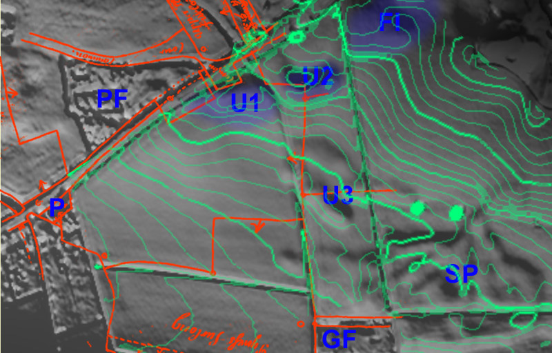
The figure is a
Lidar scan of the Towcester Road with features marked thus, P = Pynus
Cottages, PF = the Parish field and GF = Glebe Farm. The field boundaries
and road alignment from 1727 mapping are overlaid. Depressions and other
surface features are revealed by sunlight rendering from the NNE. SP =
Slatpitt Quarry, FI = the first known ironstone ore quarry and U1, U2 are
U3 hitherto unknown depressions possibly quarries. The feature in the 1727
mapping that draws one's attention to the depressions is the
"yard" to the south of the road which, if the lines are taken
literally, seem to extend the field that became the parish field. There is
another area to the east that suggests an
animal enclosure. Both this and the yard are close to depression U1.
The
kink in the field boundary around U2 also lays some emphasis on the
depressions. According to Tonks (Eric Tonks' book The Ironstone
Railways of the Midlands - Blisworth and its surrounding area is
covered in part III) it was
at the site FI, in 1852 (after the Great Exhibition in 1851), that a Mr.
Clare and Mr. Hickman began extraction. Their project failed for a lack of
an effective carrier arrangement to get the stone to the canal. This site
was where Grafton agents presumably directed the miners so it seems very plausible
that the general area to the south of the road was for the red stone mentioned by
curate Bullyer in 1718. Since the curate suggested no particular place we may
assume that the site was disused by then (yet the mapped yard feature
remained by 1727). The question of the location of an ironstone quarry is clearly a tantalising one.
Notes
on the Use of an
Ironstone Wall-plate Not very many houses show the
use of an ironstone wall-plate. They are listed below with comments. Some
may say that, in view of the probable age of most of these houses, ie. 300
years plus, the frequent traces of a wall-plate is quite indicative of
what may be regarded as a building convention, not necessarily afforded in
every case.
At the time of
building these houses there was clearly an available supply of ironstone
that was used by the Crown managers or the Duke of Grafton's agent in
providing houses sufficient for the population. which might have been ~300
in 1500 - 1600. In some cases the wall-plate may be considerably
older than the main fabric of the house. No evidence was seen for timber
supports in the outline of the building. Note that there are a number of
well constructed houses, particularly Stoneacre (High Street) and
Thackstone (Stoke Road) that show no use of an ironstone wall-plate at
all, unless such courses are located below the ground level. The data
assembled here does not prove a link between a cottage of considerable age and being built
with an ironstone wall-plate. The data is presented mainly to place
the constructions on record and merely suggest that maybe the smaller cottages were
the norm in ancient times (with wall-plate) but were superceded by more substantial
gable-to-road houses at a time when such wall-plate was
deemed unnecessary as robustness in the foundation was provided in some other way.
With this hypothesis I lay out my shaky stall and await discussions. Note that everyone of these houses are built high enough in the village to
have their foundations resting on an ironstone strata. From No. 44 High
Street, onwards, the substrate is blue clay.
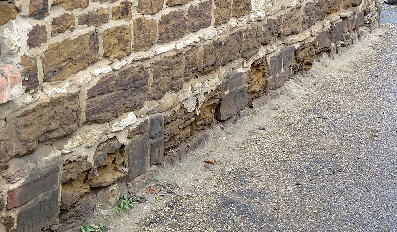
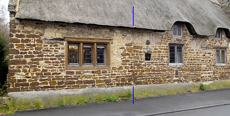
Elmtree House
(photo)
- the base is coated with a thick and strong mortar layer, to a height of
about 14 inches. The wall surface and some of the mortar is supporting
growths of lichen. The ironstone edges occasionally hint of the wall-plate
behind.
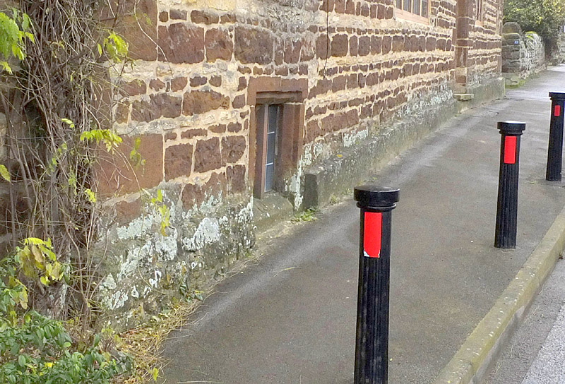
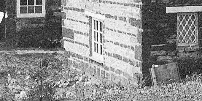
No. 32 High Street (photo) - a wall-plate that is much eroded by frost, ice
and salt attack is periodically repaired with an amateurish use of stone
and engineering brick. The effect is ugly but one wonders how old is the
iron-stone that remains. This cottage is near one previous recorded
adjoining the blacksmith's shop, now demolished, that displayed the date
1613 with the Goodridge initials NG . IG.
No. 34 High Street (photo)
- a similar wall-plate as shown at No. 32 but
without so much erosion. Neither of these cottages are listed by EH - presumably
because they have been subjected to too much modification.
Crieff Cottage (archive
photo) - this cottage is actually a relatively modern
cottage that has been refurbished in the1990s. Back in 1920 there was a
high gable end facing the street with a substantial ironstone wall-plate
but now there is left only a 6' high garden retainer wall with the same
foundation. This gabled house was quite prominent and stood only a gate's
width apart from the L-shaped Crieff House (before the fire damage of
1798 , see building labelled 'c' on Stoke Road in this reference ).
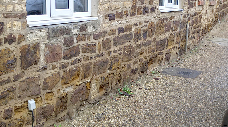
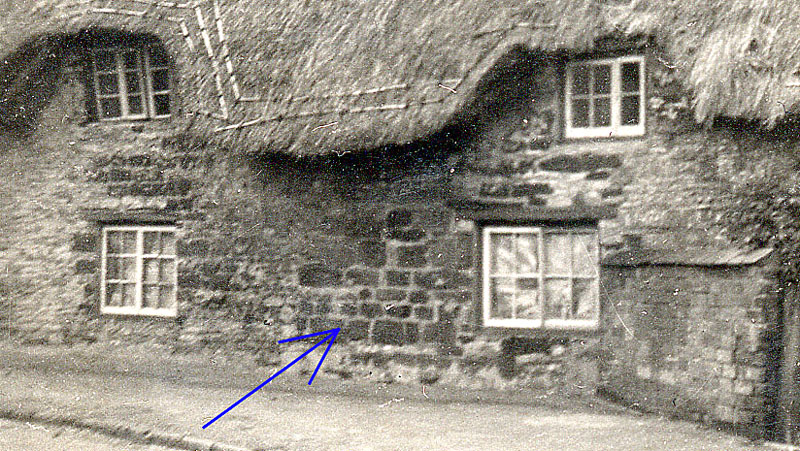
No. 31 Stoke Road (photo) - this is a remarkable house that was built
entirely in ironstone and in two separable phases, the second of which
consisted of the addition of a barn on the north gable end. The two phases
are distinguished in the photograph. Clearly the
house rests on an ironstone wall-plate but that is completely hidden by a
strong layer of mortar.
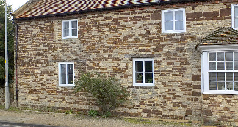
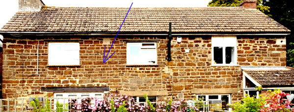
No. 4 Northampton Road (photo) - this house has no obvious ancient features
but, until the 1980s, there were upstairs a few separating walls
consisting of willow/birch hurdling covered with daub, being testimony to
its age. The wall-plate is
partly preserved while the wall carries exuberant randomness in the
stonework. Note also the use of ironstone block work for a repair - see
below.
Nos. 9 and 11 High Street (photo) - display an incomplete wall-plate layer.
Willow Cottage at Elmtree corner (archive
photo) - a substantial building that is
setback from the roads. Recorded in 1727 as a house but in 1838 as an
unoccupied garden house behind the house next to Elmtree House, ie. behind
7 Courteenhall Road. Its varying status is a mystery that might relate to
a dire roof condition at some stage.
Building at corner of Little lane and Chapel Lane (archive
photo) - clearly built
primarily of ironstone but demolished in 1938. The corner stones are set
to provide a curve for easement for horses and carts.
The following is a
list, with comments, of houses in the village that carry, or carried, a
notable amount of ironstone coursing within a substantially limestone
construction. These are simply examples - there are others.
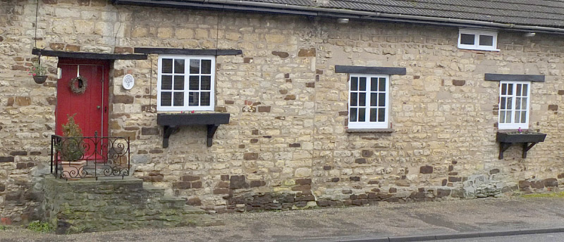
No. 35 Stoke
Road (photo) - a building known to have been built in 1652, re-roofed in c.
1850 with slate and refurbished generally in 1960. There is a prominent
course of ironstone at the level of a presumed thatch eaves-line, evident
in coarse blocks to the east (to the right) and well cut blocks to the west. The latter
are presumed to have been placed in 1960 along with the panel of
whimsically cut blocks above it. Clearly there must have been a source of
well cut ironstone blocks in 1960 but would that have been in the village?
The High Street mail sorting house (photo) - demolished in ~1960,
constructed entirely in ironstone at some time since 1850 at which time availability
was evidently no problem. The site was once occupied by a very substantial
building until it was destroyed by fire in 1798.
Cottage near the Chapel (photo) - demolished c. 1938 because
it had become unsafe. Built
without much ironstone but repaired with some well cut blocks at an
unknown time. The original build date is unknown but probably before 1727.
|