|
Farming , Blisworth, Northamptonshire, UK. All pictures are presented at relatively low resolution. There will be hundreds of pictures on this site - there is an economic limit to the webspace available. The point of this presentation is that you can see for yourself the extent of the collection and return later as the collection expands - as it surely will. Any interest in copies of a picture at a higher resolution (ie. clarity) should be directed through contacts given in the Blisworth "Round and About" parish council publication or using the comment form on the home page. In some cases the pictures are not available due to copyright restrictions. However, permission has been obtained, where possible, to include them here. Printed below each image is the photographer's name, if known.
|
||
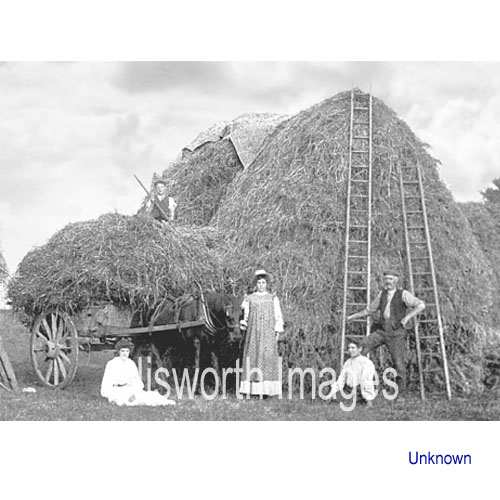 |
14-01 Dating from 1907 this family is engaged in stacking what appears to be corn on the ear. Ricks like this were normally thatched and the use of a tarpaulin sheet is probably temporary. |
|
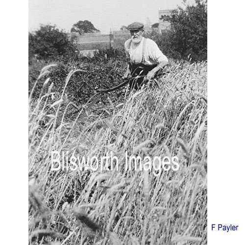 |
14-09 Hand cutting corn where the use of a binder in a small patch is not worthwhile. Date 1930's in Tiffield. |
|
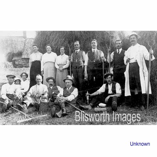 |
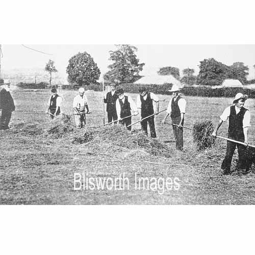
14-09a This group of family workers are pausing for the photograph in a convenient place. It is the paddock behind the Royal Oak Inn where corn threshing was set up during harvests. A similar activity took place in Half Moon Yard by the Sun, Moon and Stars Inn.
|
|
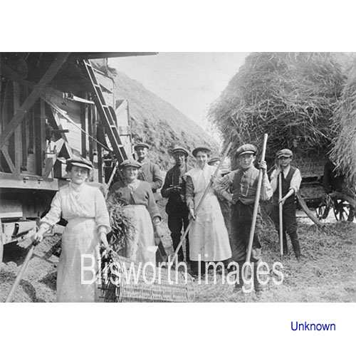 |
14-02 A threshing team from Blisworth at work in Milton.
|
|
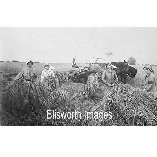 |
14-23 Working with stooks. A binder is in the background. See image 14-04 below.
|
|
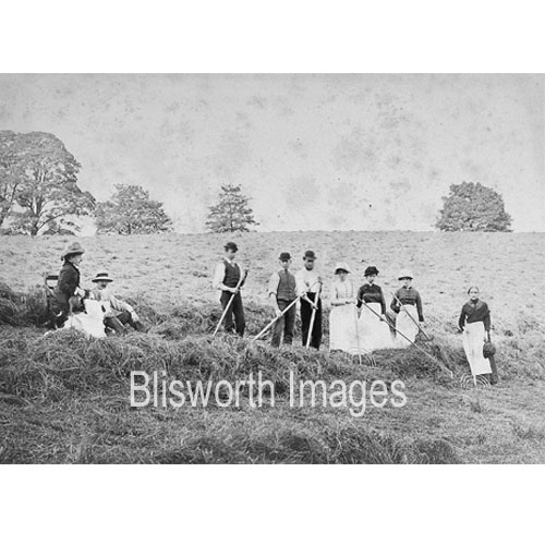 |
The lie of the land is very suggestive of a Lounds field 'behind' Gayton Hill Farm. So perhaps these people are Ropers or Osbornes. | |
|
Footnote: Farming practice in 1791 is sketched in the articles by Arthur Young (visionofbritain.org) an extract from which is available here. |
||
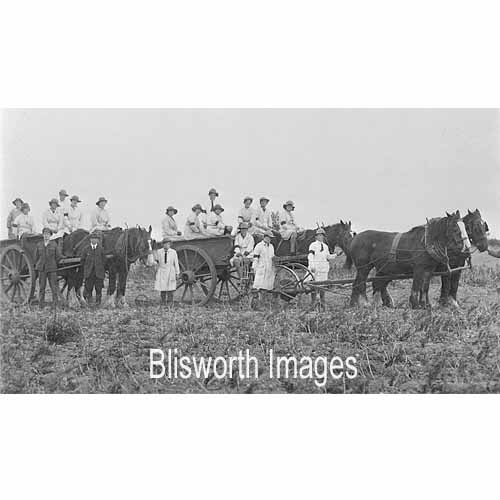 |
14-24 This picture is of WW I land-girls. The lady on the extreme right is Mrs Beattie of Northampton (re. Beattie's Auction Rooms) and the scene could be anywhere in Northants. | |
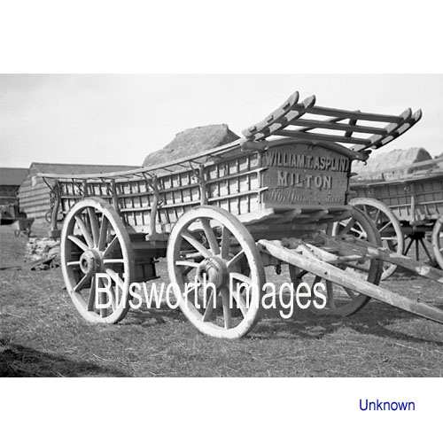 |
14-02a A hay-wain that once belonged to a local farmer.. | |
|
Footnote: The early use of the railway station for moving cattle - colourfully recounted. |
||
 |
14-16 Blisworth Hill farm was established by the Duke of Grafton in c. 1850. This picture, taken in c. 1890 shows Wm. Westley on the left looking on as a group of men gather corn with the straw for threshing. | |
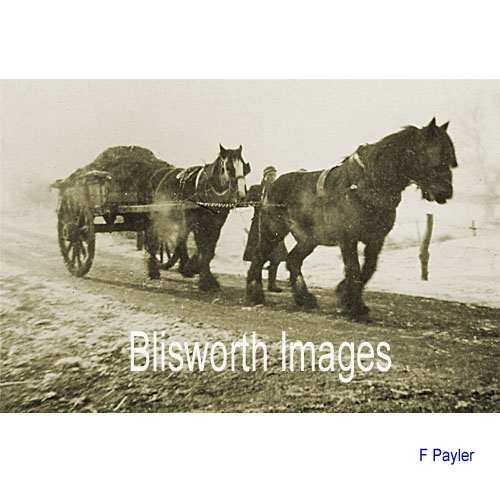 |
14-10 Mucking out animal sheds and spreading on the fields was a labour intensive business. The muck cart would not need two horses but they probably like working together. Date 1953 near the Gayton Road crossroads. | |
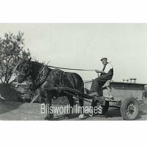 |
14-21 Fred Gulliver (c. 1882 - 1975) Picture is dated c. 1955. He was one of a few dairy farmers in the parish. He took the milk in churns daily to the Milk Marketing board depot in Towcester Road, Northampton for collection and from there the milk was taken to the dairies for bottling. He continued farming until two weeks before he died.
Picture kindly provided by Susan Clarke. |
|
|
Footnote: In
prewar years there was a considerable emphasis on grassland and very
little arable fields. Note the map of the
area, dated
1935. Around Blisworth and Gayton much of the arable fields were a
residue from Victorian ironstone surface mining. |
||
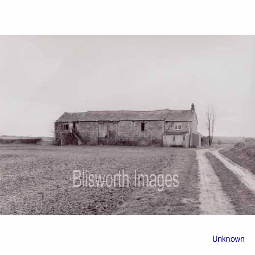 |
14-13 Glebe Farm c. 1975 just before being converted into a private house. It had been farmed as a 120 acre grassland dairy farm by the Gulliver family for many years before that.
|
|
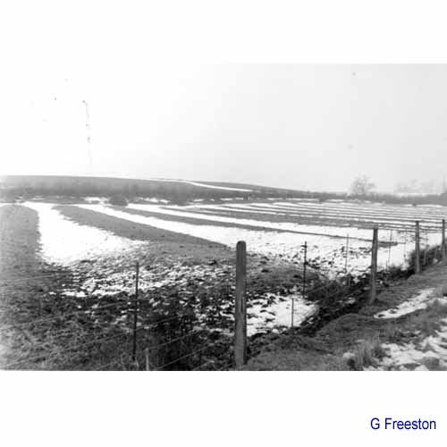 |
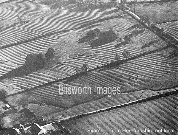
14-15 A rather good
picture taken by George Freeston in the early morning light which shows
up the ridge and furrow profile in the field adjacent to Station Road.
The profile arose from a feudal farming system and, for Blisworth this
involved over 350 acres which dwindled to less than 20 acres by 1812
when inclosure (fencing in favour of cattle and sheep, to the benefit of
relatively few farmers) in the parish was near complete.
There are some striking arrays of ridge and furrows in England - see this attached picture. |
|
 |
14-03 Establishing some drains in a field hollow - date unknown. | |
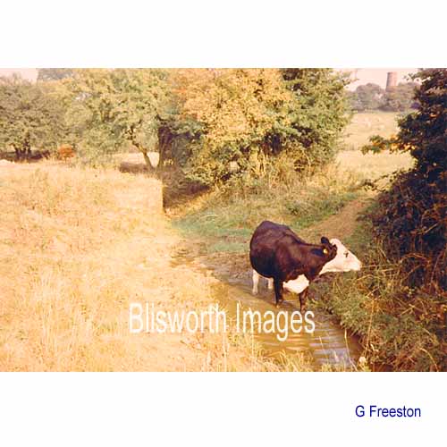 |
14-19 Some people find it hard to imagine this stream, Fisher Brook, providing enough water to drive the water mill that was operated at Pond Bank until about 1700. In summer, a toddler can play in it without a problem. This picture was taken a little upstream from the field (Fishweir Close) that was once supposed to accommodate a large fish-pool. | |
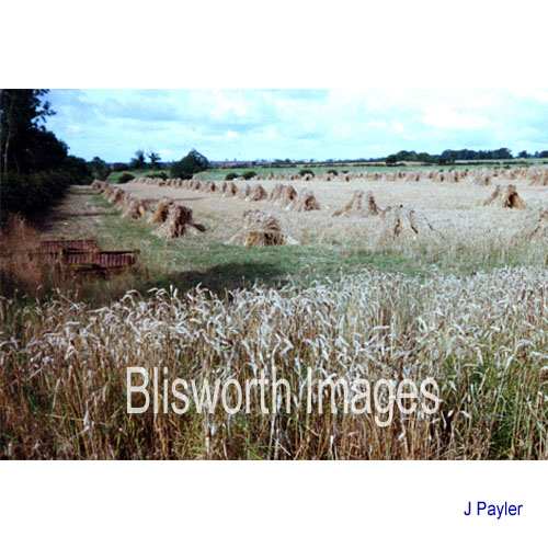 |
14-04 This shows stooks of corn cut by an old binder (pre-combine harvester style) set to lean in groups of three to five. When satisfactorily dried, they would normally be carried to a threshing machine which would either be brought to the field or set up in the farm yard. However, as the date of this picture is 2003, in Tiffield parish, it can be safely assumed that the straw is intended for thatching. | |
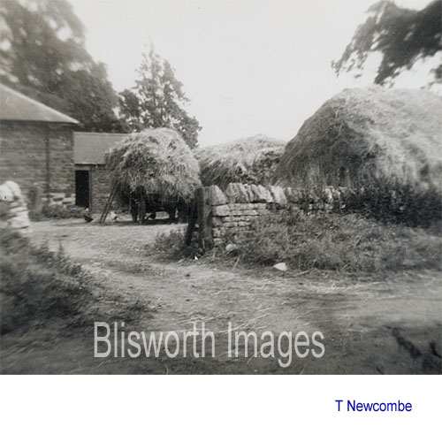 |
14-12 This was how the
yard looked at Hill Farm on Gayton Hill in 1955. Hill Farm was
probably occupied by the notorious John Roper and certainly by his son
Benet. See the list of farmer
occupants on this website.
This view is from the field lane called on some maps "Lowndes Lane" (heading due north) and the entrance to the rick yard is off that lane. The entirety of the space shown here is now laid to heavy concrete - Gayton road passing on the right. |
|
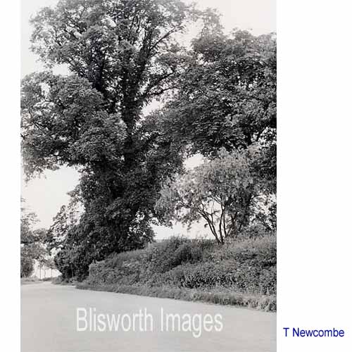 |
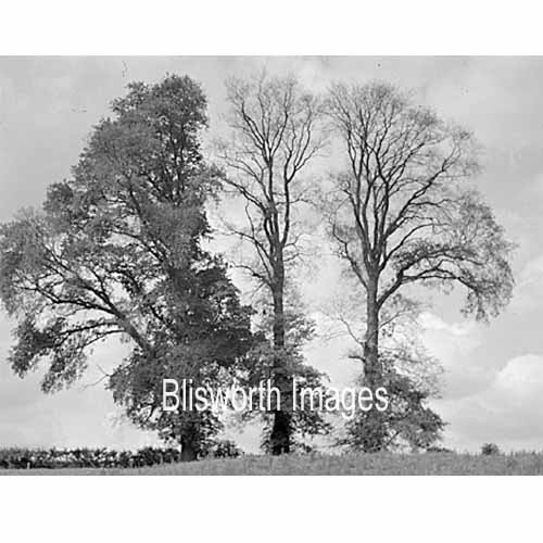
14-20 A truly amazing sized elm tree just a few yards from the access in the picture above. Until the advent of Dutch Elm Disease the countryside around the village was enhanced by many such examples - see below. | |
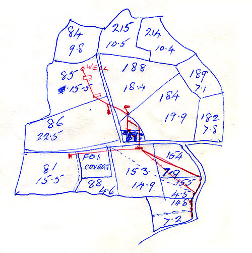 |
Hill Farm in H. M. Osborne's time
amounted to 200 acres of mixed grass and arable land. Osborne's
map, traced from OS, shows his well for fresh water feeding cattle
troughs and the house. He used a petrol engined pump to raise the
water from the well near the border of Lounds fields into a holding
tank. The red lines in the south half of the area appear to be a
mains water connection made around 1959.
Note the farmer places the Fox Covert extended right up against the Gayton Road. In the 1825 Bryant map it is only in the lower half of the field and referred to as Goodes Bushes (because Mr. Goode farmed field number 88). Ironstone extraction in the 1880 and 1890s, however, ruined the soil and thick bushes eventually prevailed right up to the road. The straight line path (shown dotted) was re-angled to avoid going into the scrub and formalised in 1951 as a registered footpath. This point about the path is raised in connection with a possible Roman path taking this course from the region of the church in a continuous straight line to the highest part of Gayton Hill. |
|
|
|
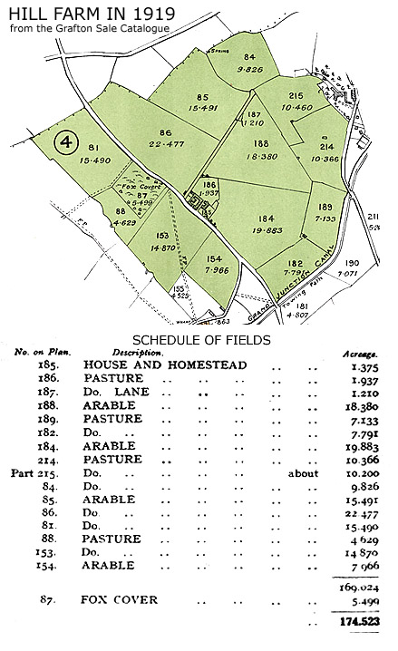
When the farm was up for sale by the Duke of Grafton in 1919 the field plan was published along with a description of the house and buildings and a schedule of all the fields. Here is an extraction from the catalogue. | |
 |
A picture by Stuart Woolacott of the Fox Covert from the roadside - incorporating a 2m slope into what was an ironstone extraction area. The present farming family (the Wakelins) have cleared Fox Covert back to a rather diminutive copse a fair distance from the road - perhaps as it was in 1800s. | |
 |
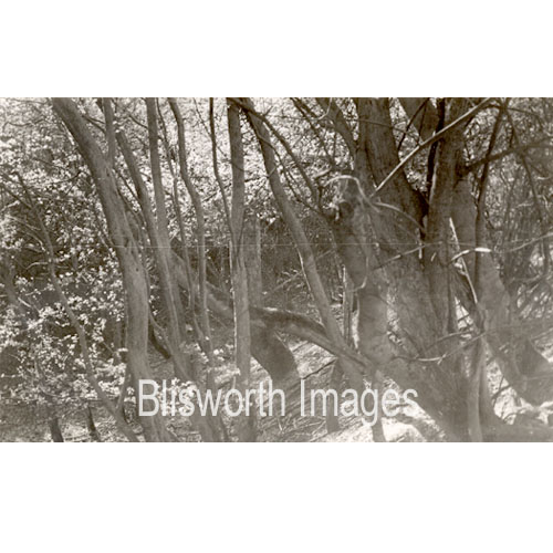
14-22 Some dying elms - a truly sad time when virtually all elms died. | |
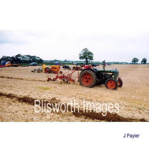 |
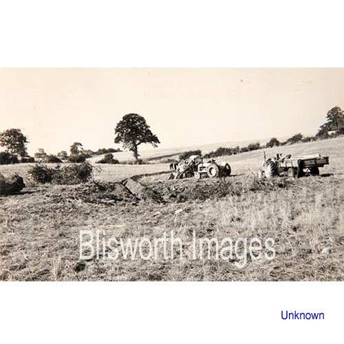
14-05 Pictured here is a relatively recent ploughing competition held at Hill Farm at which enthusiasts of veteran farm equipment demonstrate skills which are gradually disappearing. Modern systems have various computer controlled wizardry to control field work - mostly based on very large machines. | |
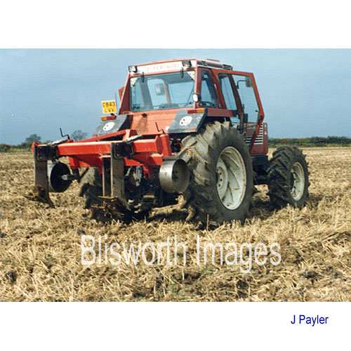 |
14-06 Taken c. 1965 - an example of a subsoiler needed to break a heavy clay soil and help drainage. Blisworth Hill, between the village and Stoke Bruerne, is capped with a layer of ice-age clay. Lower fields are generally lime or ironstone littered (many are the residues from open cast mining). Fields in the valley to the north are again coated in recent iron-age clay or have a thick alluvial layer. This last type of soil is rather rare in the parish but undoubtedly was prized in medieval times. As indicated in the Earth Works section, beneath all terrain are very thick "lias" of blue clay which has been of value for brick making and lining the Canal. | |
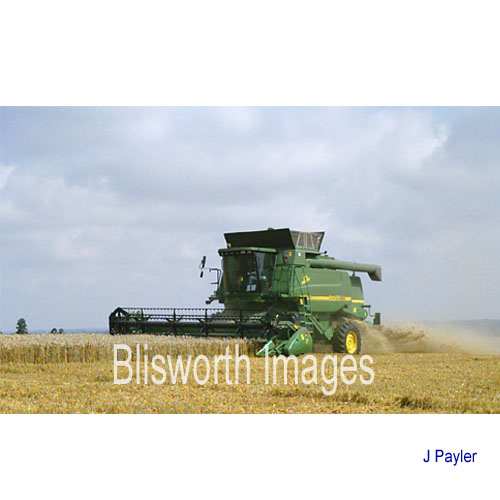 |
14-07 2005 Combine Harvester typical of the size of farm machinery these days. They are, of course, a combination of cutter and thresher. Since straw burning was banned in the 1980's the straw and chaff are pulverised and spread behind the machine - to be blended into the surface soil a few days later. | |
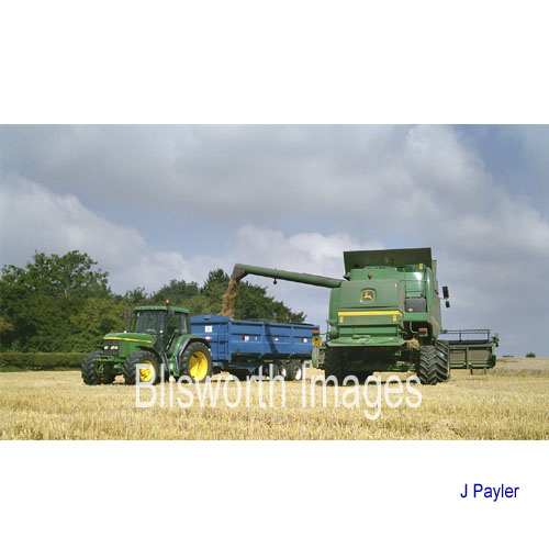 |
14-08 A brief stop from the harvesting to empty the grain tank into a trailer. Normally the grain will be stored for weeks or months (also dried if necessary) in large sheds until market conditions are right. They are never right at harvest time because of a global surplus. | |
 |
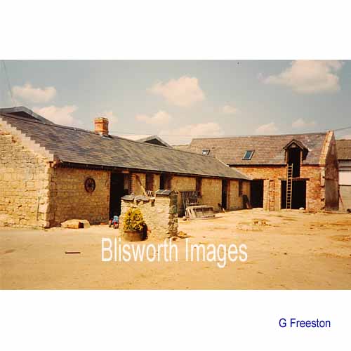
14-11 The previous pictures show how farming has changed over the years. This emphasizes the other main change where barns of classical style are converted into houses. This barn was part of Mr Bonsor's farm and once formed part of a large pre-Victorian yard enclosure which bordered the road. The tall gable was the subject of a preservation order during the conversion - its prominence arises from the change from thatching to slates. The farm house is to the right, against the road, and is also visible in a few of the pictures in the Elm Tree Corner section.
|
|
 |
14-11a This shows how much of the original barn was considered stable. The sides had to be rebuilt and the roof supported on massive RSJ "hoops". The builders were not allowed to lower the prominent gable and were not allowed to raise the roof to its level. Evidently the prominence left by thatching was a listed feature!
|
|
 |
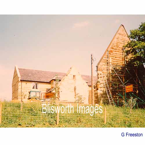
14-17 A change from cattle to arable and a move away from horses make the old fashioned low buildings of a Victorian farmyard practically useless. Many farmers have converted the barns either to housing or to accommodation for small businesses. This work was in hand on Blisworth Hill Farm in the 1970s. | |
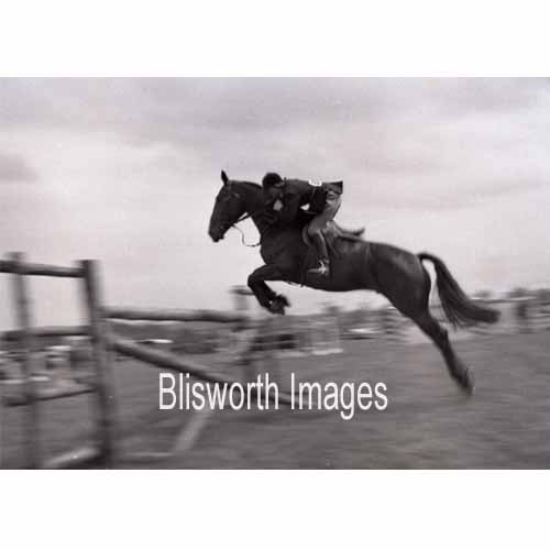 |
14-18 This picture was taken at the Blisworth Horse Show held in the 1960s at Gayton Hill Farm, then occupied by Mr Osborne. The show was organised by Ernie Griffiths (family now at Milton Malsor, cattle and sheep dealers) and the Rev. Challen. The show was intended as a fund raiser to pay for work needed on the church tower but after a few years it was discontinued. | |