|
Elm Tree Corner , Blisworth, Northamptonshire, UK. All pictures are presented at relatively low resolution. There will be hundreds of pictures on this site - there is an economic limit to the webspace available. The point of this presentation is that you can see for yourself the extent of the collection and return later as the collection expands - as it surely will. Any interest in copies of a picture at a higher resolution (ie. clarity) should be directed through contacts given in the Blisworth "Round and About" parish council publication or using the comment form on the home page. In some cases the pictures are not available due to copyright restrictions. However, permission has been obtained, where possible, to include them here. Printed below each image is the photographer's name, if known. |
||
|
Various buildings in this location are listed - information available |
||
|
||
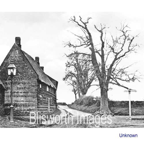 |
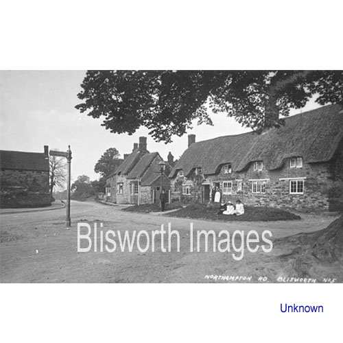
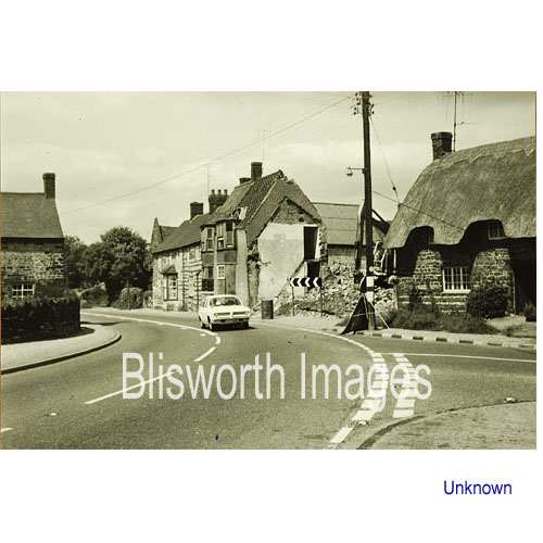
13-01 A tree at the town end of the High Street is marked on the earliest map of 1727. Perhaps this elm tree is not quite that old however. Although obviously early, the date of this picture is uncertain. Elm Tree House: perversely, there are few good pictures of this building which appears on this photo behind the main building. It is characterised by a low-angled pitch covered in slate, being a roof converted from presumably thatch in the early 19th century. The house is also outstanding because of a 17th century scripture painted on an interior wall (image 22-03) |
|
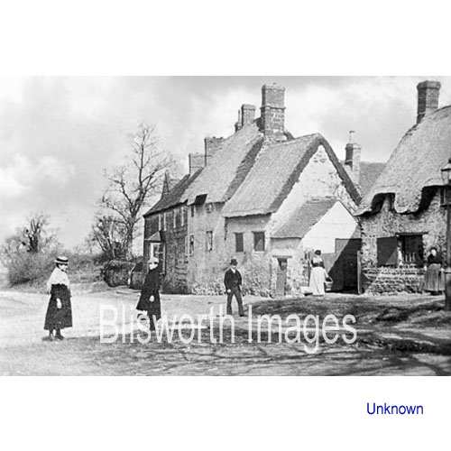 |
13-05 This picture is relatively early because there is no bay window built onto the white house with four windows, as can be seen in the next picture. Date probably before 1900*. The three roofs all over white painted buildings belong to one farm with a butcher's business.
* a feature of old photographic technology was that skies tended to be washed out. For cosmetic reasons, this image has been digitally modified to show a sky, as have a few others on this web-site. |
|
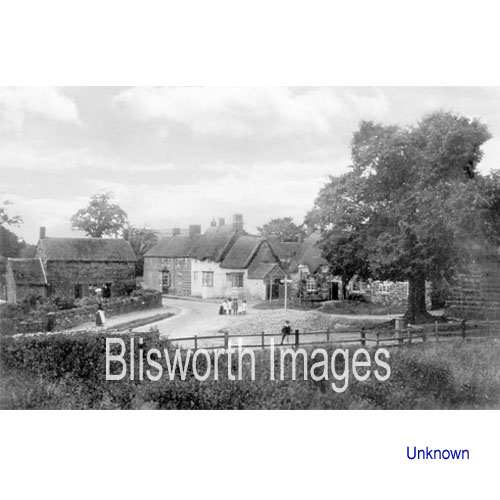 |
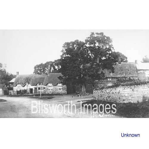
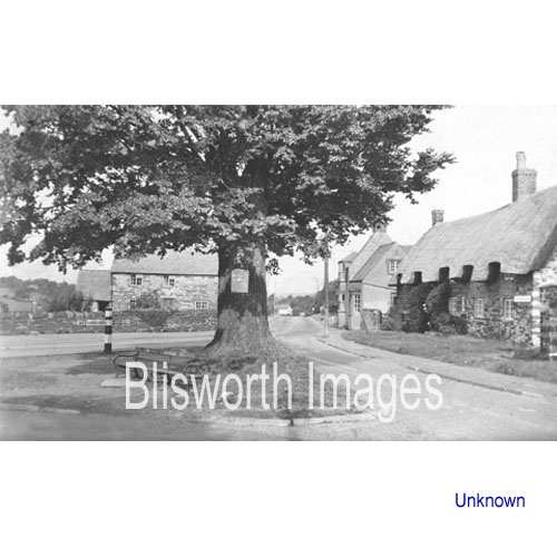
13-02 The view of elm tree corner from the field behind the blacksmiths. Note the village pump by the roadside with the fence set around it. Note also that the fence gives way to a stone wall to the left and that the sign post appears to surmount a grassy mound.
|
|
|
Footnote: According to the Parish Council minutes, the foreground field was excavated of ironstone and a fence was put up to replace a banked hedge by April 1911. The field has had time to become overgrown and the school building work began in 1912. It can therefore be safety stated that the date of the above picture is 1911/2. |
||
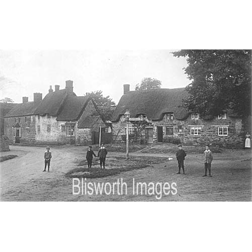 |
13-04 Another view of the cottages near the elm - date is thought to be 1908. | |
 |
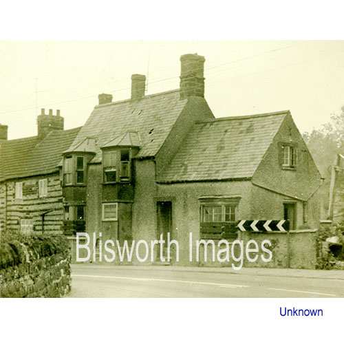
13-08 The buildings in this image and the one below, which still stand today, are all listed buildings. | |
 |
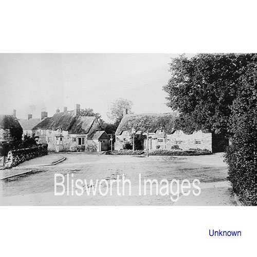
13-03 The stone wall from this angle appears to extend further towards the tree. The mound by the signpost is gone. Date uncertain other than it is clearly before 1911 when the field was levelled prior to the building of the new school. By comparison with 13-02, this picture shows a much longer section of walling. | |
 |
13-04 It appears that this picture pre-dates the one above and that the foliage on the right is ivy growing down the stone wall. the date is therefore thought to be c. 1905. | |
 |
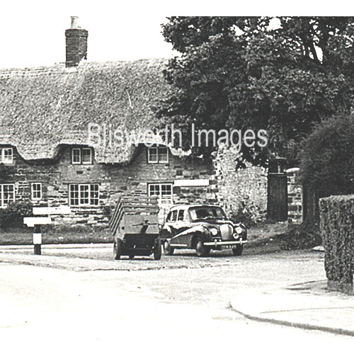
13-06 There is a long jump in dates to this scene. The farm house now has twin bays which have been extended through the eaves, probably at the time the house was re-roofed. With the small barn taken down, in 1950 this was the site of the village diary business run by Sid Cherry. By the 1970's it is being demolished. The site, including the land behind it, was left undeveloped until about 1995.
|
|
 |
13-07 The demolition continues. |
|
 |
Once the tree had acquired roads on three sides of near equal status,
the triangle became first a haven for the council to deposit heaps of
road repair gravel. They were deterred and resolved to only use
the 'green' in front of Grafton House being a tradition from the 1920s.
Not long passed and an outbreak of parking beside the tree was noticed. The parish council frowned on this right up to the time when (1973 - the time of the Arab imposed panic?) we were no longer expected to use sidelights when parking. As the council's argument was chiefly about confusion with lights on the triangle, they gave up then. |
|
 |
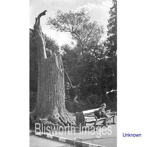
13-09 Date approximately 1960. A few years on saw the tree in a less healthy state and it was trimmed to encourage growth. | |
 |
13-10 | |
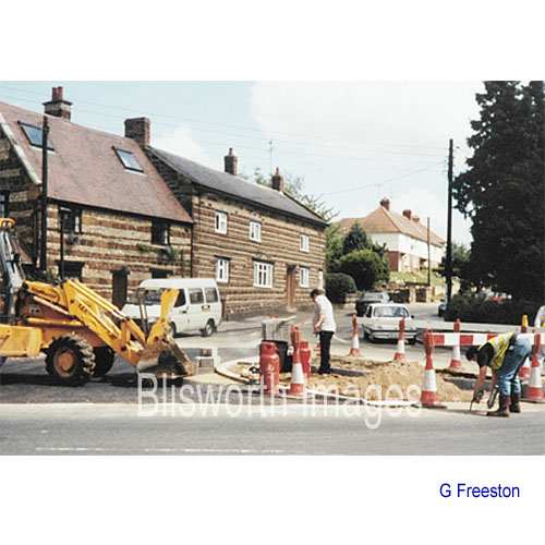 |
13-11 This marks the obliteration of the site of the elm tree in 1984. It was struck by lightning in Sept 1965 - the remaining stump is shown below. In late 1965 it was decapitated at a height of about ten feet and given "a 12 month reprieve for new growth". Rather longer than 12 months was allowed - in April 1970 there were plans to incorporate the stump into a novel design of bus shelter. The shelter was built in 1971/2 but the stump was set on fire in July 1972 and the shelter followed suit in another fire in October 1972. The miscreants who did these deeds would be about fifty now - it's to be hoped they will read this. Eventually it was decided by the council in 1984 to totally remove the tree stump and create a rather featureless road island planted with some "road furniture". In 1994, the island was joined with the pavement to the right when some revisionist traffic consultants arrived in the village to calm the traffic.
|
|
 |
13-12 The elm tree as a stump. It was eventually cut off square and incorporated into a bus shelter. There must be a photograph of this shelter somewhere! See below . . . | |
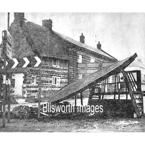 |
Sadly, this newspaper photo is the only one available. It shows the state of the bus shelter after the second firing. | |