|
"Fishweir" or Fisher Close, Blisworth. |
|
 |
Grafton document
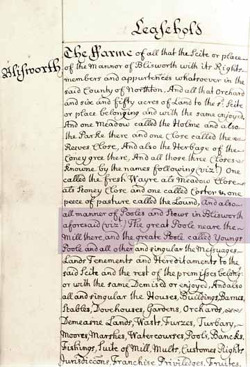
G3881, NRO, specifies the leasehold farms for 1705 and the picture alongside shows
the entry for Blisworth. It mentions 65 acres for the farm
associated with the manor, including a few specific fields; Holme,
Reeves & Meadow & Stoney Closes - none of which are names
carried into 19th century maps. The Lound and The Park are notable
however. The passage of interest here is highlighted: "..all manner of pools and stews ... the great pool near the mill
and the great pool called Young's Pool..." |
|
over a year-round period including times the stream is full. In
summer, the stream can be only an inch or two deep. Very probably
the pool, essentially a manorial one, was developed in medieval times from natural undulations by means of a dam. |
|
 |
|
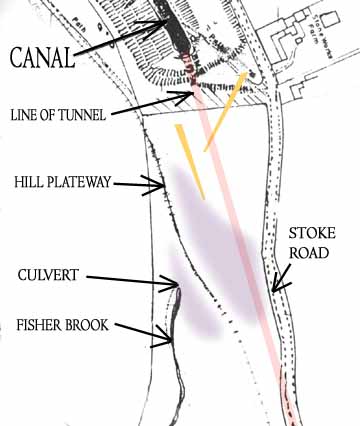 |
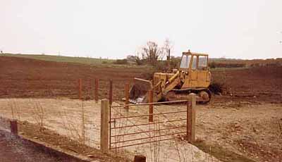
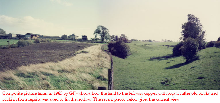
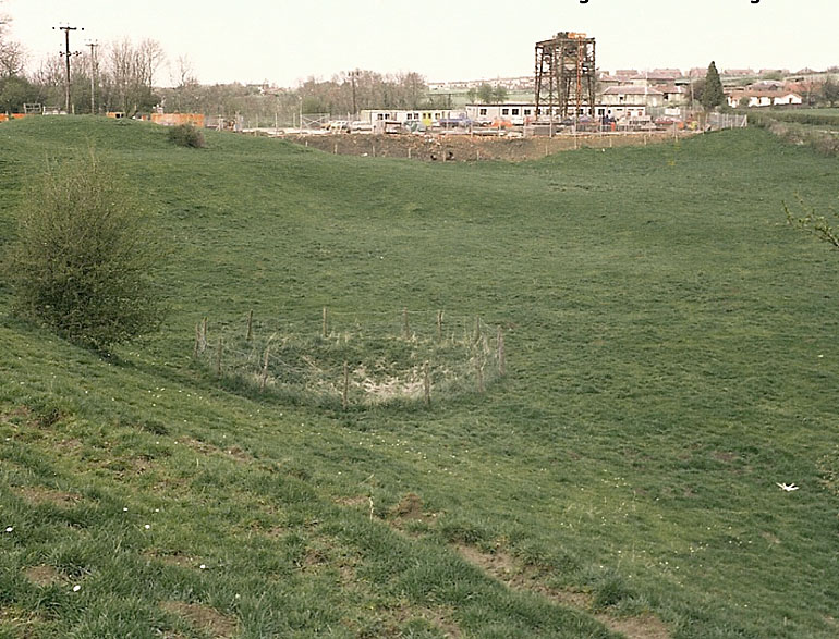
The depression that was evident to the left of the railway embankment was over 20 feet deep. The second photograph shows the same field from a position in the "Tunnel Car Park". In the early 1980s contractors Mowlems repaired the tunnel and deposited hundreds of tonnes of rubble in the depression to the east of the hill plateway path thus levelling the field. The machine has just completed the return of the topsoil and presides over a rather inventive arrangement of gates and traffic control posts which were soon taken away. To the lower right of this picture is the steep path down to the tunnel entrance. There are pictures below, taken from a location on the plateway, a little to the north of the depressions shown in the map. One was taken in 1985 and the other in 2006. The map here is accurate as regards the hill plateway with the implied division of a deep landscape that was once a pool. The extent of the pool is best suggested in a new comparative map. The orange arrows indicate camera angles (see above).
|
 |
|
 |
|
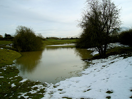 In February 2009 the culvert at the base of the "hollow to the
west" became blocked with sticks and British Waterways folk let the
water get too deep to work in. Much of the water goes to supply
the locks at Stoke Bruerne, via the tunnel.
In February 2009 the culvert at the base of the "hollow to the
west" became blocked with sticks and British Waterways folk let the
water get too deep to work in. Much of the water goes to supply
the locks at Stoke Bruerne, via the tunnel.
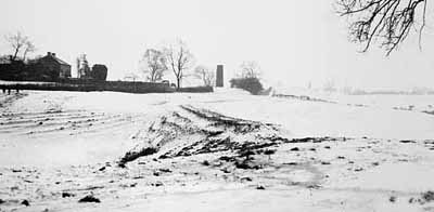
This picture gives some idea of the scope of the supposed old manorial fish pool. What you see here would have been less than a third of its extent in the 16th century. In about 1800 the building of the hill railway caused a considerable portion, to the left, to be filled in. Photo Jim Payler |
|
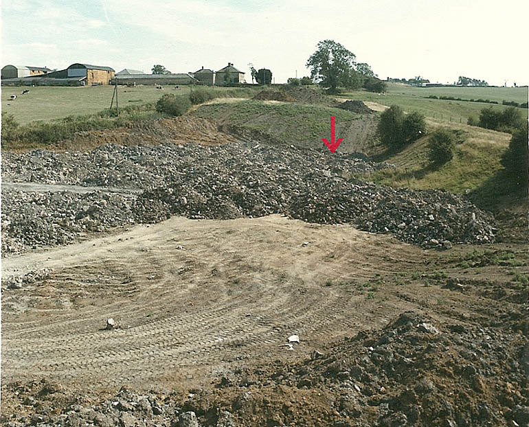
| Apart from the fun enjoyed, there are distinct benefits from holding anniversary celebrations as we did for the completion of the 1980s repairs to the tunnel. The benefit was that two engineers (Roy Slocombe and John Woods from Mowlems) involved in the project gave a presentation. Included in that presentation there were two pictures that are shown below. The first is looking north across the large hollow in the field on the north of the hill railway and shows a dangerous subsidence at the first of the original access shafts. This subsidence was corrected and sealed meticulously with steel and concrete before the hollow was used to accommodate the thousands of tonnes of rubbish from the repairs. The hollow demonstrates at least half of the rather large size of the original fish pool. The second picture shows the hollow part filled with rubbish with the approximate location of the subsidence indicated with an arrow. From inspecting the right of this picture it becomes evident that the path for the railway could be described as a rather narrow earthen causeway. It is the only picture we have of the feature. | |
|
|
|
|