|
Local Northamptonshire - Part I. This section covers miscellaneous
archive pictures from All pictures are presented at relatively low resolution. Any interest in copies of a picture at a higher resolution (ie. clarity) should be directed through contacts given in the Blisworth "Round and About" parish council publicationor using the comment form on the home page. In some cases the pictures are not available due to copyright restrictions. However, permission has been obtained, where possible, to include them here. Printed below each image is the photographer's name, if known. |
|
|
Back to Home Page This is Part I Part II |
|
|
Click here for a review of the History of Blisworth Arm |
|
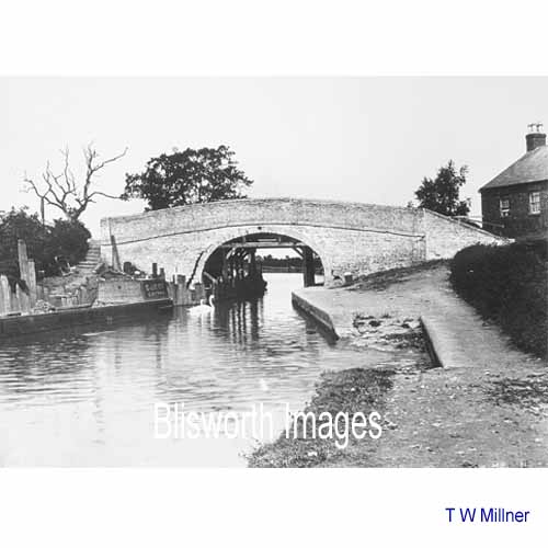 |
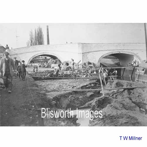
28-01 The bridge at Blisworth Arm toll house in 1910/11. The cracking shows a serious fault in the foundations of the bridge. |
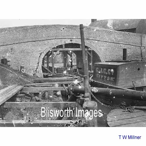 |
28-02 Wooden access path was created along with some supporting timbers for the arch. The bridge would be taken down brick by brick. Thomas Millner, chief engineer for this section of the canal and resident at Blisworth Arm, not only supervised the work but also took dozens of photographs at various stages.
|
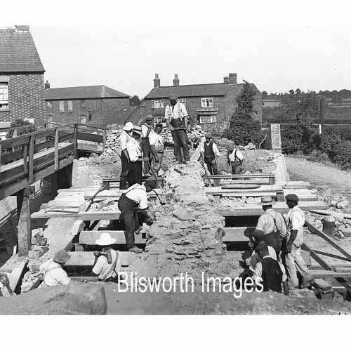 |
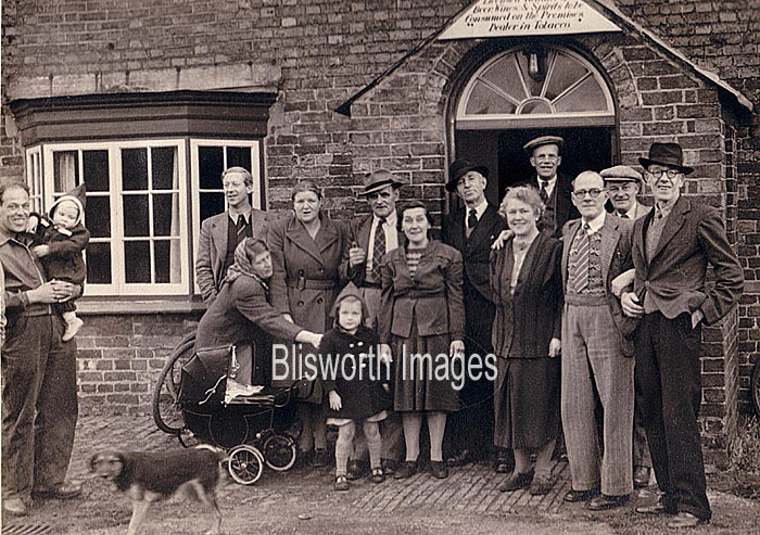
28-03a This picture shows the process of dismantling the bridge. There is a rare view of the Navigation Inn in the background .... |
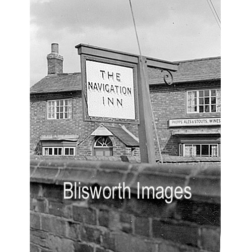 |
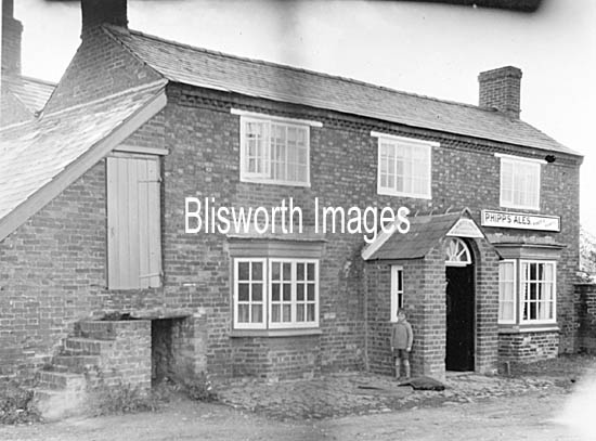
The Navigation Inn.
|
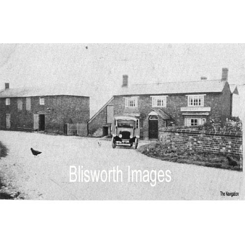 |
Navigation Inn The Inn was built at the time of the canal, 1806, once it was known this location would have the link to Northampton, first by horse rail but upgraded to a flight of locks by 1815. A picture dated 1926 is shown in this link.
|
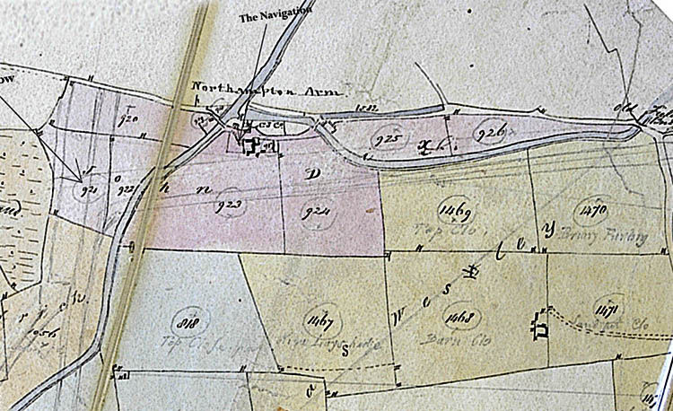
The map segment below shows that the tenant of the Inn, probably the first 'landlord', and the surrounding fields was a John Dix in c.1825 when it is believed this pocket map was drawn. The map shows interesting features: a pencilled indication of the new railway and its suggested branch (1830?) and the name of the place - "Northampton Arm", please note all boaters. There is also a "C. J. Co" label where the canal company had and still has its depot and wharf. It also shows odd spur of canal running to the north of what is now Gayton Marina, labeled field 925 in the map. This spur was very probably there to link with the horse rail line. Note there is a label on some neighbouring fields - "Thomas Westley" with the "t" crossed out. He
and his father and grandfather, from Tiffield, were known as
Wesleys but were in fact ultimately related to the Westleys from
Piddington that gave us Joseph junior. |
|
|
|
|
|
Footnote: The name John Dix crops up rather frequently in Blisworth records. He was appointed by the Duke of Grafton as a rent collector (c. 1828). He managed the 'Stoneworks quarry' for a spell before Ben Roper took over (c. 1820), he carted stone for the new railway (c.1839) and he became a major farmer in the Parish according to Grafton records. |
|
|
|
|
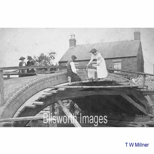 |
28-03 With a new arch completed, Mrs Millner set the date stone.
|
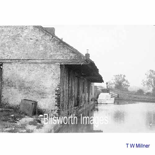 |
28-04 Date unknown but probably between the WWs. These are the warehouses at Blisworth Arm. The approach road to the above-mentioned bridge from Station Road can be seen in the distance.
|
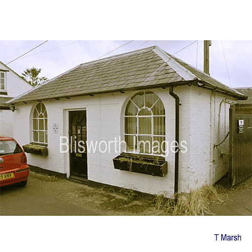 |
Present day appearance of the Gayton Yard office which has been occupied by the now defunct Northants canal partnership. Note the styled cast iron window frames. The building immediately behind the camera having the same style windows has been claimed to have been a stable. However, neither of these two buildings go back to the 1810s when the Arm was established - this one is not apparent on the 1900 OS map and it therefore seems very unlikely that the other one was a stable.
|
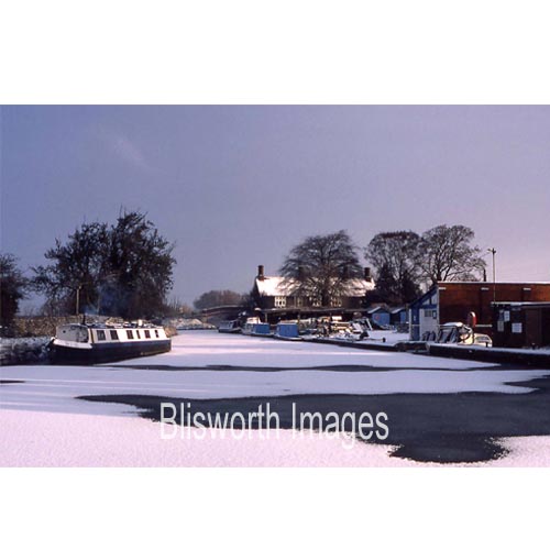 |
28-04a Blisworth Arm in 1985. The main canal runs across the scene in the foreground, the canal arm for Northampton is straight ahead. T W Millner's house was the imposing building near the arm bridge, centre. |
|
For memories of the Arm please see Doreen Blood and John Dale |
|
Click on this banner for the Towcester Railways History website. |
|
 |
28-05 This is the twin arched bridge over what were twinned locks. The work in hand in this picture appears to be to fill in the pools alongside the single lock - those pools being all that was left of the second lock as it became disused. The date is not known but note that the Stoke Bruerne mill chimney was still standing, ie. pre-1914. |
 |
28-06 Lock maintenance work at Cosgrove circa 1925. |
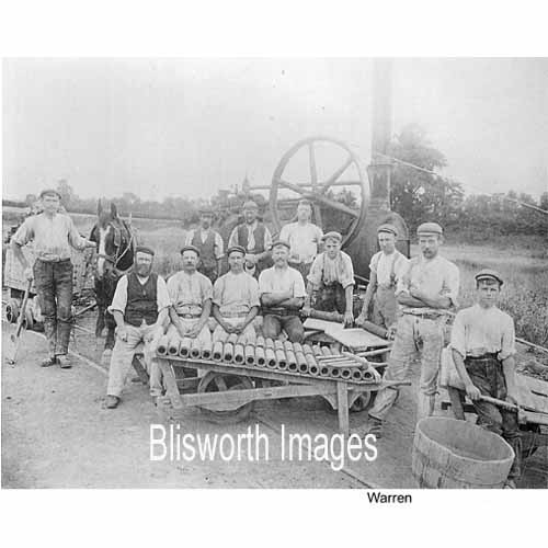 |
28-07 Savage's Brick and Tile Works at Stoke Bruerne, circa 1900. The one name included was probably supplied by the donor of the photograph (to GF). |
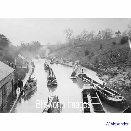 |
28-08 Taken from over the
arch of Blisworth Tunnel at the southern end. The boats are
amassing waiting for the steam tug to emerge from the tunnel.
Tugs were in continuous use from 26 April 1871, when the members of the Leggers Fraternity were pensioned off, to 30 Sept 1936. |
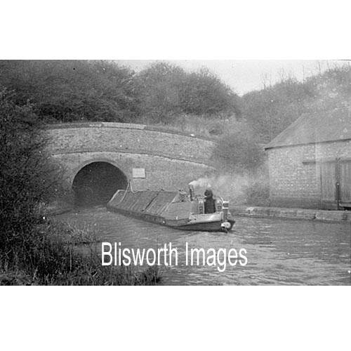 |
28-08a The tunnel mouth at the Stoke Bruerne end, date unknown. |
 |
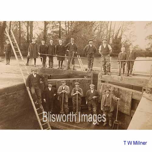
28-09 A gang is evidently working on the lock gate at Stoke Bruerne, circa 1910. |
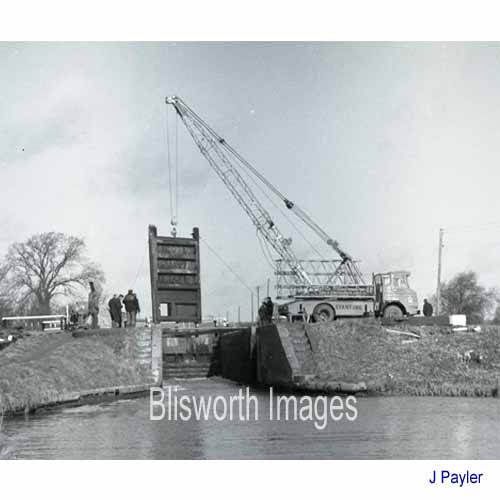 |
28-10 A more modern gang is experimenting with a crane for lowering a new gate into the flight below Stoke Bruerne. Date - late 1960s. |
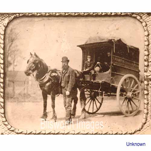 |
28-11 Steve Martin, general haulier at Roade, c. 1890. |
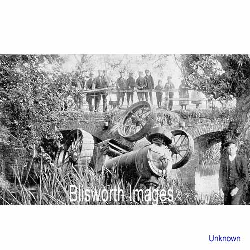 |
28-11a A rather sad steam traction engine which apparently was being maneuvered near the river to pick up water. The bridge is on the Stony Stratford road.
|