|
Affordable Housing, Part II, Blisworth, Northamptonshire, UK. All pictures are presented at relatively low resolution. Any interest in copies of a picture at a higher resolution (ie. clarity) should be directed through contacts given in the Blisworth "Round and About" parish council publication or using the comment form on the home page. In some cases the pictures are not available due to copyright restrictions. However, permission has been obtained, where possible, to include them here. Printed below each image is the photographer's name, if known. |
|
|
Back to Home Page Part I This is Part II |
|
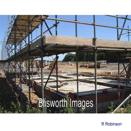 |
44-17 The base shown in the previous image is then surrounded by a full-height array of scaffolding with decks at the first floor and eaves levels. The base is fitted with damp-coursing and ... |
 |
44-18 ... pre-fabricated sections of wall are then raised on the base. These sections provide a significant degree of thermal insulation. Even so, another insulating layer is inserted between them and the outside brickwork, which in this image has yet to be built.
|
 |
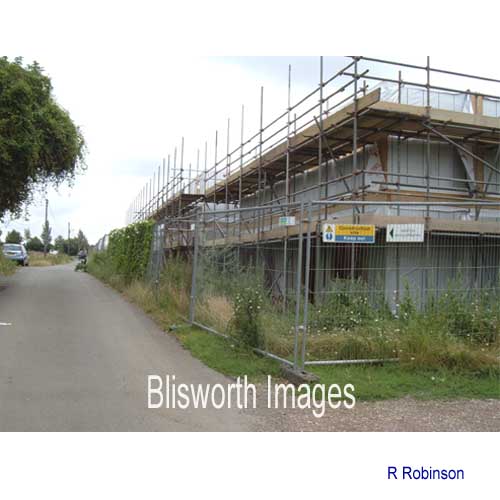
44-19 Before the brickwork however, the roof is fitted out, being based on the familiar trusses which are nailed to the upper wall sections and braced against high winds with a lattice of wooden rails. |
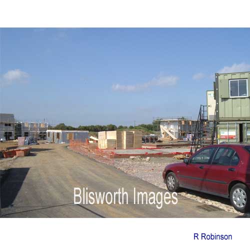 |
44-20 Late July, 2006, meanwhile the roadway into the new area has been made up. The site manager's office is to the right. |
|
|
|
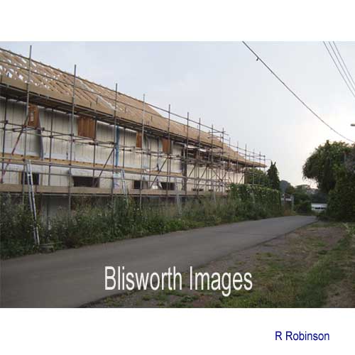
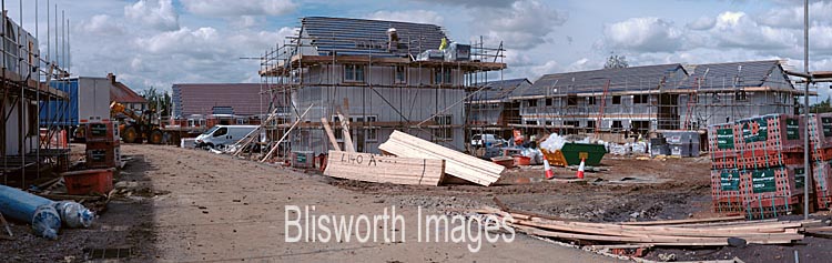
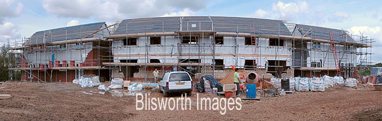
| These two pictures were taken late August - a time when most blocks are being worked on. Progress ranges from fitting plasterboards in some houses to a stage near the completion of the roof. | |
|
|
|
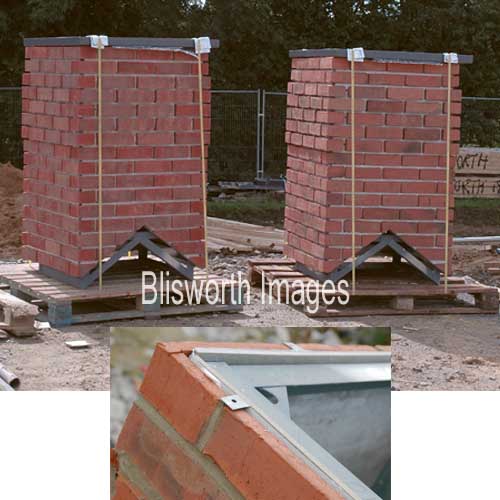 |
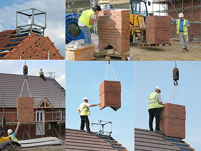
44-21 In August a load of fake chimneys arrived on site. These are assembled with thin fake sections of brick mounted onto an angle iron frame - as shown in the inset. On 13 September the first four of these chimneys are mounted on some houses. The heating gas-flues must exit the houses through the walls using a 'balanced flue' since the construction is by timber frame. These chimneys are purely aesthetic. The composite illustration shows that the roof is prepared with a steel location bracket. Then the 'brickwork' is pointed, in ordinary mortar, and when hardened, the units are hoisted and carefully positioned over the brackets by the site manager, John. Each unit weighs about 200 lb. |
|
December 2006 - The name of
the road in the new development, which will be adopted, History: Since c. 1500 there have been fields, or some small allotments within the medieval open fields, worked for an income dedicated to the provision of decorations in the church and a continuously burning light before a statue of Our Lady located in the Lady Chapel of the Church, close to the site of the Wake Tomb, see 43-00 and 43-14 in the Church Images section. At the time of the inclosures (c. 1815) the various pieces of land were condensed into one field and, at some point, this condensed field passed from church to County Council. The field in question is the neighbouring field to this development; in Victorian times it accommodated allotments. More recently it has been divided for allotments and for a community village playing field. Comment: The choice of the name is welcome. An alternative name was 'Quarry Road' to call attention to the fact that there was ironstone open-cast mining over this whole area in Victorian times - see linked map at the head of the Ironstone Section. Other suggestions included Westley Road and Freeston Road but they were not favoured. Remarkably, in November 1967, the name 'Lady Field' was proposed by the then Chairman of the Parish Council, Ms. Bellairs, for one of the roads now known as Windmill Avenue, Buttmead, Wellspring &c. A procedural error occurred while the chairman was absent and the name was not given consideration. The then clerk for the Parish Council, George Freeston, had provided a list of historical field names they might consider. It has not been possible to find, on historical maps, any field once called Lady Field and it is possible that either George or Ms. Bellairs thought of it via a similar reasoning to that above . . . we will never know! |
|
 |
|
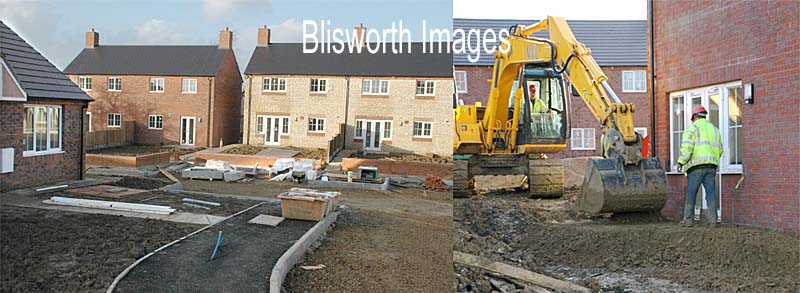
| January 2007 Some of the houses near completion, the site has been tidied and kerb edging is beginning to be laid out. Garden fencing appears to be of high quality with either concrete or brick supports between familiar 'lap' units. The levels near the individual houses are being established. | |
 |
|
 |
|
 |
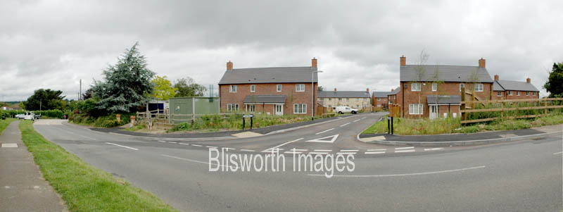
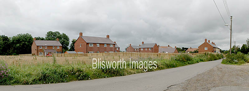
July 2007 The little estate is
finished and occupancy is complete. The two panorama pictures
above can be be compared with those at the start of the panorama
section.
When the site was first prepared, some topsoil was placed in the north-east corner of the assigned plot. As it formed a sizable mound there were no houses placed there. This is the end result, a 50 yard square paddock of use only to the developers at some future date. Oh well!
|
 |
|
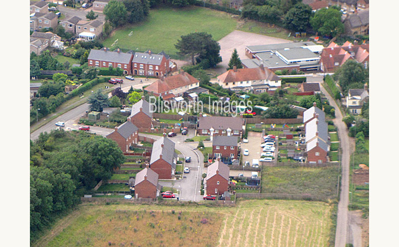
| The aerial shot above was taken on 13 July 2009 by Ian Ridgers flying with pilot Andy Hart on their way from somewhere in Hertfordshire to Foxton Locks. It gives us a good glimpse of the land that might be used for the second tranche of affordable housing and it shows us the five house development at Courteenhall Road corner. The school, with its playing field is in the background - the far end of Eastfield is visible at top left. | |