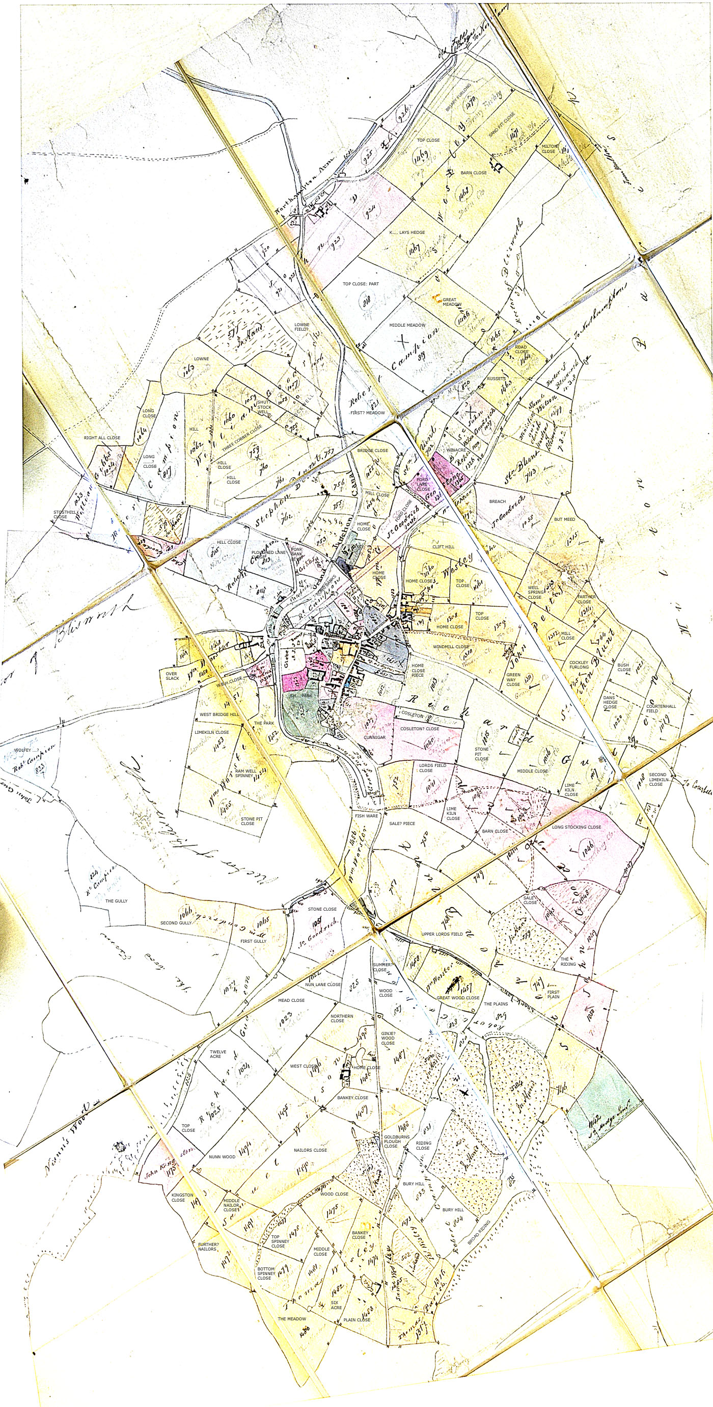
1820 - from a Grafton Agents folding map (NRO).
The date given for this map is an estimate that is mainly
based upon the drawn extent of the stoneworks
quarry. The quarry project
was brought to an aging Duke in 1820-1 but it is evident from letters that the
quarry was started before then, perhaps 1810. The map
shows a very small quarry, hence the estimate 1820. Another factor is that
Geo. Stone farms one field next to Ford Lane yet he is not
included in the 1821-4 rent records. A rent book is missing and we find
Stone renting many fields (~ 6) by 1834 having arrived in the
village in 1825. Consequently the
map is a basic 1820 plan with farmer colourings-in (note how the one field is
strongly coloured) and
annotation updated to c1826. There are pencil lines showing ideas for the new railway
station and the spur for Northampton etc. that
must be c1836. The by-pass
has no other record - available Vestry records begin 1890.
Please note that the maps require the use of the horizontal scroll.
Other early field name information can be gleaned from toll road and water mill details.
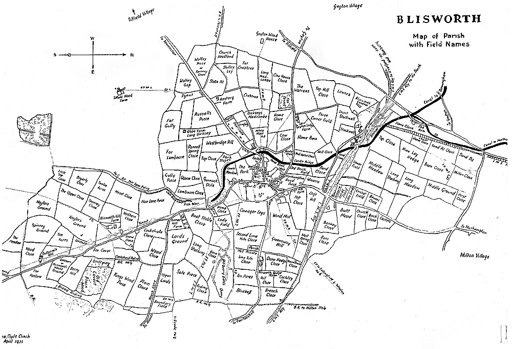
1935 - Mona Clinch's collation, from her book. Dated 1935 by M.C.Clinch