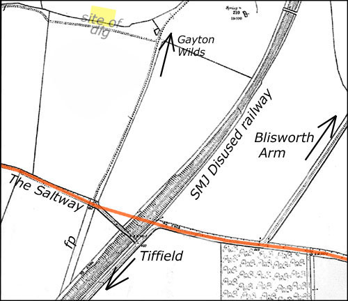
Location of the dig area in Gayton Parish in relation to the Saltway track
Archeological Dig near the Saltway, 29-30 August 2007
Location of the dig area in Gayton Parish in relation to the Saltway track
|
|
The Story This account is going
to be light on archeological facts because we are waiting for the
reports back from the expert and the organiser of the dig - Stephen
Young - who is a lecturer at the Nene College. More may be added
later.
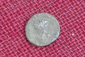
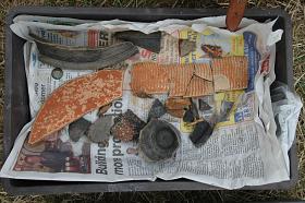
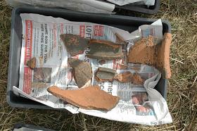
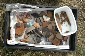
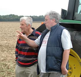
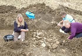
Neither Blisworth nor Gayton has much Roman history. Pottery has been found in the 1950s and 60s near The Loundes on both sides of the SMJ disused railway line. The remains of a Roman villa or temple was found in 1842 at a site now obliterated by the A43 Blisworth bypass and a number of interesting artifacts have been discovered on the hill between Gayton and Blisworth mainly by people with metal detectors although simple field walking by people with good eyes have resulted in much pottery shards being discovered. In the book, now out of print, reproduced on this website a case is made for a track between the centre of Blisworth and the area near the 1842 villa at which there was found a corn-drier during preparation for the bypass. This case was purely based on maps and crop markings. In October 2009, the whole of the Monumental Record has now been mapped and available on this website. The above paragraph is a little light on detail! For years, members of a metal detector operators club have examined fields under the care of farmer Colin Wakelin and this story began in 2006 when a large amount of pottery shards and broken stone were found at the site marked as a yellow square in the map above. Later that year a field walking group was assembled so that the area could be assessed statistically. Pieces of walling stone, roof tiles and pottery was found but neither valuable items nor tessella pieces (as used in mosaics) were found which suggested a lowly farmstead may be located there. The window of opportunity, 29th and 30th August 2007, came between the stripping of the field of a previous crop and the seedbed preparation for the next. A magnetometer survey had been done of the area a few days before so Clive Wakelin, the farmer's son, was called upon to draw out a selection of trenches to a depth of about 60 cm. as guided by the suggestive alignments on the magnetometer mapping. The mapping showed two boundary lines for an enclosure and some more subtle lines indicating the edges of field divisions which could be Roman or iron age. Each trench was tidied most carefully to achieve near vertical sides, parallel edges and smooth horizontal bases. This was so that, in photographing the trenches and any feature therein, an accurate 3D impression may be gained from the view. The tidying process must be done with patience using a trowel and brush so that for any artifacts that are discovered their position may be recorded and analysed before lifting them out. In the one trench where there is a picture of workers on the left, there was soon revealed what initially seemed to be a stone wall. However the stones are placed together too loosely and in fact this feature, which coincides with one of the enclosure boundaries, has no definite explanation at present. Stones placed in a trench close to a boundary suggests a measure had been taken to prevent whatever animals were enclosed from digging their way out. Perhaps this field was a Roman warren? A more mundane explanation is that the structure was a drain - as indicated by water collecting at the base when the stones were removed. Nothing was found to revise the earlier impression that the site was of a modest Roman farmstead with a dating roughly indicated of 100 - 300 AD though a settlement could well have been there in Iron Age times. One highlight was the discovery of both the bottom and the top of a Roman glass perfume bottle found by Jim Aveling. The current view of Roman occupation of the Midlands is that there is at least some farmstead at every kilometer interval over grounds of all types; clay, gravel and loam. A bit of bone was found in one trench and this warrants further analysis. At the end of the second day the farmer returned to fill in the trenches and harrow the whole field for the next crop. People from the village enjoyed the two days and appreciated the enormous patience that archeologists must have to deal with any site in a disciplined way - so as not to mess up alignments of objects as they are discovered. Over a dozen people were involved in either the earlier field-walking or in this dig, at least part time. Maybe the next dig will be more rewarding - there is another promising site but its location is not being disclosed yet. Some catalogue of finds and an account of the site is hoped for from the archeologist. When that is received this preliminary account will be updated or a link will be provided here to the account, which will probably be posted on the CLASP webpage. Their August 2007 report is out and posted on that site. Page 15 gives the briefest mention of this dig but a later compilation by Clasp states: Initial analysis of the pottery from the this site indicated that the settlement was particularly active during the late 1st to early 2nd century with 61% of the diagnostically datable pottery identified as belonging to this period. A significant amount of material from the assemblage indicated that the settlement flourished into the 2nd and early 3rd centuries. However it is interesting to note that the diagnostically datable material for this middle Roman period is only 36% of the total assemblage and approximately 50% of that available in the early period. In the late Roman period of the mid 3rd to 4th centuries AD associated pottery accounts for only 2% of the remaining sherds. The potential archaeological development here is that site pottery profiles related to settlements near Lactodurum (Towcester) are different compared to settlements associated with the Bannaventa (Whilton Locks) area. This chronological accent is indicative of an early Roman focus as opposed to the era of, in general, most 'Romanisation' during the late 2nd to early 3rd centuries AD. Should this result prove to be the 'norm' for the site profiles around Towcester, then we can start to see that the 'imperial experience' here is going to be substantially different from that around Bannaventa. This is what it's like - with every new site, archaeologists can gradually piece together a coherent story - and three years on dr. S. Young gave a fascinating talk in Blisworth on current conclusions.
|