| SOUTHERN END OF THE
STATION To move the view to other
parts, use the "next" and "previous" links >
NEXT |
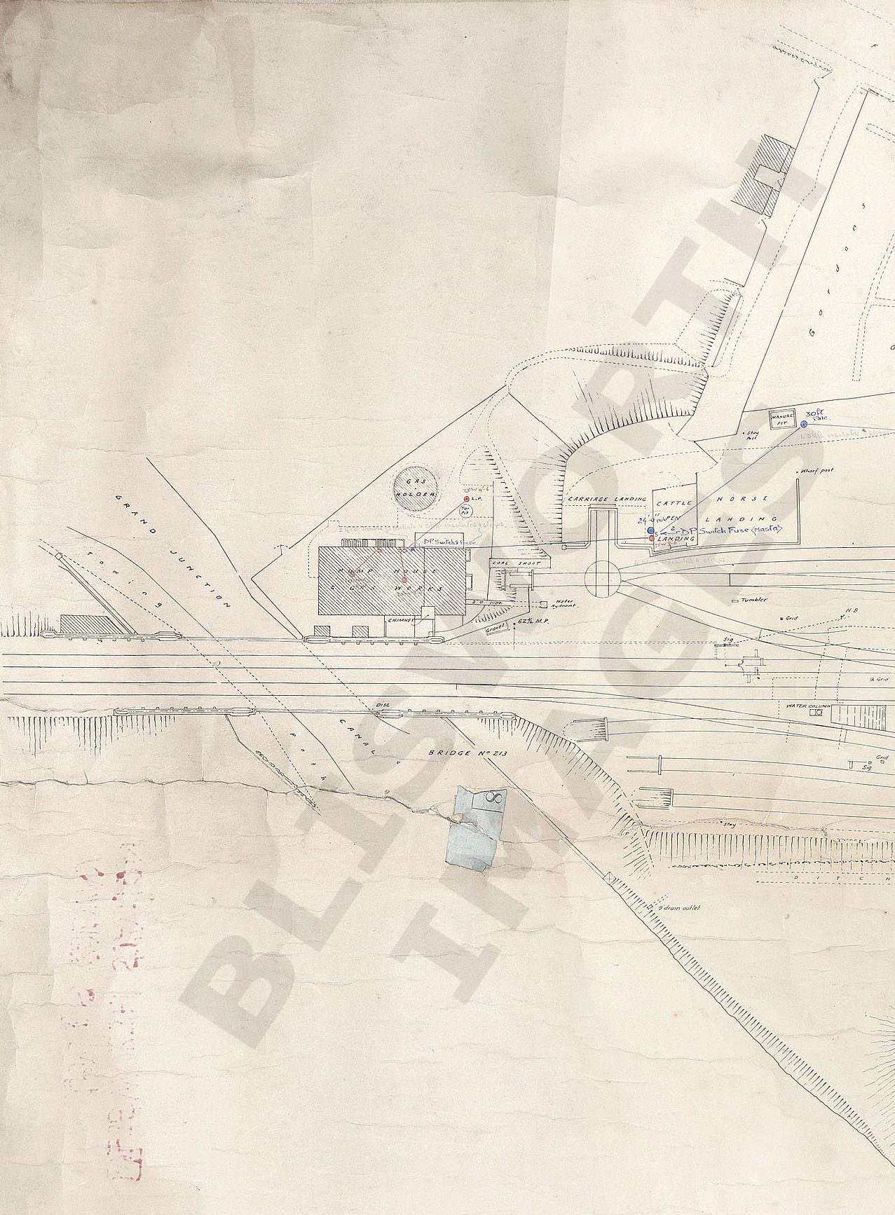
| The entire station layout at Blisworth is
shown in a sequence of four sections. The date of the original
map, which measures 0.8m by 2.7m and is drawn at a scale of 240:1, is
unclear. It certainly shows much updating, it was a 'working' map,
but also shows some old features such as the gate across Ford Lane on
map 2. The SMJ cottages (1890) are shown on map 4 but there are
numerous little diagrams of the signalling 'trees' and some of these
might be dated at post-1923 when the regrouping of the railway companies
took place. This map has fewer buildings (little huts etc.) on it
than the heavily annotated map that is also
on this website - we are not certain of the dating of that map
either. The map is the property of Andy Newbery, Blisworth.
It may be offered to the NRO. All four maps have coloured and
pencilled notes describing electrical installations. Some of the
pencilled notes are hardly decipherable on the original. On a
17" screen, the scale of these maps is about 275:1.
MAP No. 1: Of particular interest is the driveway leading to Ford Lane and the arrangements (incl. a carriage turntable) for off/on loading cattle. Access to some railway cottages and the Tank House are shown off this driveway. The plateman's hut is clearly shown by the bridge - it was possibly also used by the postal workers dealing with the mailbag ejector, but no access paths are shown leading to/from this hut. Quick Escape to Home Page |