|
Just Miscellaneous, Part II , Blisworth, Northamptonshire, UK. All pictures are presented at relatively low resolution. Any interest in copies of a picture at a higher resolution (ie. clarity) should be directed through contacts given in the Blisworth "Round and About" parish council publication or using the comment form on the home page. In some cases the pictures are not available due to copyright restrictions. However, permission has been obtained, where possible, to include them here. Printed below each image is the photographer's name, if known. Back to Home Page Part I This is Part II |
|
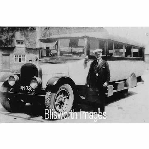 |
22-19 The Nightingale bus service, circa 1925 from Hanslope to Northampton. The type of bus is a "Brockway" in a blue livery. Frank Beeden operated a service from Towcester to Northampton, through Blisworth and apparently he used a mixture of vehicles including Lancias, Gilfords, Tilling-Stevens and A.E.C. in a dark green livery.
Information provided by Barbara Joy. |
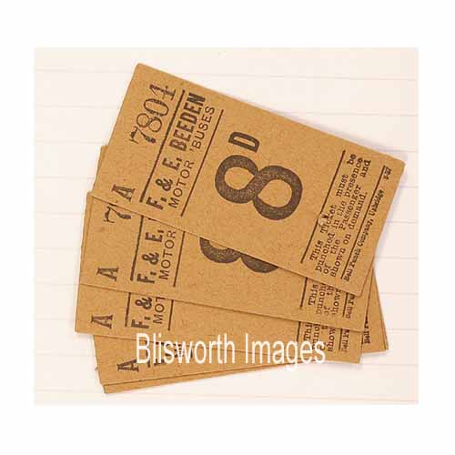 |
22-20 Beeden bus company tickets. The first bus service through the village started in c. 1915 with Mr Nightingale's covered bus from Towcester to Northampton. Within 5 years Beeden and United Counties services began.
|
|
Footnote: Pictured c1925 is a group, along with two Beeden bus drivers, assembled in the Sun, Moon and Stars car park. |
|
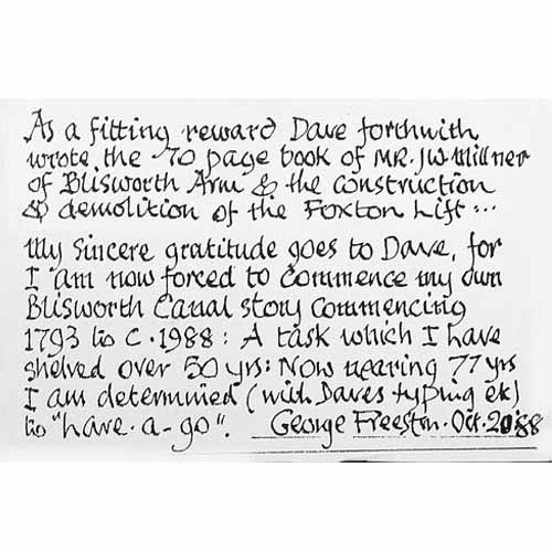 |
22-21 In 1988 a David
Goodwin published a book about the Foxton Incline Plane. He also created a
partial biography on T W Millner, canal engineer, and an index of
Millner's many letters. In the flyleaf of a notebook of George
Freeston's in which he had made notes about the books, George had
written this to himself.
The idea seems to be correct; namely, that what put off George from writing a substantial book were the typing and the graphical challenges |
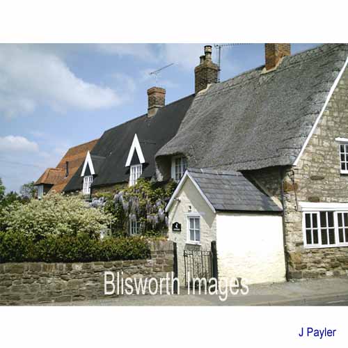 |
22-22 At the corner of Chapel Lane and the High Street. Tiles, tin and straw, all on one ridge! |
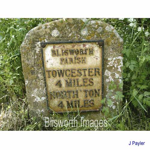 |
22-23 Let's hope we can retain this relic of the coaching days for decades to come. Well, that's what we said in 2005 when the website was set up. Around 2011 however, some bastard had stolen the cast iron plate by undoing the square headed screws at each corner (see below).
|
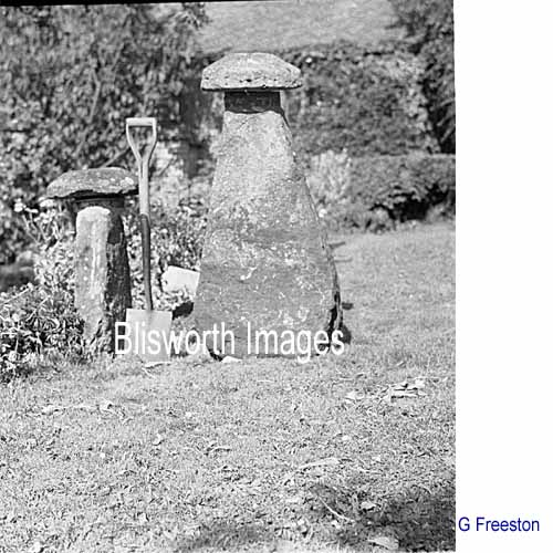
 The curious thing about this is that the remaining stone is a gravestone
from the 17th century. We cannot make out the detail enough to say who
the deceased was but from our births/deaths record for 1644 there is
nothing like a match. In the remaining holes are yellow "Rawlplugs"
probably of 1970s vintage (no earlier) and the fitting looks rather
professional. The more conventional milestones of Victorian design are
of solid cast iron, two vertical faces towards the traffic and one
sloped top bearing a number. So the question is - who did this
installation? Was it George Freeston?
The curious thing about this is that the remaining stone is a gravestone
from the 17th century. We cannot make out the detail enough to say who
the deceased was but from our births/deaths record for 1644 there is
nothing like a match. In the remaining holes are yellow "Rawlplugs"
probably of 1970s vintage (no earlier) and the fitting looks rather
professional. The more conventional milestones of Victorian design are
of solid cast iron, two vertical faces towards the traffic and one
sloped top bearing a number. So the question is - who did this
installation? Was it George Freeston? |
|
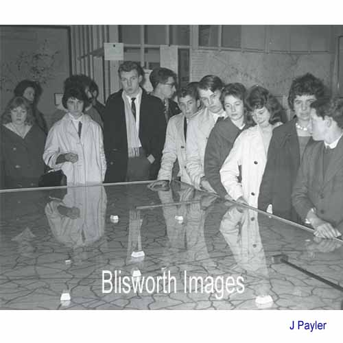 |
22-24 A Blisworth Youth Club visit to the Police Headquarters at Wootton Hall, date 1967. |
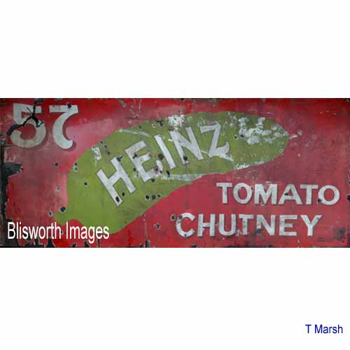 |
22-25 The village was once highly decorated with stove-enamelled sign boards such as this one which measures 10 foot by 4 foot. No one knows where this was hung. |
 |
22-26 Staddle Stones. Three or more of equal
height (if the ground is level) would support a network of wooden planks
some distance off the ground. This enabled farmers and homesteaders
to build ricks of straw with corn on the ear out of reach from rats
or mice who could not get around the overhand. It was best to
store corn in this way throughout the year rather than turn it into flour
that would fill the small houses and wouldn't keep well anyway.
The ricks needed to be securely thatched to ward off the rain and keep sparrows from getting at the corn. However, sparrows became very adept at burrowing . . . |
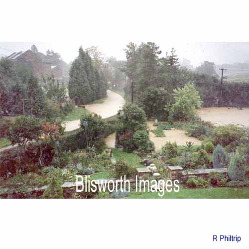 |
22-27 In Sept 1992 the area experienced about 5 inches of rain in one day. The general area to both the west and the south-west of Northampton was affected and all this area drains through the canalised section of the River Nene at Northampton. The town experienced severe flooding while Blisworth demonstrated that its lowest point in the Gayton Road by the mill was capable of being flooded. The canal, just off the picture to the left, reached the top of its bank and this water is perhaps just a few inches higher than that. It is thought that this area was the site of a ford across the brook
(Fisher Brook) in Saxon times. Even with a bridge at the bottom of
High Street, the ford would have been used regularly for animals -
possibly right up to the 18th century. Neither ford nor brook are
shown on earliest maps (Grafton 1727) but that is not indicative as the
maps were drawn to help the Duke deal with rent collection and land
allocation. |
| Floods of this magnitude have happened before, of course. Mercury, Feb 12th, 1897 "Blisworth: The premises of Messrs. Westley Bros. were partially flooded, much damage being done. Here it was found necessary to remove the horses, etc. from the stable yard on the Grafton House side of the road. The road from the mill to Gayton was almost impassable." | |
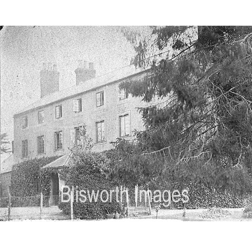 |
Blisworth House sporting an interesting porch of uncertain date (1900 ?). A very elaborate porch was once placed in the style of the original porch of the old rectory. It hid the 1702 date that is believed to mark the time of enlargement of the house. This photograph is the only evidence that a 'lesser' porch had ever been installed.
|
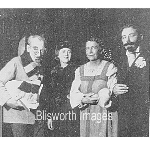 |
Blisworth Drama Society - left to right, Dr. Dudley Jeaffreson, Mrs. roe from gayton, Mrs. Jessica Jeaffreson, Mr. Thomas Thorpe. What might the play have been ?
|
|
|
|