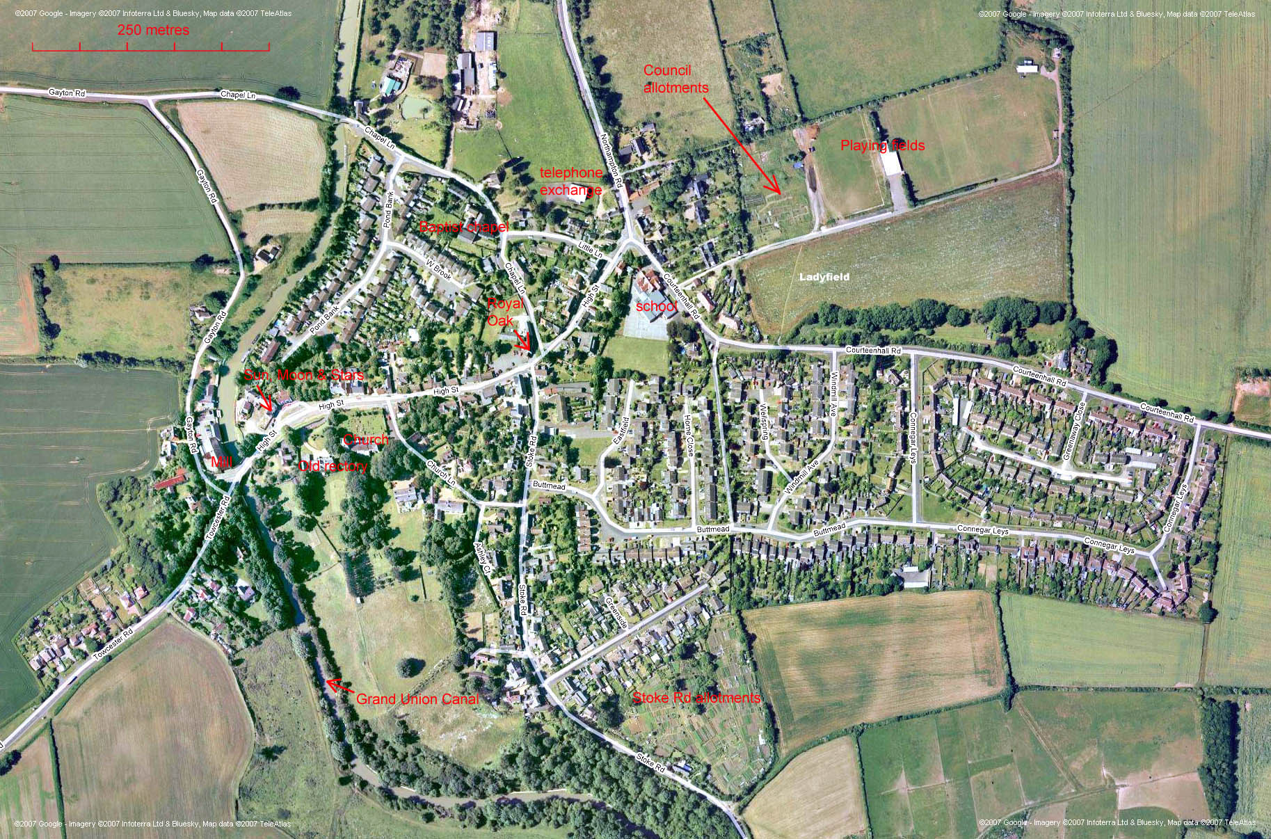
Satellite Map of Blisworth Village (a 0.5MB download - please be patient)
The map below has been generated using the Google service and is based on
2005/6 data.
In consequence the recent development of Ladyfield is not shown - the field is a
bare one!
Parts of the map may be used in future, overlaid on archive maps, to show
clearly the changes
over an interval of time.
It is necessary to use both vertical and horizontal scroll bars - the bars
are coloured pink to
serve as a reminder that they are there (for users of IE5.5 or more recent . .
.).