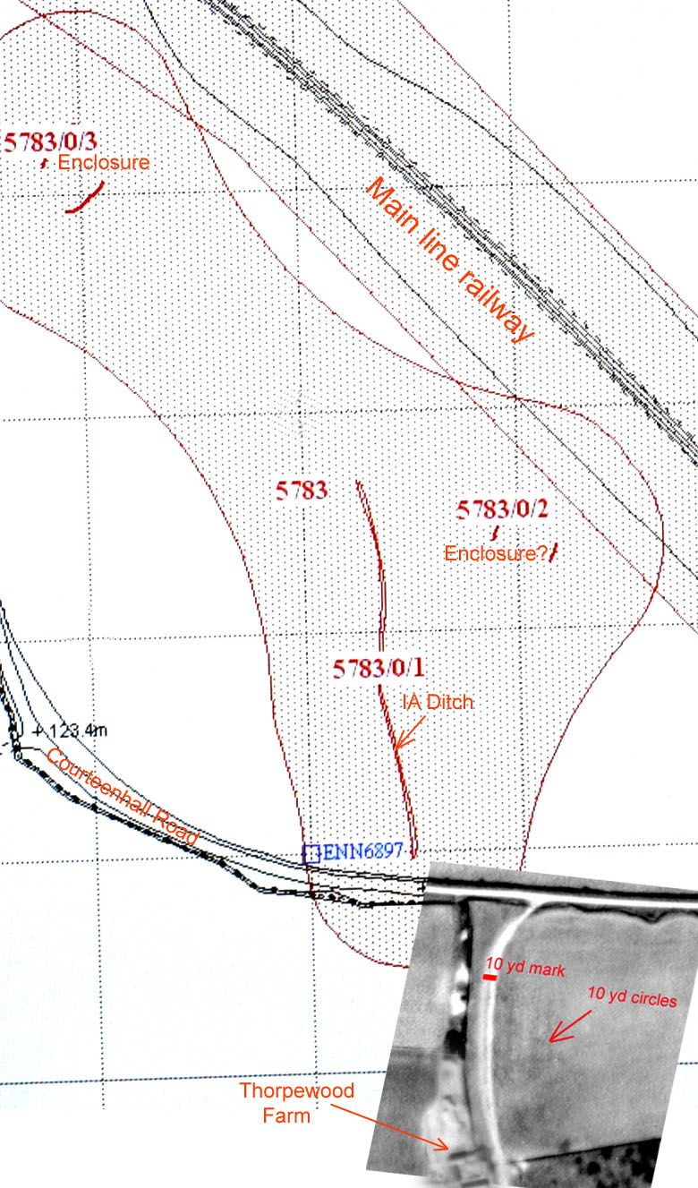
A combination of HER data regarding ditch and enclosures with a portion of the USAAF vertical aerial photo taken in
April 1944. The evidence for the hut circles is indeed quite tenuous and magnetometry survey work would be needed
to confirm the observations. In medieval times this whole area was part of a feudal East Field that joined to a
forested area which was shared with Roade parish, this confirmed by traces of "ridge & furrow" marking around the farm.
The hut circles are not yet confirmed by an archaeologist and incorporated into the HER database.