|
Canal-Side Improvements by
The Blisworth Canal Partnership This page will be in construction over the next many months. The Canal Partnership was reformed in 2009 and surveyed the entire canal-scape within the parish. A number of improvements were noted and some have been completed. Here are monitored some of the improvements and for this website the main point is to note for posterity these very definite enhancements to the village while the detail may be found on the Partnership website:
|
||||||||||||||||||||||||||||||||
|
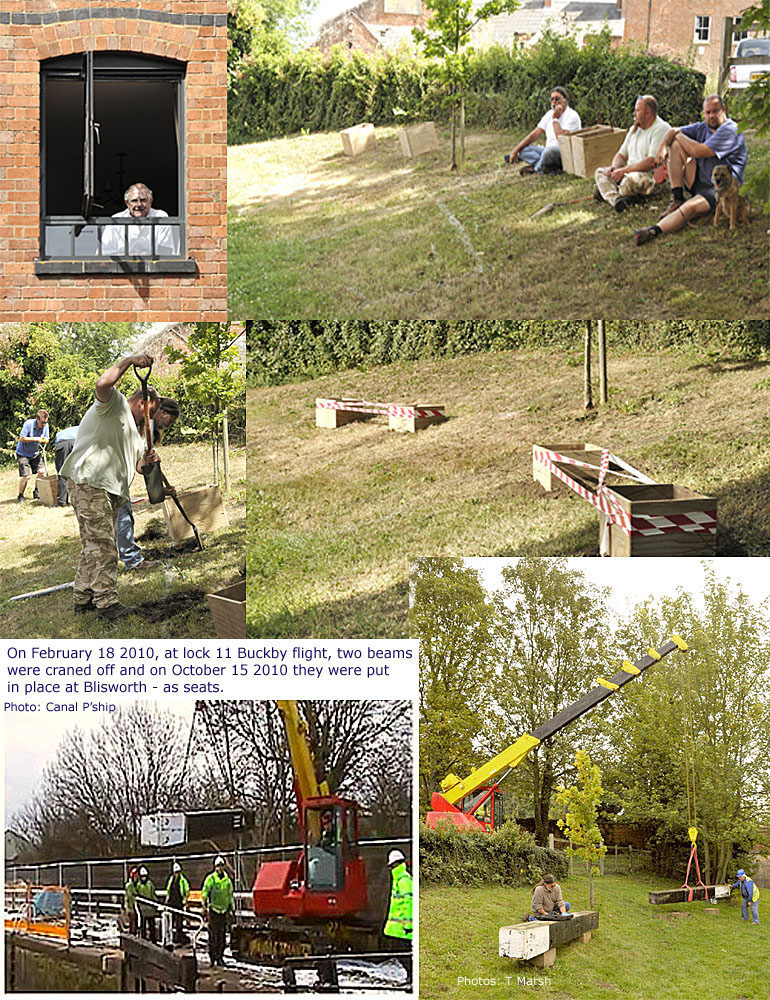
"Lock
Beams" - canal-side seating opposite the Mill building.
Installation from 10th July to 15th October 2010, spectators and volunteer workers alike wait for BW to arrive,
they dig holes
for concrete and 'pour'. They returned 3 months later and craned the lock
"balance beams" onto the plinths. An all abilities
access path from the towpath will be established later.
|
||||||||||||||||||||||||||||||||
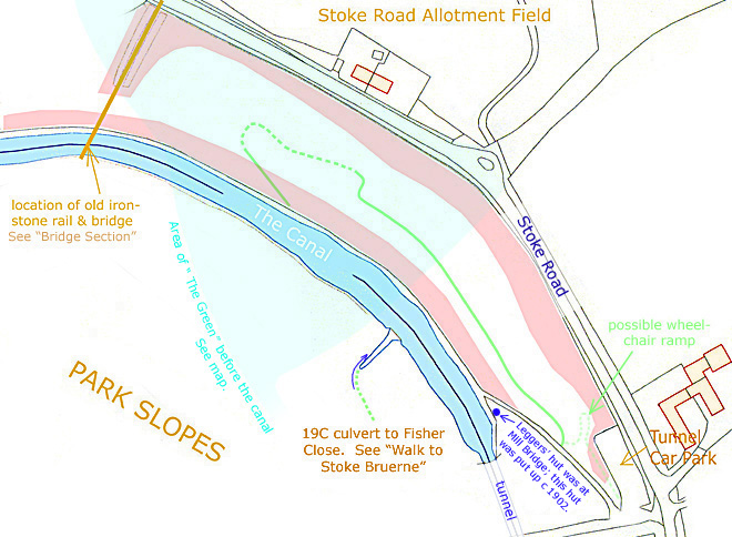
 A Walk in the Woods - Pocket Park.
This project has already attracted some funding, £1000 in July from the
Northampton Branch of the IWA and a
staggering total of over £4600 arose from
the 2010 Canal Festival, but a little more is needed. Shown
below is the area of interest, a section of the canal embankment near
the mouth of the tunnel, with the green lines showing the present
lines of paths that will be an approximate basis for the "Walk in
the Woods". Areas marked pink are the steepest parts of the
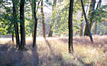
embankment. The inset picture was taken in a cropped out beech
forest in Oxfordshire but hopefully illustrates the eventual appeal of
the place. The project was displayed at the Canal Partnership
stall at the August 2010 Blisworth Festival to encourage suggestions from the community.
The current
management plan document is available for download here. See
the panels below for some details on the creation of the Pocket Park. A Walk in the Woods - Pocket Park.
This project has already attracted some funding, £1000 in July from the
Northampton Branch of the IWA and a
staggering total of over £4600 arose from
the 2010 Canal Festival, but a little more is needed. Shown
below is the area of interest, a section of the canal embankment near
the mouth of the tunnel, with the green lines showing the present
lines of paths that will be an approximate basis for the "Walk in
the Woods". Areas marked pink are the steepest parts of the
embankment. The inset picture was taken in a cropped out beech
forest in Oxfordshire but hopefully illustrates the eventual appeal of
the place. The project was displayed at the Canal Partnership
stall at the August 2010 Blisworth Festival to encourage suggestions from the community.
The current
management plan document is available for download here. See
the panels below for some details on the creation of the Pocket Park.
|
||||||||||||||||||||||||||||||||
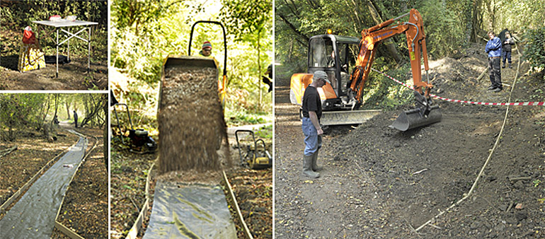
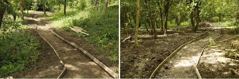 May 14th 2011 - Use of a small digger rapidly established the line of the path, digging out a width of 4 feet and a depth in the region of 6" to be filled with compressed grit and stones. Villagers must have seen the Springtime appeals on the notice-boards for volunteers to help with clearance of the area and sort out various problems. Support was considerable since the weather warmed a little (!) and progress has been very impressive. The left picture is taken from near the southern most extent while the other is taken near the point where the path will turn left and descend the bank to join the towpath in a series of broad steps. The actual line of the path takes interesting turns around groups of young trees (mere maidens, some of them, at present) and so does not follow the line of the original casually worn path that is shown in the plan above. October 21st 2011 - having filled the upper part of the path with compressible stones and grit during the summer, the work moved steadily towards completion in Autumn sessions.
Beverages in a thermos with nibbles were lunch support while a digger was used to refill, at the car park, a dumper with stones for the path. The digger was also used to fashion a slope at the lower end of the path to rejoin the tow path. A final task for the digger will be to profile the surplus soil to render a natural look. Some young tree and wild flower planting and the installation of some benches later this year should make the whole area very attractive. An idea imported from the Yorkshire Dales may be set up; a "money tree" based upon an old trunk into which 1p and 2p coins are hammered into the bark by visitors. It is proposed to rename the area "The Tunnel Spinney". |
||||||||||||||||||||||||||||||||
|
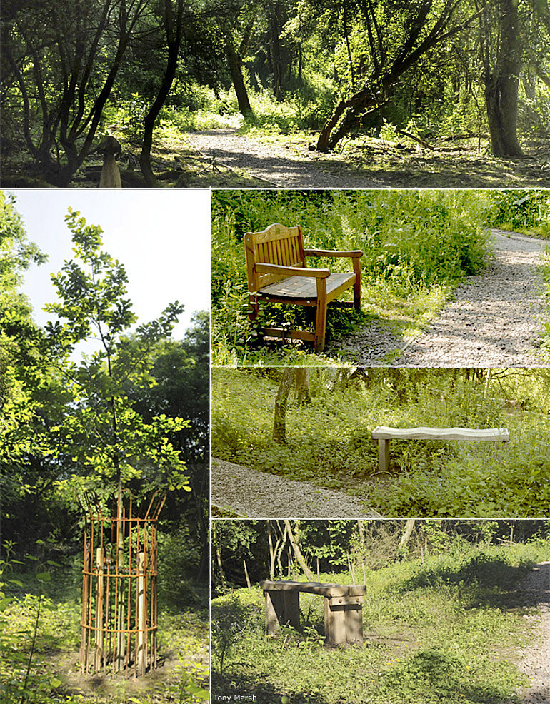
June 2012 For the past few
months a working party has frequently assembled and persevered in adding a little
more. As the year 2012 is the Queen's Diamond Jubilee year an oak was
planted at the far end of the walk. The oak is encircled with an
iron cage that was constructed by our local blacksmith, Bob
Nightingdale, who is now lodged in Stoke Bruerne next to the
southern tunnel mouth. Three benches have also been placed which,
with a little remodelling of nearby trees, will provide views onto the
canal. The paths of granite chippings have mellowed into the
environment whilst the general vegetation has burgeoned upwards with the
damp spring.
|
||||||||||||||||||||||||||||||||
|
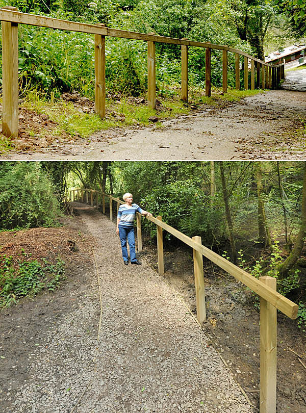
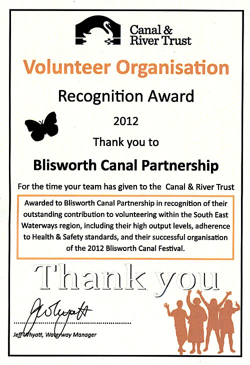
Monday 17 December 2012 - Northampton
Chronicle and Echo (excerpts). The Blisworth Canal Partnership was this week presented with an annual Volunteer Recognition Award by the Canal & River Trust, the new waterways charity entrusted with the care of 2,000 miles of waterways in England and Wales. As evidenced above, their work has included the transformation of an area of scrubland into a nature conservation area, planting it with wildflowers and tree saplings, creating a new pathway and nature trail, installing a new handrail to improve accessibility and organising the hugely successful 2012 Blisworth Canal Festival. John Highmore, volunteer coordinator at the Canal & River Trust, said: “The Blisworth Canal Partnership thoroughly deserve this award as they have dedicated a huge amount of time and energy over the years into improving this stretch of the Grand Union Canal. The effort from the volunteers has transformed this area of the canal, making it a really interesting and attractive place to visit”. Jan Andrews, from the Blisworth Canal Partnership, said: “We are delighted to receive this award from the Canal & River Trust and to be recognised for all the hard work we do. The canal in this area is really popular and we have really enjoyed helping to improve the area and making this stretch a lovely place to visit. Now we have a new nature trail and pathway we hope many more people will come and visit the waterway and re-discover their local canal”. |
||||||||||||||||||||||||||||||||
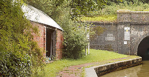 Saturday 16th March 2013 - the tunnel building,
often known as the "Legger's Hut", at
the Tunnel Mouth began to acquire a new look - the first step was to
install some attractive iron gates to secure the space.
Saturday 16th March 2013 - the tunnel building,
often known as the "Legger's Hut", at
the Tunnel Mouth began to acquire a new look - the first step was to
install some attractive iron gates to secure the space.
Read more . . . |
||||||||||||||||||||||||||||||||
|
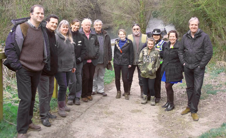
Tuesday 9th April 2013 Members of the
Blisworth Canal Partnership met with members of the Canal and River
Trust and some delegates from a wide range of volunteer groups
including Volunteer England and The National Trust.
Feedback from the meeting, which was to discuss our canal project, was
very positive. Frankly they thought it was both inspirational and
fantastic - we should be proud of our efforts. One delegate from
Manchester wanted to stay with us all day and not get on to a Milton
Keynes meeting he was supposed to attend. The picture below records the
meeting.
|