|
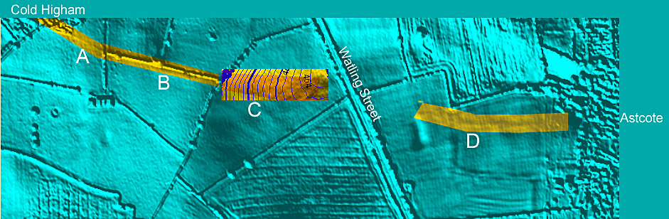
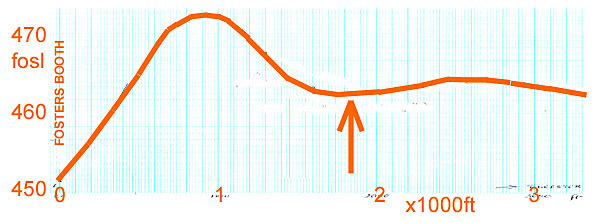
Photogrammetric Evidence for a Watling Street Crossing The initially assumed Saltway path from Cold Higham to Astcote is a near-straight line based upon 1885 OS location of footpaths. In the above picture from Bluesky, using v.12 of Global Mapper, there is evidence of very weakly hollowed tracks at A, C and D. At C the hollow is very broad, descending gently to the east, and only revealed using an overlaid map of height contours which are spaced at 2 foot intervals. For the segment B the path is assumed to have followed the line of the post-enclosure hedge line. Thus the path appears to have been slightly cranked. For the profile of the lie of the road (Watling Street) use is made of the heights above sea-level provided in 1885. The plot is shown below.
The assumed crossing point (cranked line) is arrowed. It too corresponds with a weak depression in road level. |