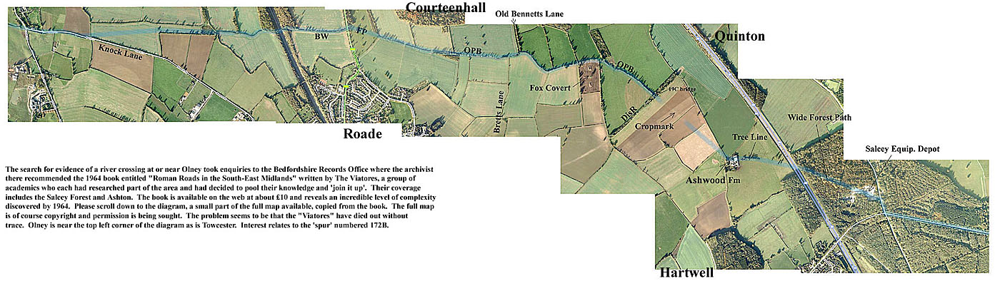
Proposed Routes for the Roman Saltway East from Blisworth Parish
From the 1729 Grafton maps it has been possible to connect the Saltway at Pattishall Rd. with Knock Lane. (See article).
It would be satisfactory to have a suggestion
for its route to the east. In the Northamptonshire Records Office 18th
century
maps of Courteenhall, Quinton, Roade and Hartwell Parishes have been examined.
Various paths rather suggestively line up
- see the Google-based chart below (and use the horizontal scroll bar to work towards the
east).
In the chart, BW means bridleway, FP footpath, OPB old
parish boundary and showing a path in 18C (may still be in the
same position nowadays), DisR stands for dismantled railway. The
young farmer at Ashwood Fm seemed to know what I was
on about but failed (!) to show me the line of trees which, along with the
crop-mark* in his field, seemed to clinch how the path
heads towards Salcey Forest. The broad but overgrown path leading through
the forest was found first on foot by using one
of the clearly visible access paths. Eye of faith from Google-view
confirms its existence in accord with the paced out survey
that was made. Beyond Salcey Forest it may be shown that the Saltway
crosses the first of a few major rivers at Olney - entering
the town along Spring Lane which opens in the square and crossing Viatores route
175 at right angles as it aligns with Olney's
back streets.
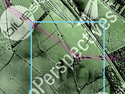
* a new mapping technique (see Bluesky
- "Surface Model")
provides visibility of surface slopes. This crop-mark is definitely
ridged
and by use of analysis software (Global Mapper v.12.02) the DSM data shows
the ridge height as a gradual ~12 centimetres with
the trackway debris now spread over a band across the field some 35 metres
wide. The feature is totally invisible to anyone
visiting the area (note made 09/04/2013) and there was not found any soil colour or stone distribution.
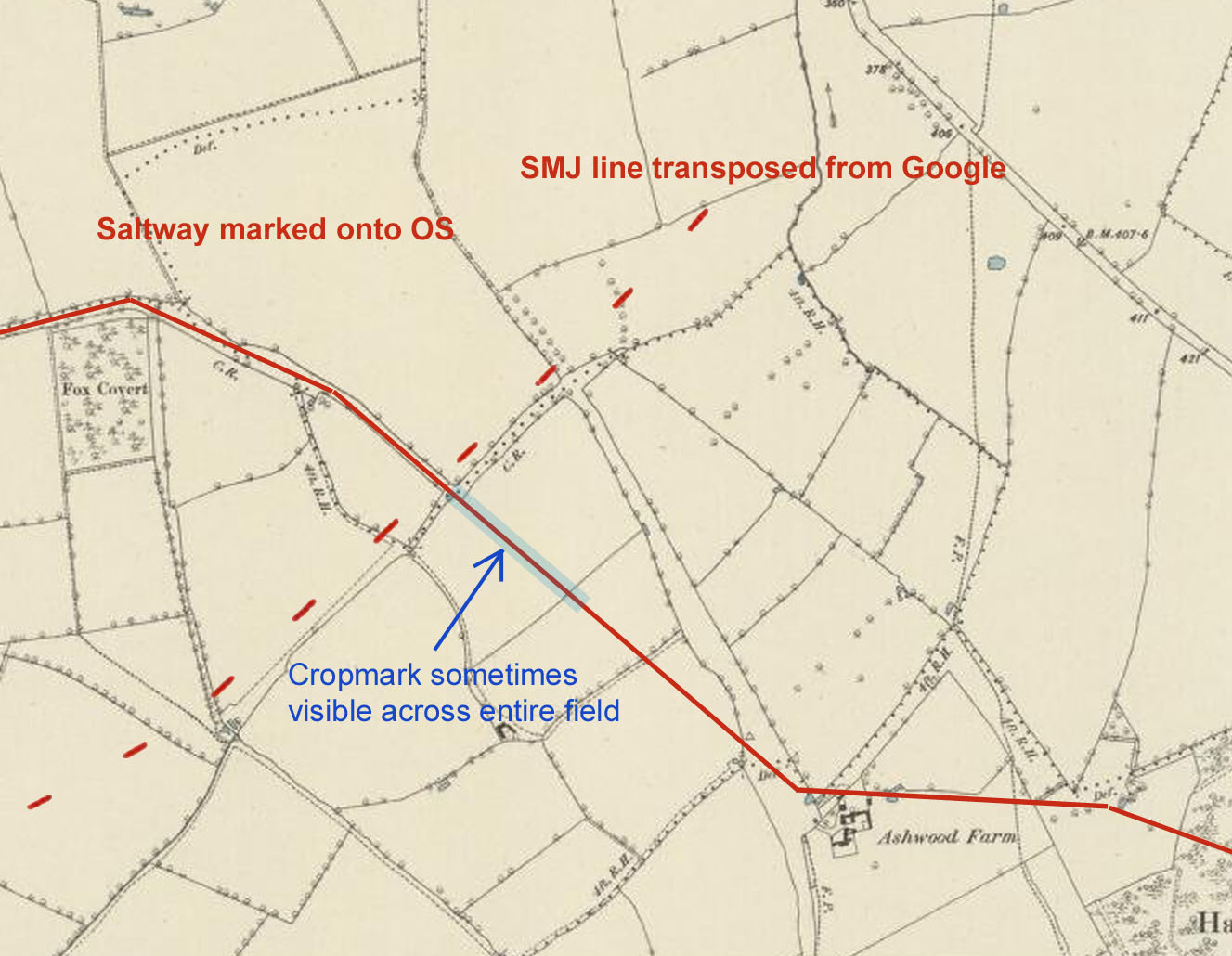
A further point of interest is that
the path was cranked after it was following a straight-line and the SMJ railway
was built after the crank. This 1882 OS map with details
and later path of the railway proves the point or at least defines the age of
the make-up of the road (giving a visible soilmark) to either
(1) a post railway and pre-arable time by a farmer wanting to straighten his
route (unlikely ?) or (2) before the definition of what appears to be
ridings through woodland that presumably prevailed well before enclosure - ie.
someone cut a line through a moorland or scrubland or
a wood. In the former case, the Saltway must have lost its directivity
amidst coppices and divers divisions in the forest. In the latter, it was
vectored towards a location within.
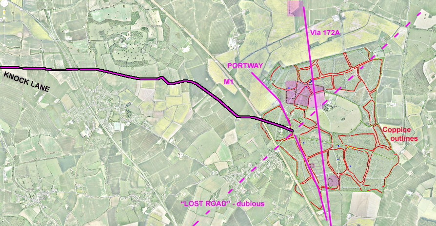
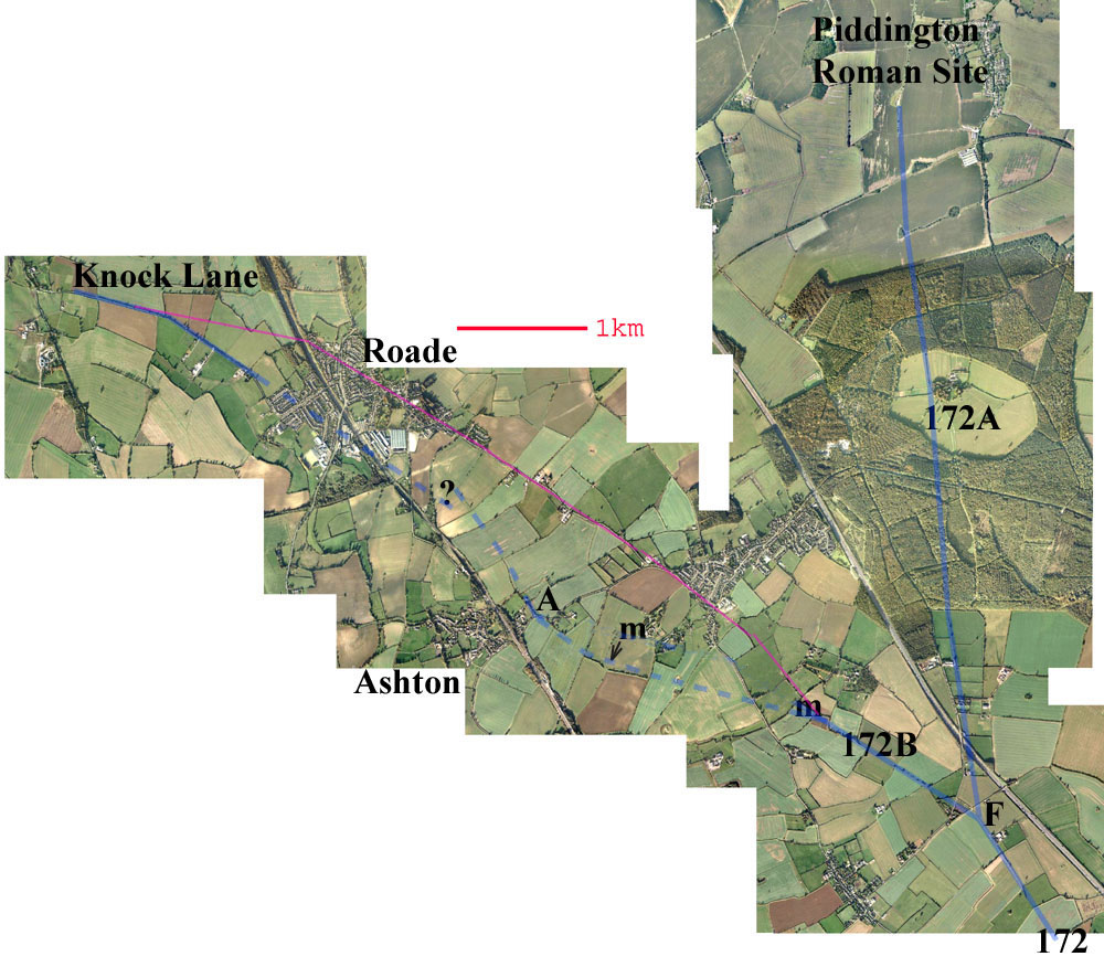
In this image is shown the suggested Saltway path in relation to known Salcey Forest archaeology.
A bit of a problem for this proposal is that
the portion of the track from Ashwood to the crossroads is not apparent on an
18C
map of Salcey Forest, but nor are any other subdividing tracks except for
Grafton's track which ran from the crossroads into
the lawn area - continuing the line of the Hartwell road. This may be only
a medieval trackway.
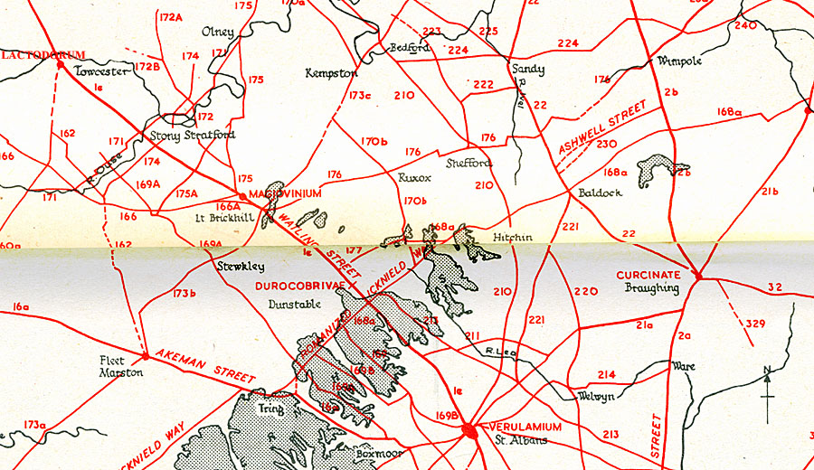
The Viatores say that spur 172B peters out
just to the east of the village of Ashton. They remark that railway works
etc. make it
impossible to take the line further but: "The
left fork 172B makes a brave start towards Hartwell, beside a stretch of county
boundary to the north-west of Spinney Lodge. It is conspicuous along the
boundaries of three more fields, and attains high ground
on merging into the modern road, where it makes a slight turn more
west-north-west. The farmer at Park Farm indicated its
presence on the east side of his house, believing that the original road was
taken up and relaid as a present track into the
Ashton road. There is just sufficient evidence to carry it across the ford to
the east of the railway, but the village plan is so altered
by the passage of the enormous railway embankment that the search had to be
terminated. On the line ahead is a group of
Romano-British sites around Blisworth, in which direction continuation might
profitably be sought." The group of sites around
Blisworth are displayed on a map of
Roman Monumental Records on this website.
The large google-based layout
below shows that 172B could be joined up with "our Saltway" given that
the eastern part of Knock
Lane is taken as part of the Saltway. Simply extending its line through
Roade brings alignment within a short distance. The Viatores
arrived at A in the layout from the east with 172B and a short length extending
from that, following hedges etc. provides potential
for a joining. The labels 'm' refer to lengths of track that have been
metalled (use of compressed pebbles). There is however a
logical problem with this route for
the Saltway because it suggests that, having traced a line between due east and
east-south-east
for many miles from Droitwich,
an excursion from fork F on the 172 south-east to nearly rejoin the
Watling Street simply doesn't
make
much sense because the Saltway crossed the Watling Street at Fosters
Booth. In short
The Viatores indicate no routes in the
area running substantially
east-west other than from the area of Little Brickhill and so a path near Olney,
crossing the river there and
heading for the Bedford area, is
somewhat more favoured. Perhaps there was a route from Olney to provide a
north-easterly
extension for the road numbered 170b in the diagram above. The Viatores
say nothing about this possibility in their book
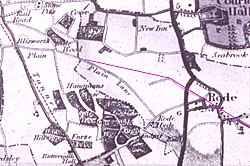 The route indicated in purple,
added in 2012, was suggested in Bryant's 1824 map; the
The route indicated in purple,
added in 2012, was suggested in Bryant's 1824 map; the
north end aligned in view
of the appearance of
early 19C Roade and the rest aligning very
well with road and some field
boundaries.
Final Comments:
The tracks across Salcey, including the one suggested in the map above,
existed
as earthen balks. Maps before about 1750 cannot be
found. Continuation through
or slightly to the north of Stoke Goldington
can be plausibly suggested but no field work to
try confirm this
has been done. Once passed Olney further pure speculation is needed
before
linking up with the Viatores track 222 to Sandy. Beyond
Sandy a division onto the
south and north parts of track way 22 seem to spell
the end of the speculation. It is worth bearing in mind that
salt trading on a line
persistently to the east must peter out as one approaches
the influence of salt sources on the east coast.
(concluding notes) Tony Marsh January 2011
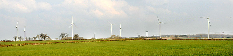
The pathway defined in the first figure of this account
is now decorated by a number of wind-generators located
in Courteenhall parish, near Old Bennett's Lane. See image below.