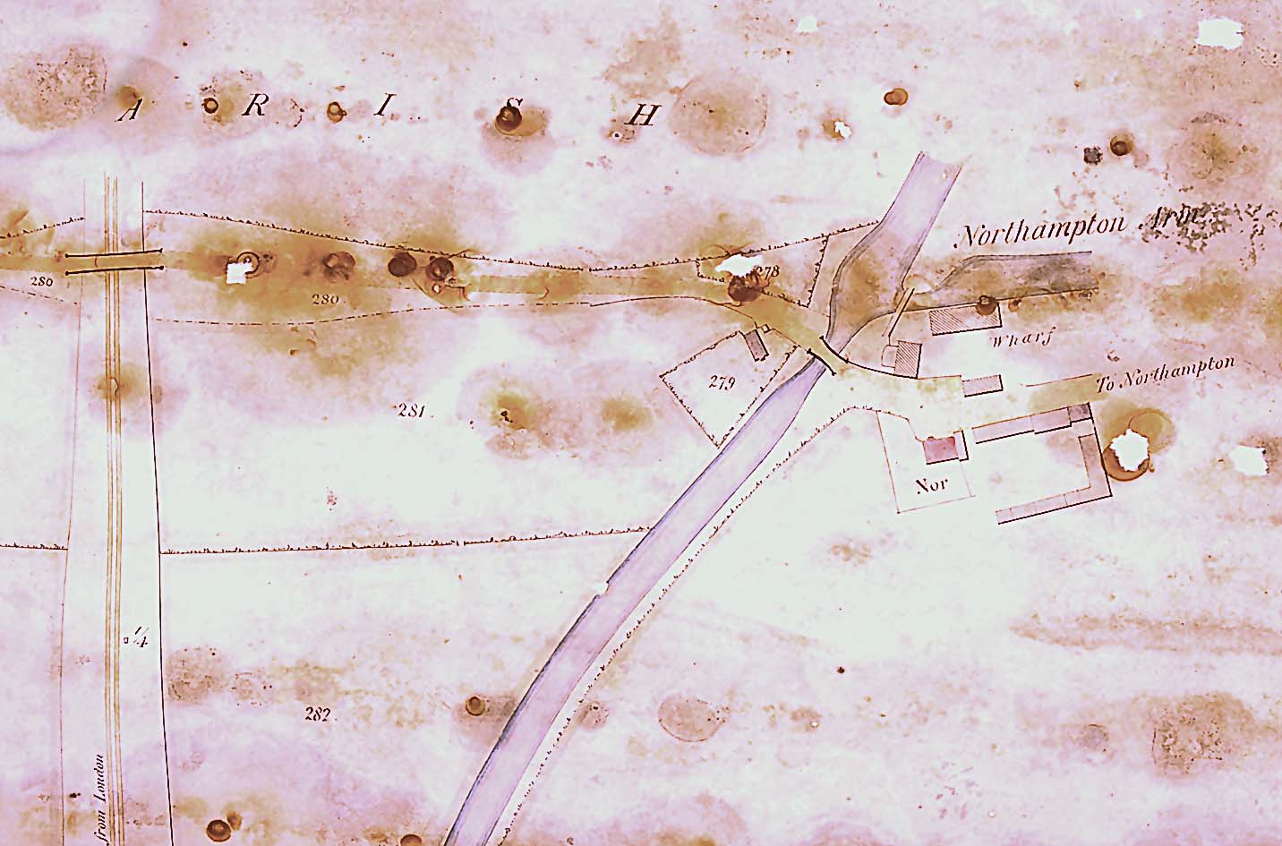
 Blisworth Arm
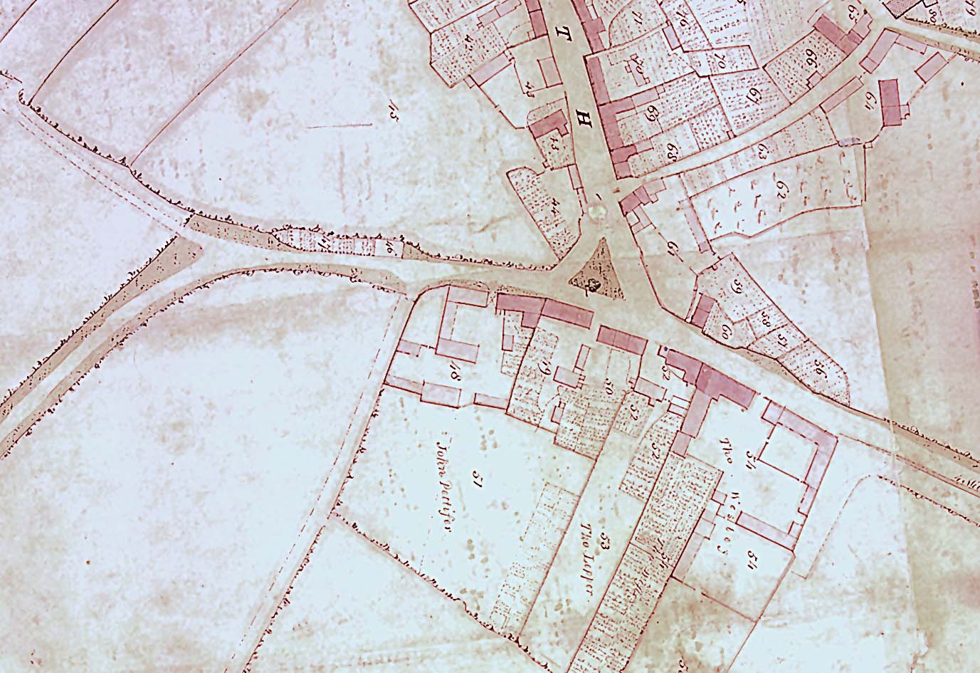
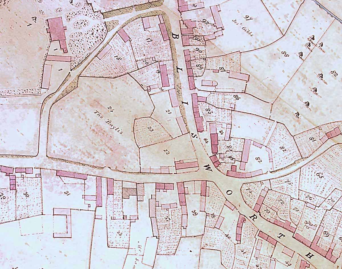
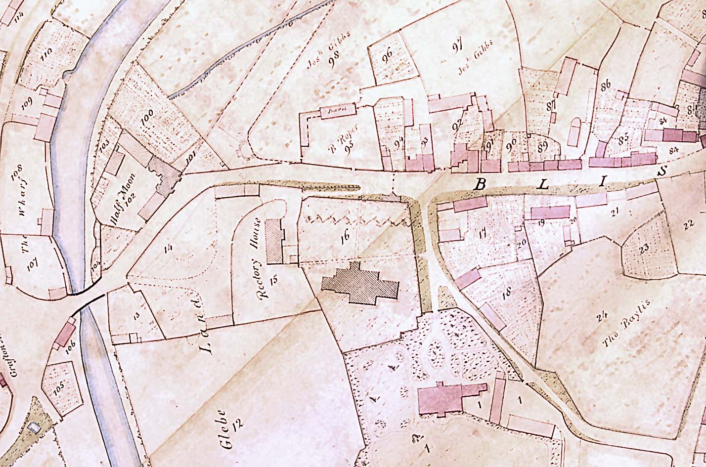
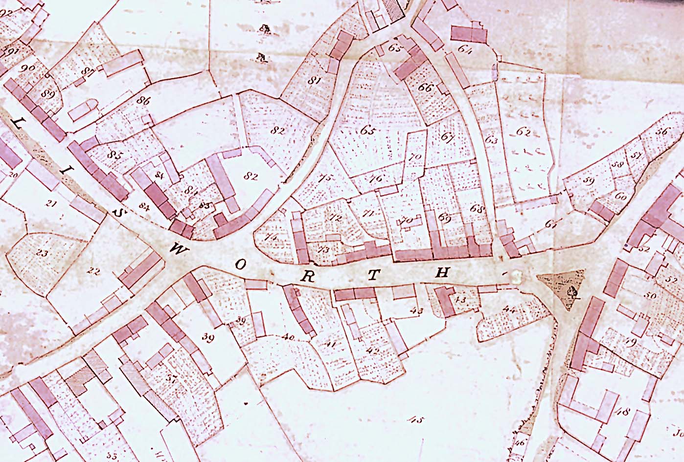
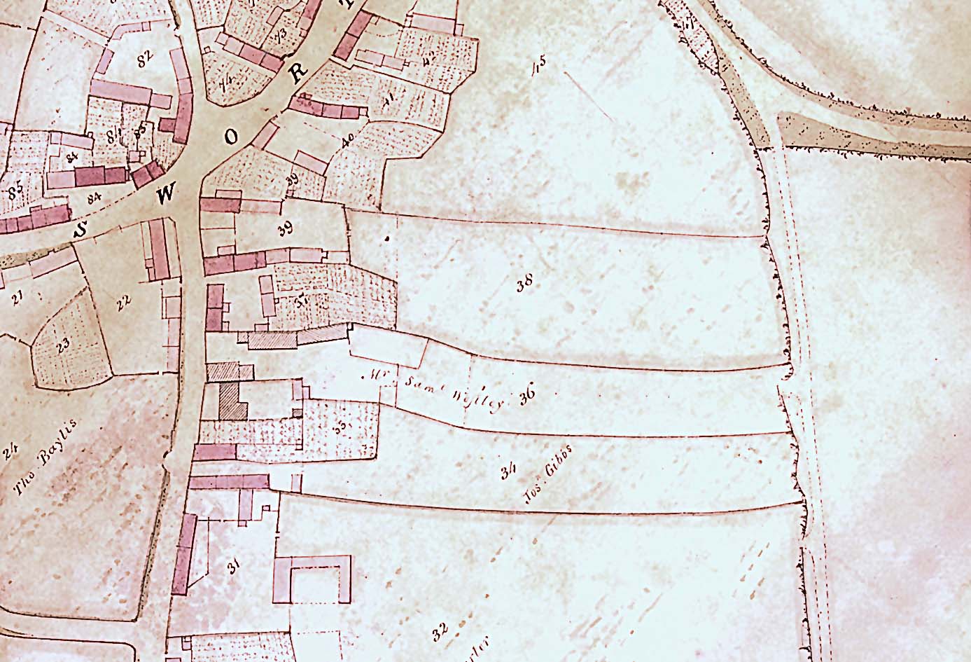
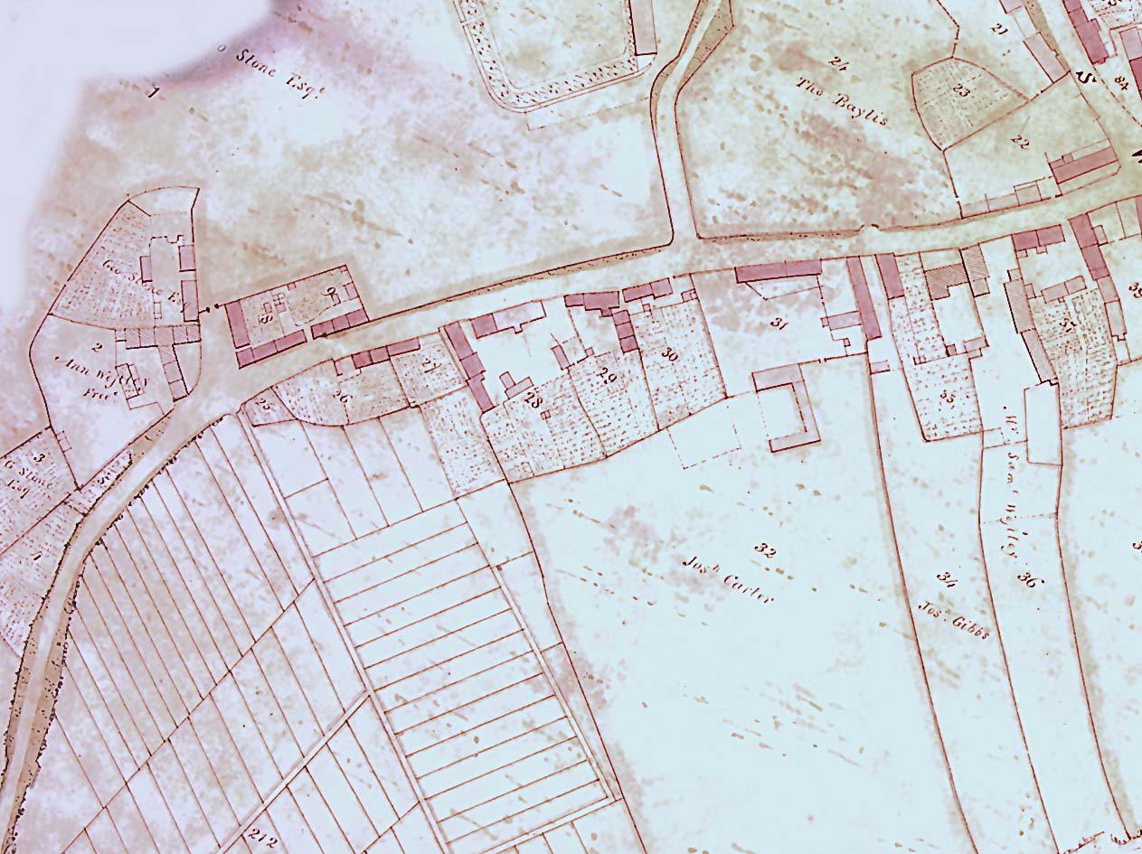
BLISWORTH STREET MAPS - GRAFTON 1839 SURVEY
To view these maps at higher magnification, simply left click on the icon map.
Buildings which are dark pink were dwellings for let, else were freehold or merely barns, etc.
The numbering for plots relate to a Survey Document, G 3879 at the N.R.O.
The first four pages of the document can be inspected here in two parts:
__________________________________________________________
Blisworth Arm
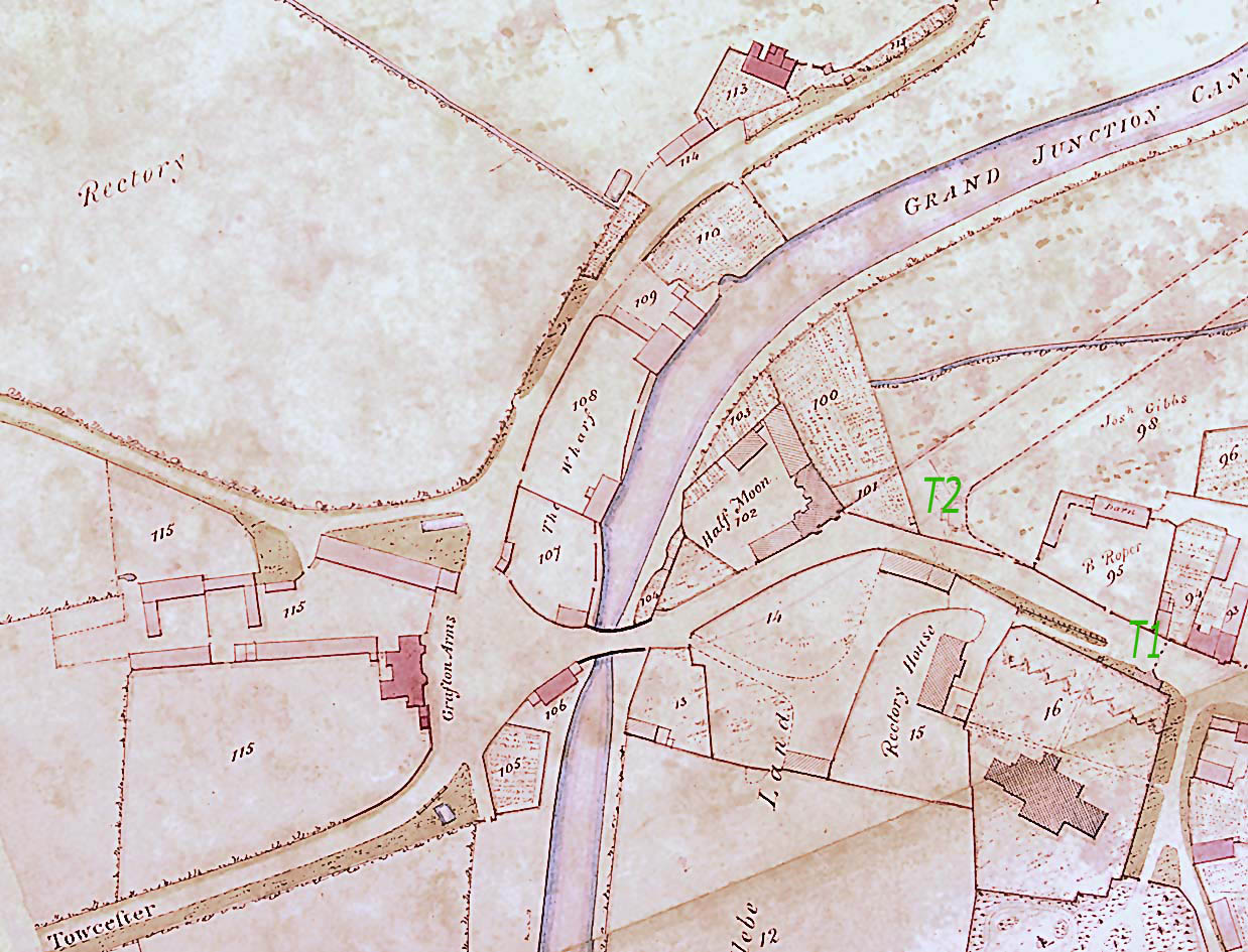 Canal Wharf
 Chapel Lane
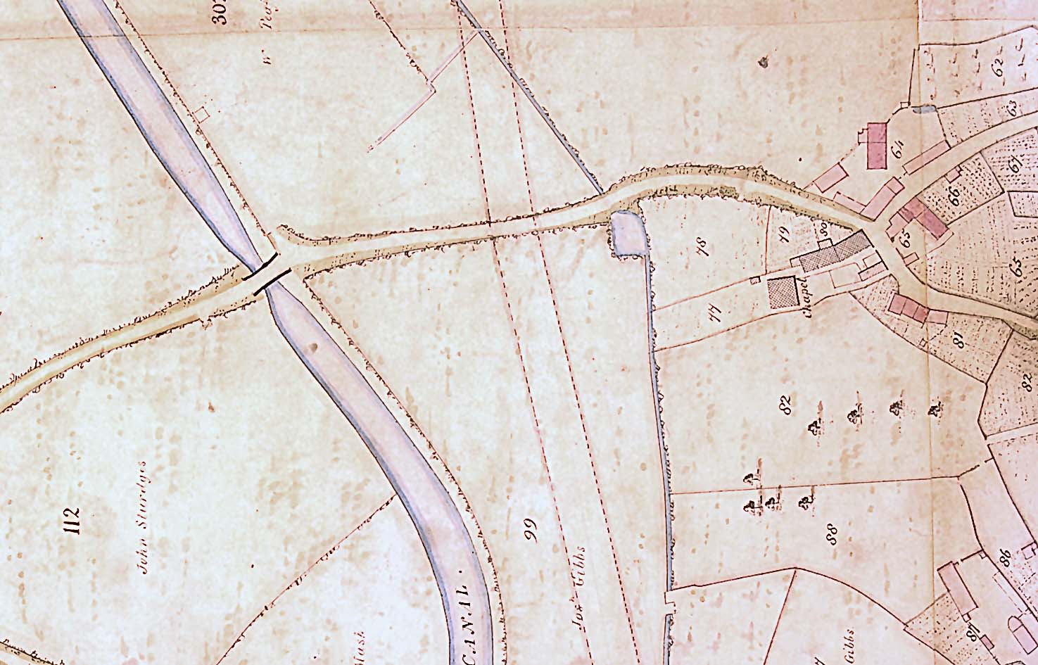
 Mill Field
 Elm End
 The Cross
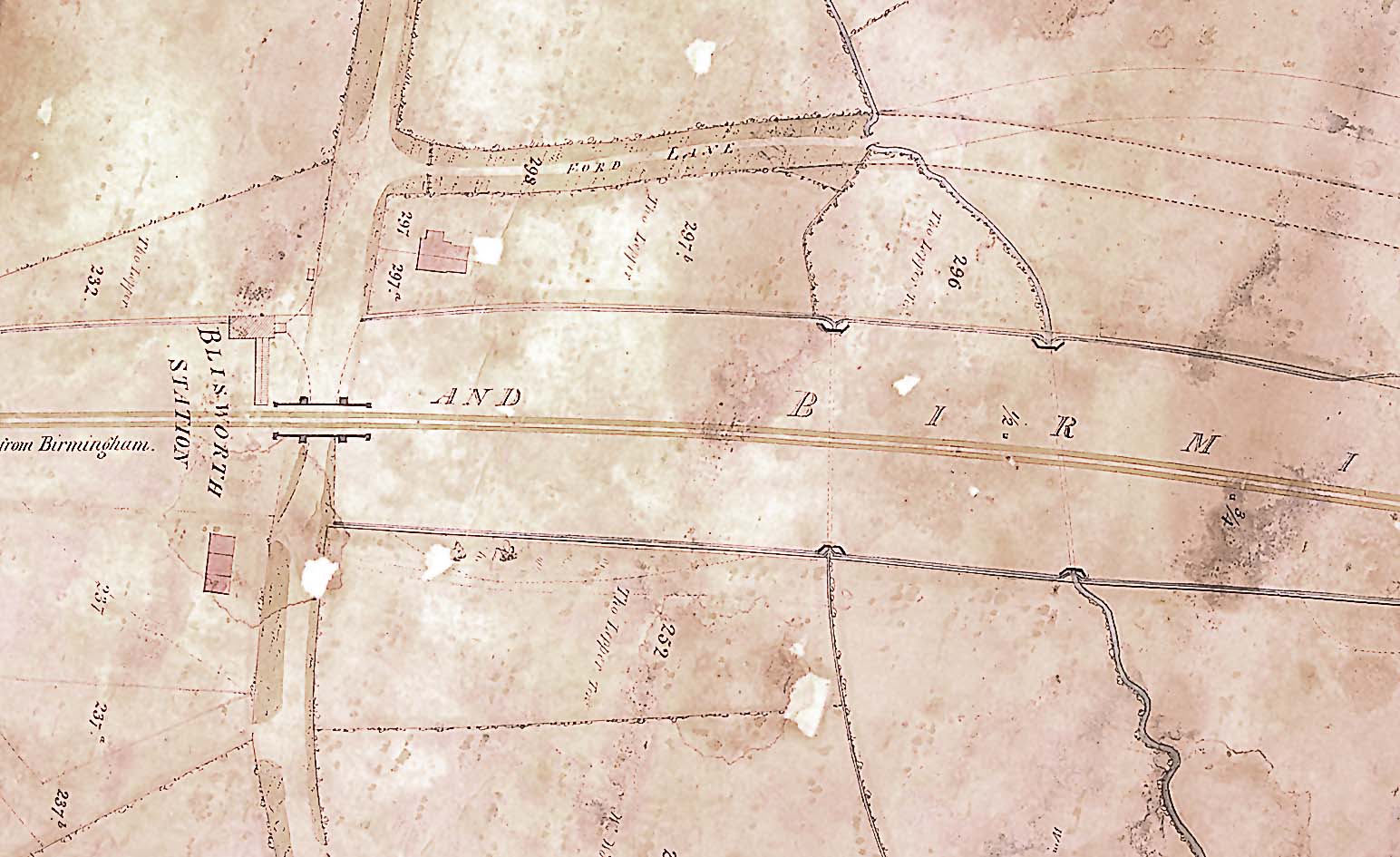 First Station (~1835)
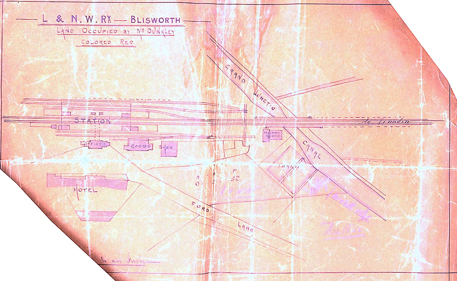 Second Station (~1845)
 Lower High Street
 Upper High Street
 Lower Stoke Road
 Stoke Road